Katalogisierte Karte
Topographische Karte des Cantons St. Gallen mit Einschluss des Cantons Appenzell

Einrichtung:ETH-Bibliothek
Vollständiger Titel:Topographische Karte des Cantons St. Gallen mit Einschluss des Cantons Appenzell
Jahr der Abbildung:1851
Veröffentlichungsdatum:1851 - 1856
Herausgeber:Topographische Anstalt v. Joh. Wurster & Comp.
Maßstab der Karte:1:25 000
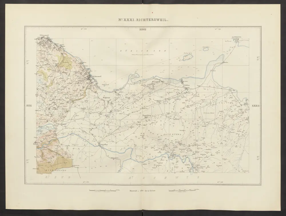
Richtersweil
1852
Wild, Johannes
1:25k
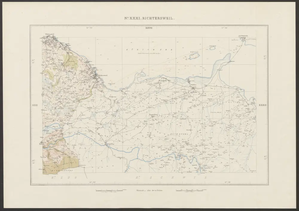
Richtersweil
1858
Graf, Josef
1:25k
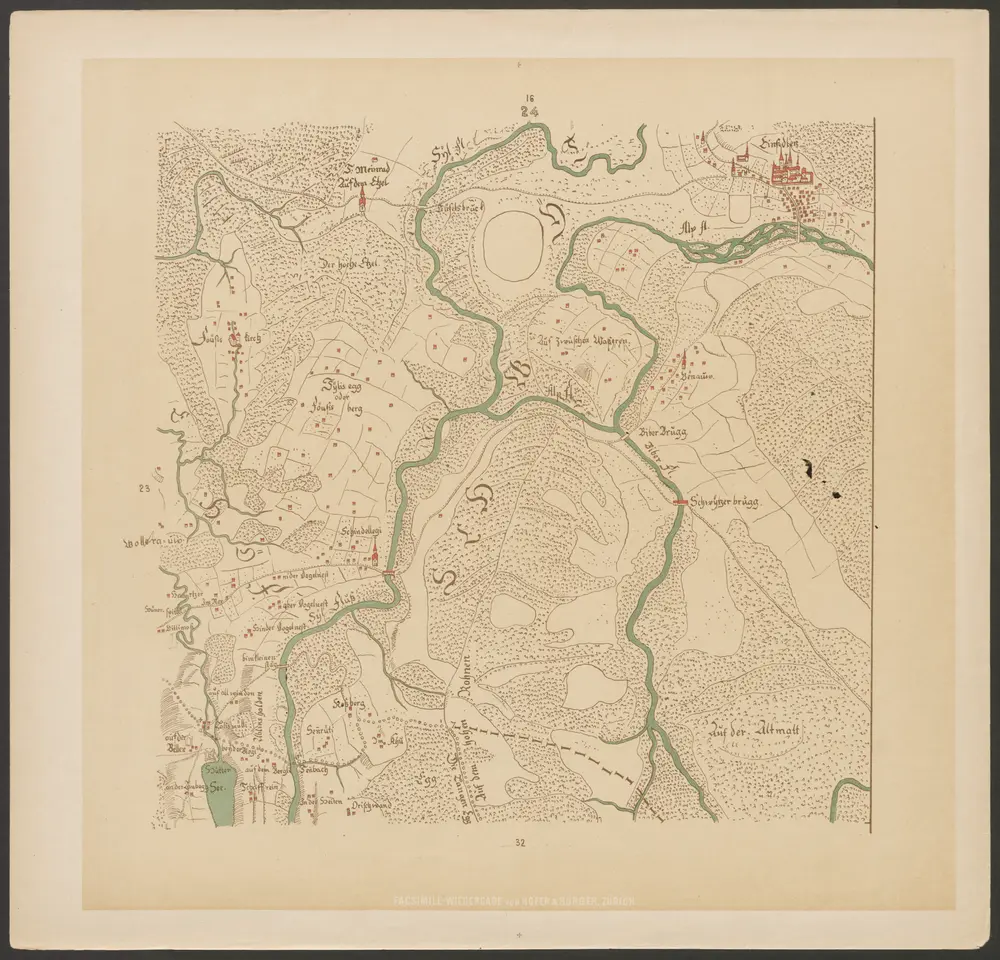
Hans Konrad Gyger's Züricher-Cantons-Carte
1667
Gyger, Hans Conrad ; Zeller-Werdmüller, Heinrich
1:32k
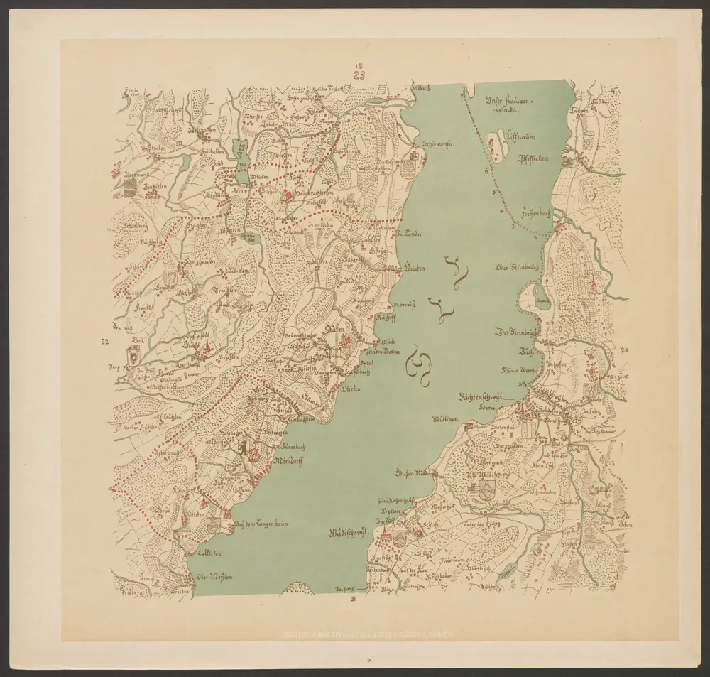
Le lac de Zürich avec ses environs, du côté de l'orient depuis Üetikon jusqua à Rapperschweil, du côte de l'occident depuis lisle de Au jusqua à Rapperschweil
1800
Johannes Hofmeister
Hans Konrad Gyger's Züricher-Cantons-Carte
1667
Gyger, Hans Conrad ; Zeller-Werdmüller, Heinrich
1:32k
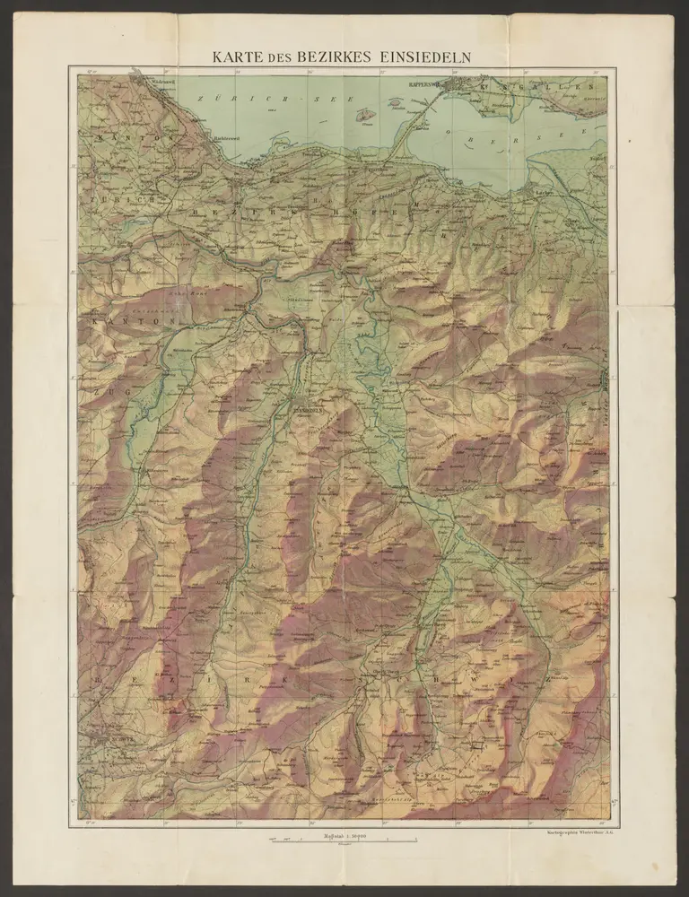
Karte des Bezirkes Einsiedeln
1906
Kartographia Winterthur A.-G.
1:50k
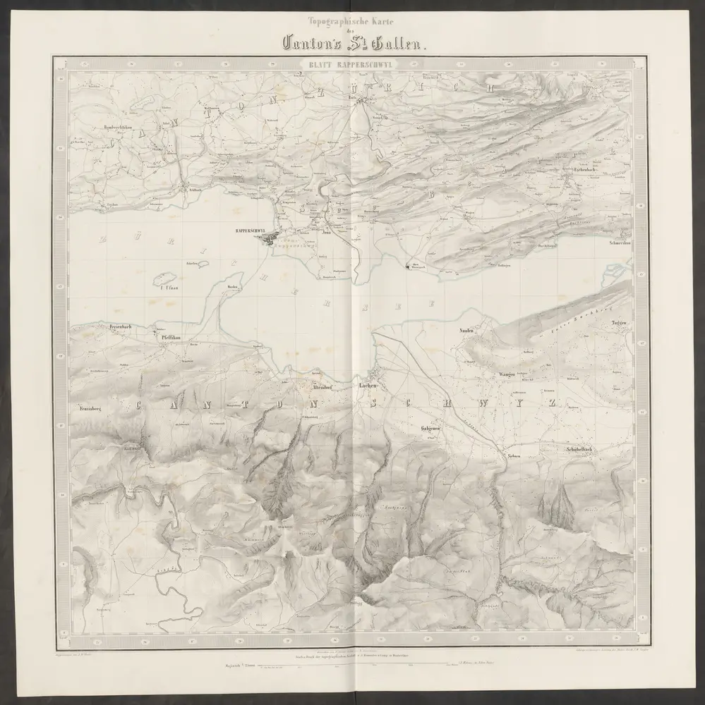
Topographische Karte des Cantons St. Gallen mit Einschluss des Cantons Appenzell
1851
Eschmann, Johannes ; Steiner, P. ; Randegger, Johannes ; Ziegler, Jakob Melchior
1:25k
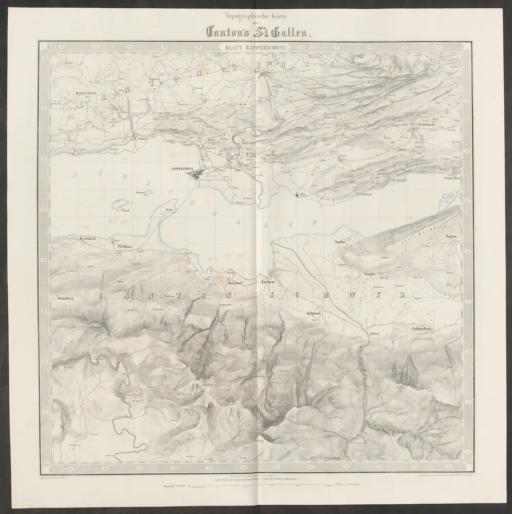
Topographische Karte des Cantons St. Gallen mit Einschluss des Cantons Appenzell
1851
Eschmann, Johannes ; Steiner, P. ; Randegger, Johannes ; Ziegler, Jakob Melchior
1:25k
Nova descriptio ditionis Tigurinæ, regionumque finitimarum, 2
1750
Johann Jost Hiltensperger
Nova descriptio ditionis Tigurinæ, regionumque finitimarum, 2
1685
s.n.