Skatalogowana mapa
A map of Kentucky, drawn from actual observations by John Filson.

Instytucja:community
Pełny tytuł:A map of Kentucky, drawn from actual observations by John Filson.
Rok ilustracji:1794
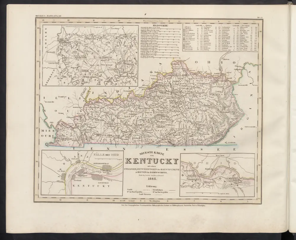
Neueste Karte von Kentucky mit seinen Strassen, Entfernungen der Hauptpunkte & Routen für Dampfschiffe
1860
Meyer, J.
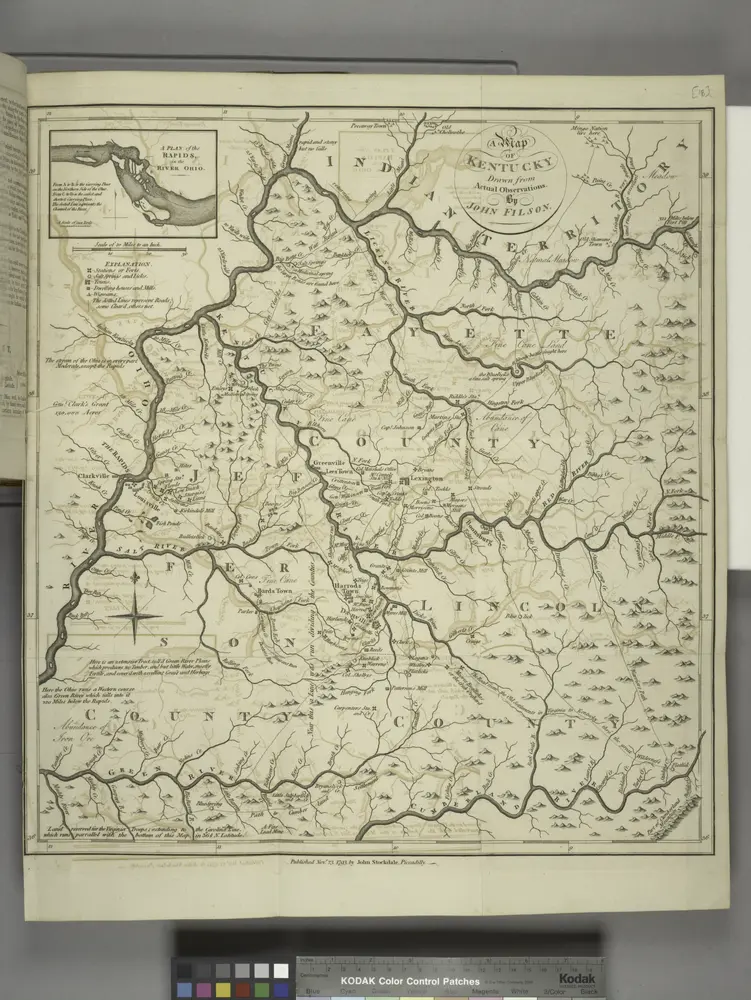
A map of Kentucky, drawn from actual observations by John Filson.
1794
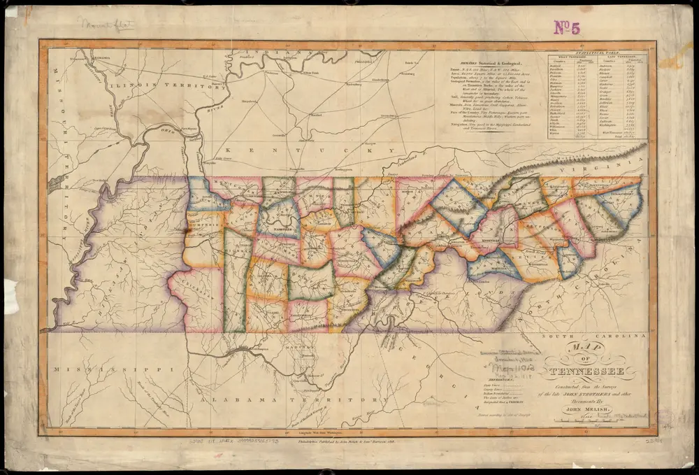
Map of Tennessee
1818
Melish, John
1:1m
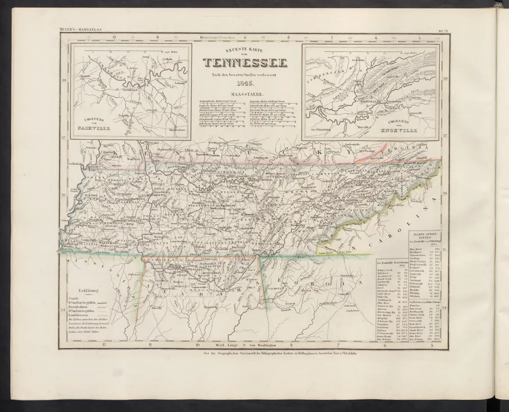
Neueste Karte von Tennessee
1860
Meyer, J.
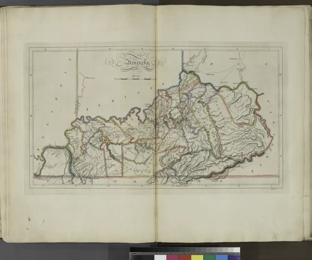
Kentucky.
1814

Evansville
1961
1:250k

Evansville
1957
1:250k

Evansville
1957
1:250k

Evansville
1957
1:250k

Evansville
1954
1:250k