Documento

West Grinstead
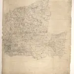
The ochre-coloured Roman road, Stane Street, runs from Pulborough at the bottom left of the map to Rudgwick at the top right. Windmills proliferate throughout the area and are represented in elevation. The physical condition of the plan is poor and place names are difficult to read because the manuscript is dirty, worn and ripped.
The British Library1806

