Projekt
Wspólnota
Aktualności
Moja aplikacja
Moje mapy
Katalogisierte Karte
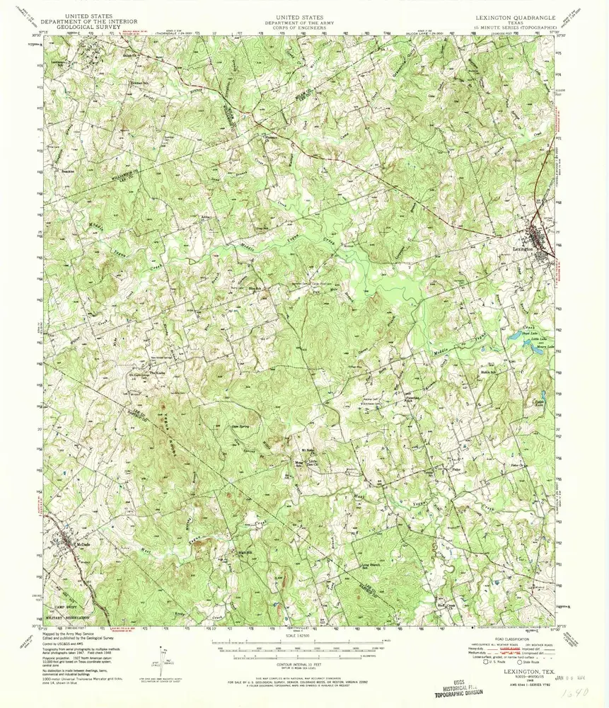
Lexington
Wyświetlanie na zewnętrznej stronie internetowej
Zobacz zdigitalizowane
Einrichtung:
United States Geological Survey
Vollständiger Titel:
Lexington
Jahr der Abbildung:
1948
Veröffentlichungsdatum:
1974
Maßstab der Karte:
1:62 500
Lexington
1950
1:63k
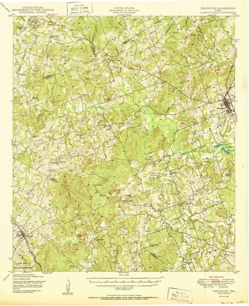
Lexington
1948
1:63k
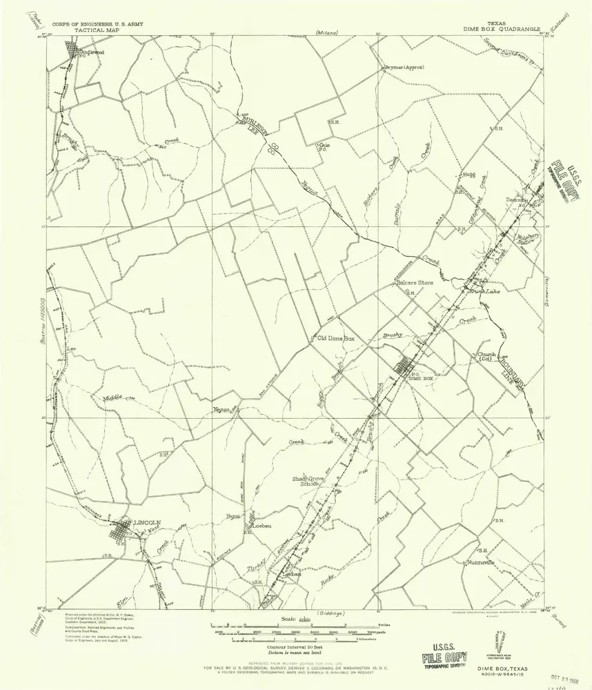
Dime Box
1919
1:63k
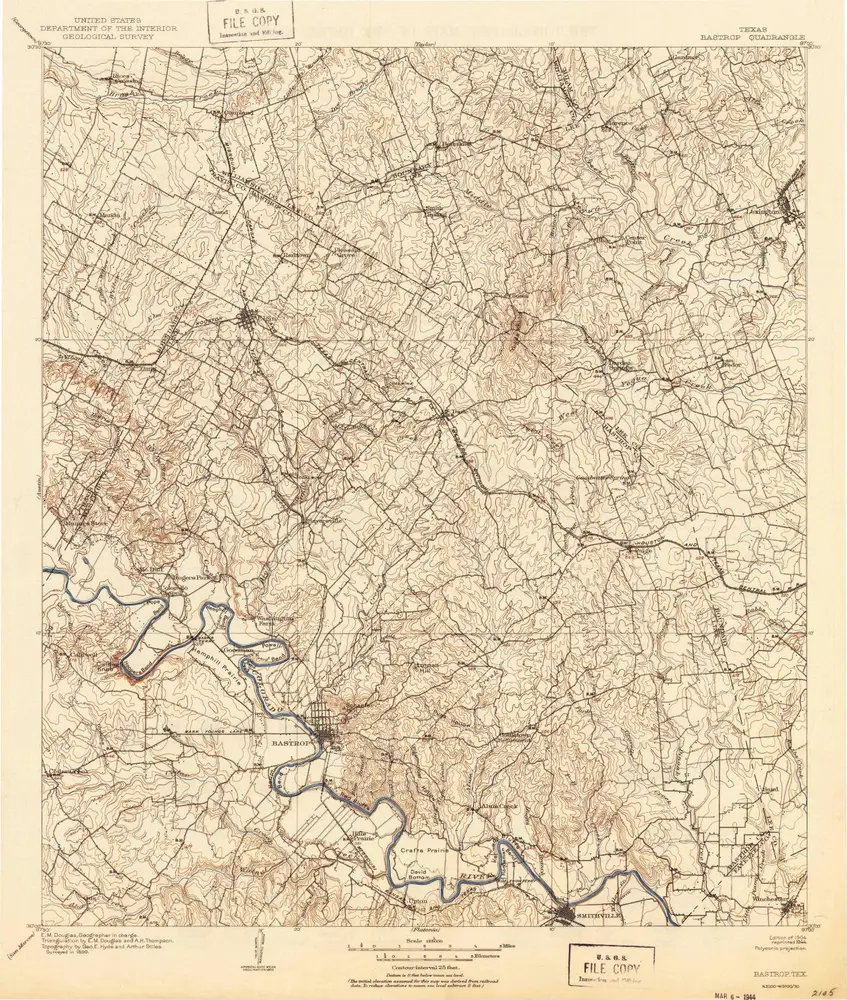
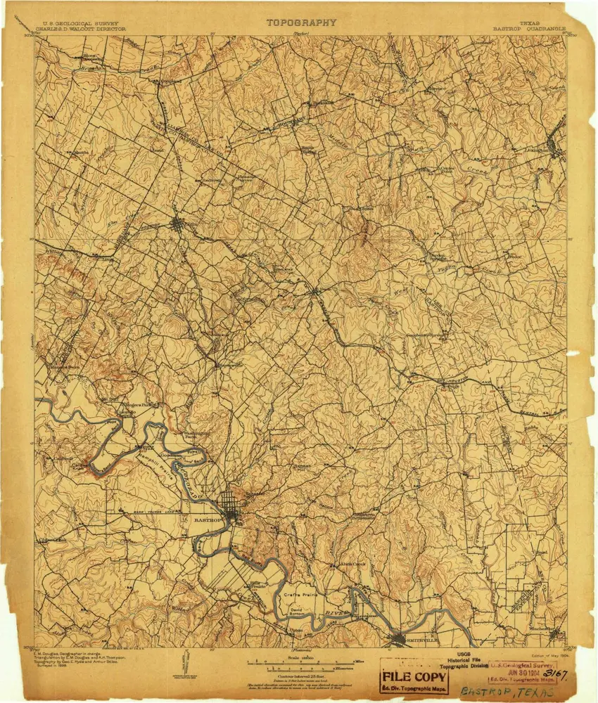
Bastrop
1904
1:125k
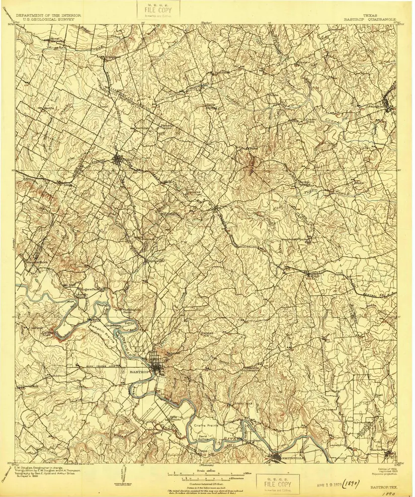
Bastrop
1904
1:125k
Bastrop
1904
1:125k
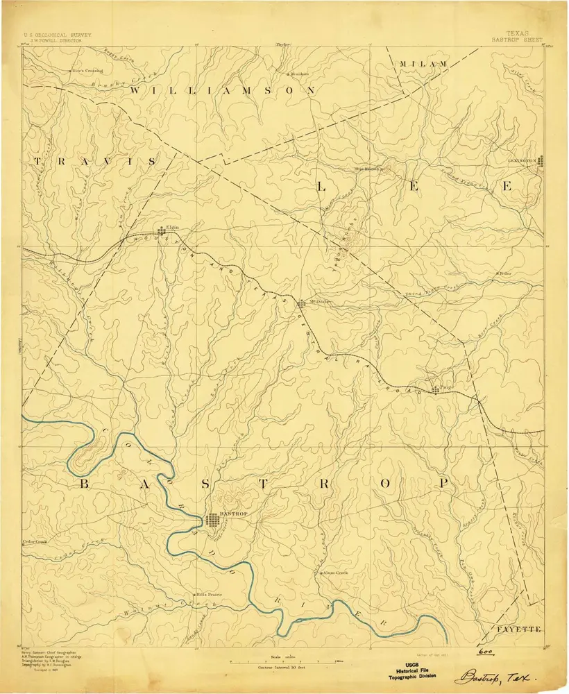
Bastrop
1893
1:125k
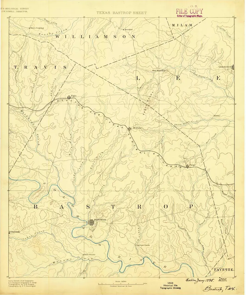
Bastrop
1885
1:125k
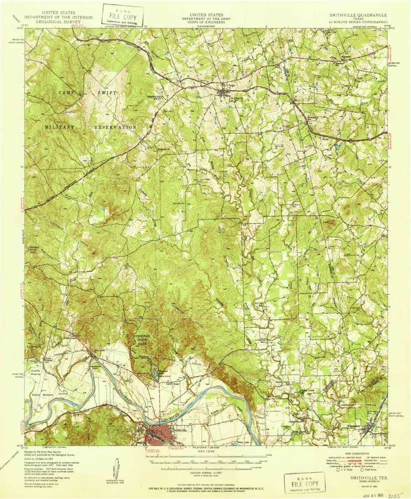
Smithville
1950
1:63k
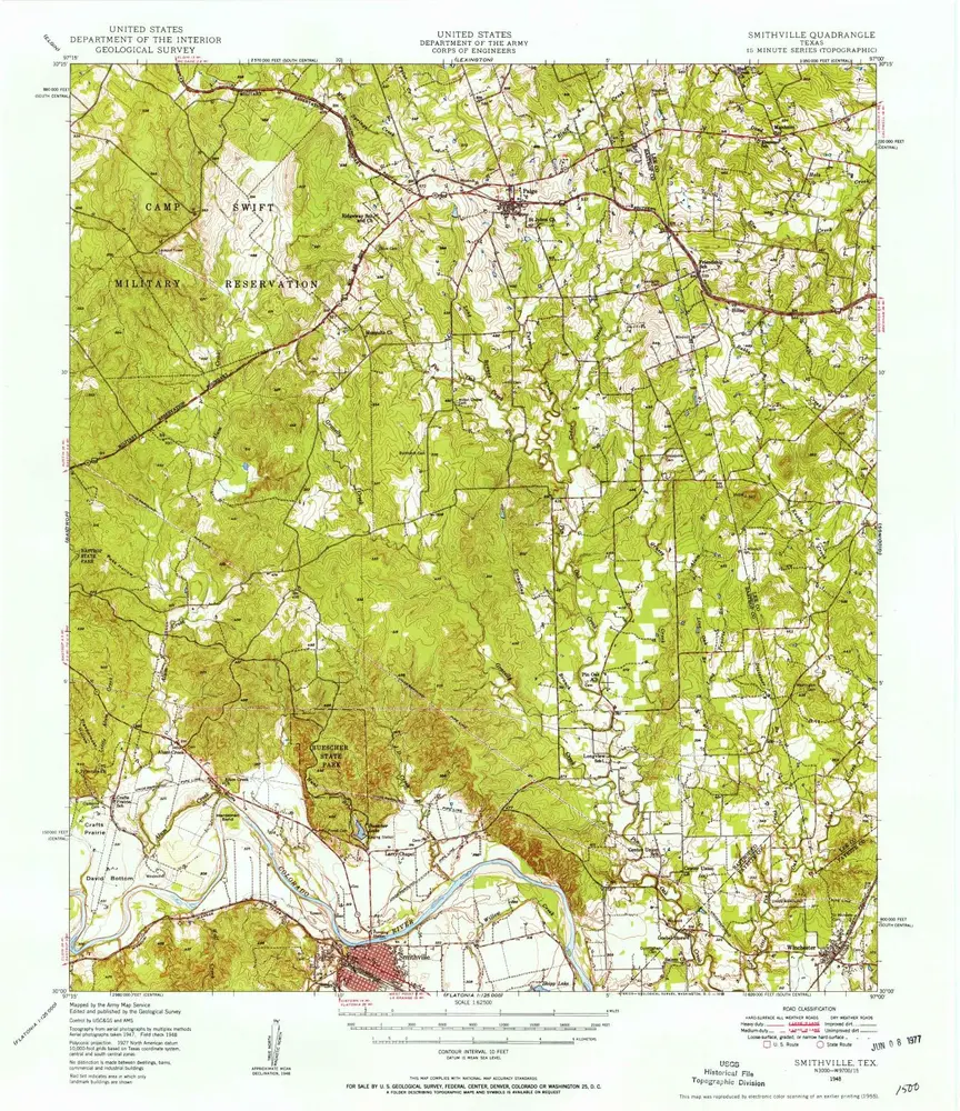
Smithville
1948
1:63k
Geschichte