Projekt
Wspólnota
Aktualności
Moja aplikacja
Moje mapy
Skatalogowana mapa
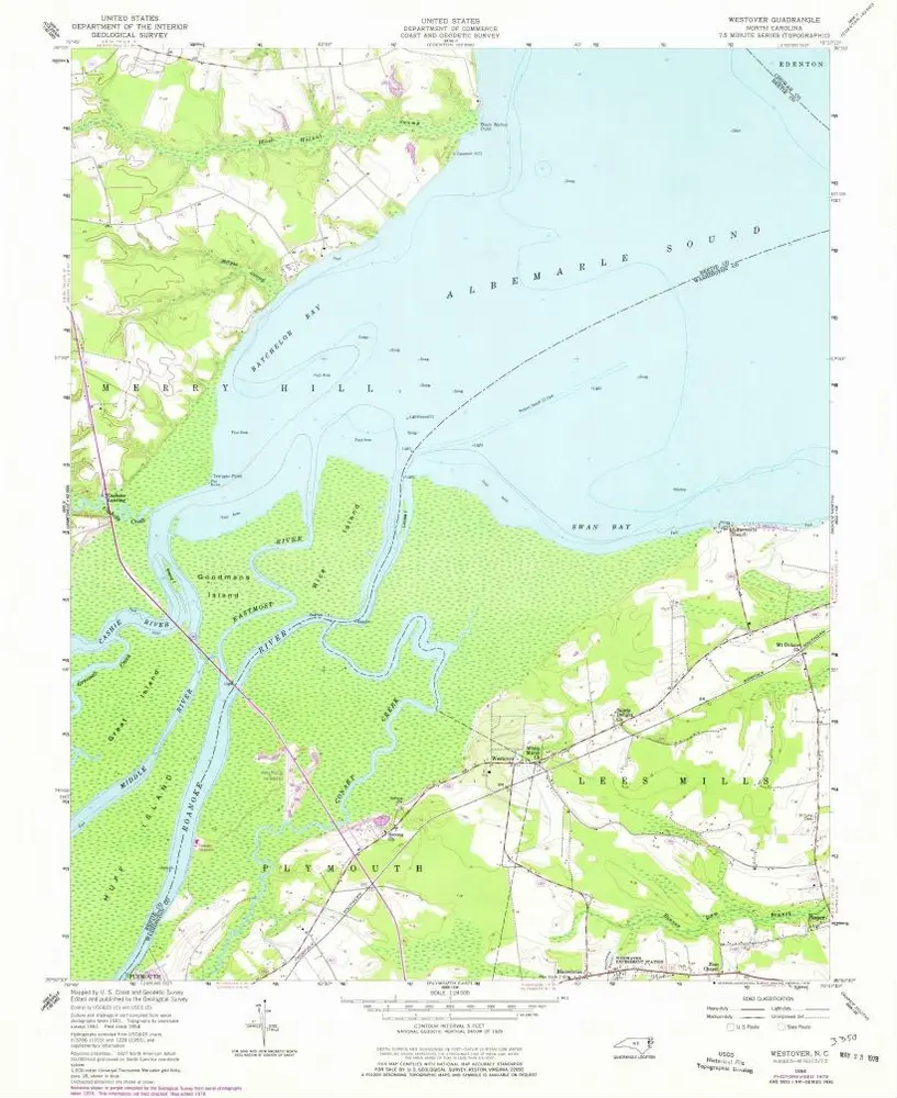
Westover
Wyświetlanie na zewnętrznej stronie internetowej
View digitized
Instytucja:
United States Geological Survey
Pełny tytuł:
Westover
Rok ilustracji:
1954
Data publikacji:
1978
Skala mapy:
1:24 000
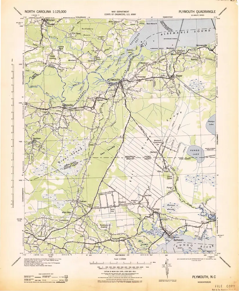
Plymouth
1943
1:125k
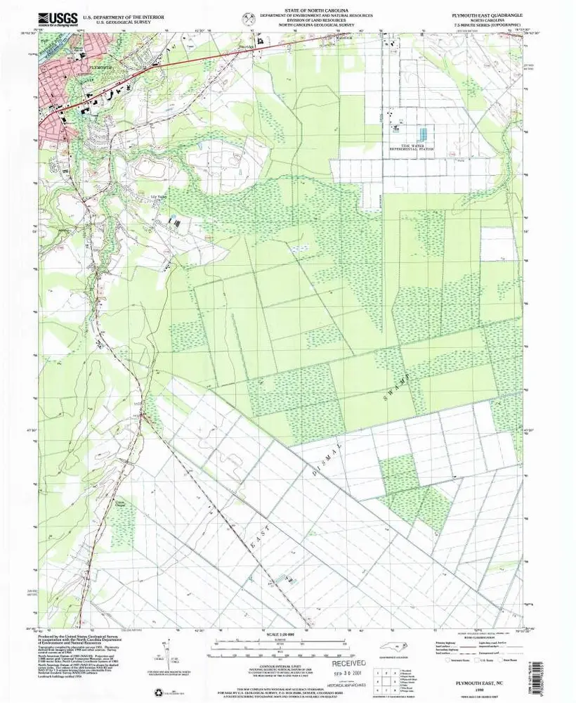
Plymouth East
1998
1:24k
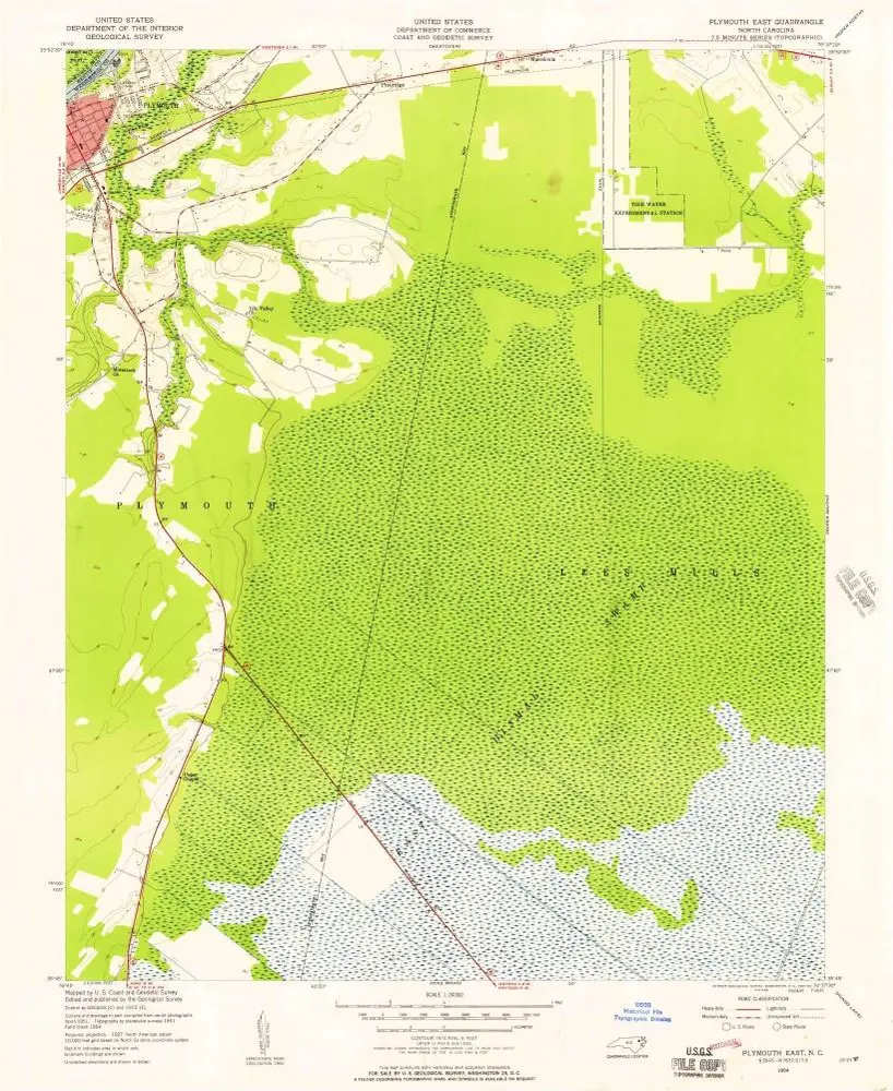
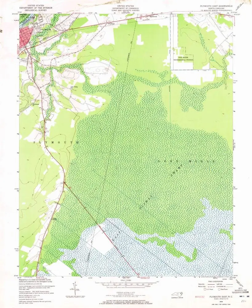
Plymouth East
1954
1:24k
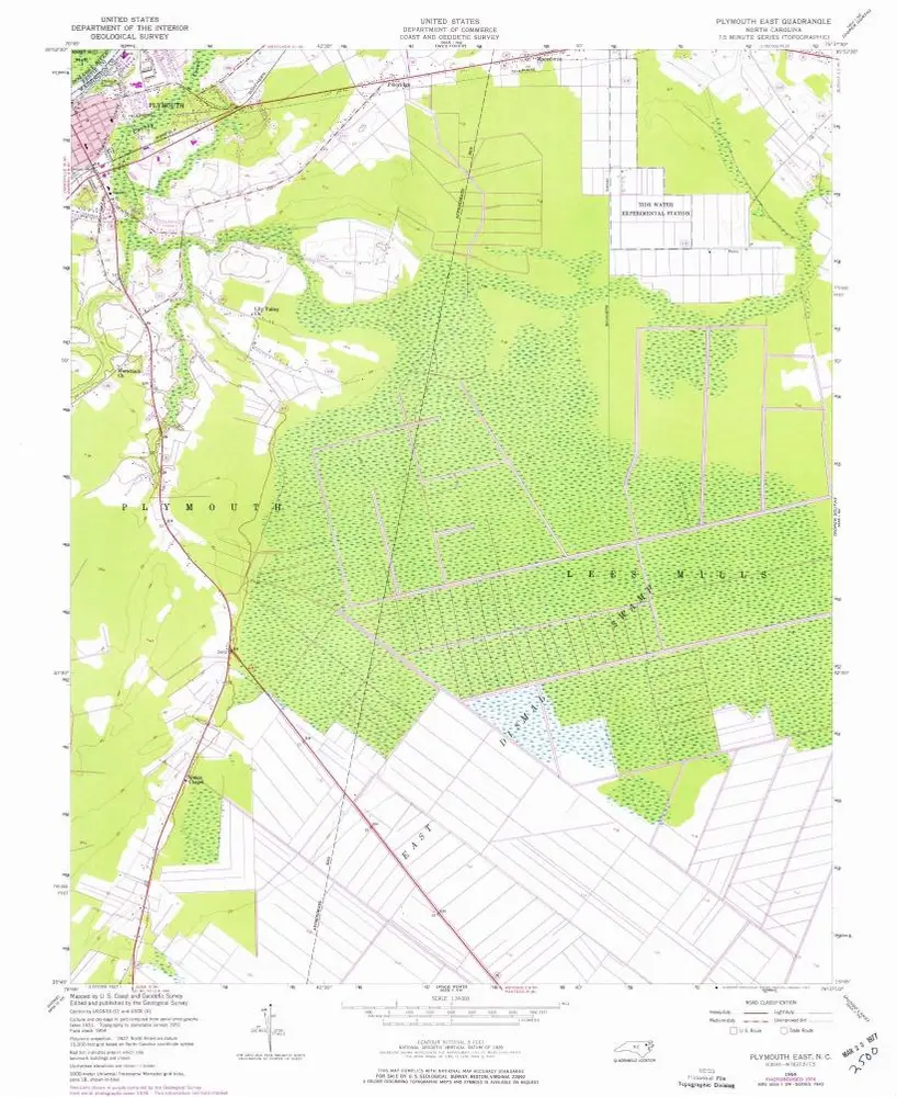
Plymouth East
1954
1:24k
Plymouth East
1954
1:24k
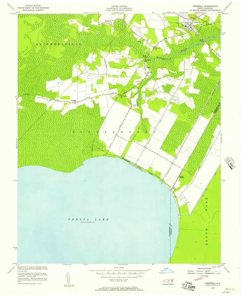
Creswell
1954
1:24k
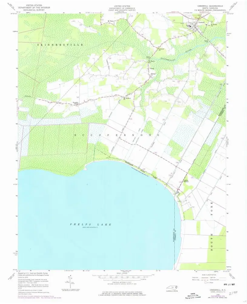
Creswell
1954
1:24k
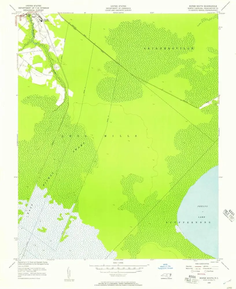
Roper South
1954
1:24k
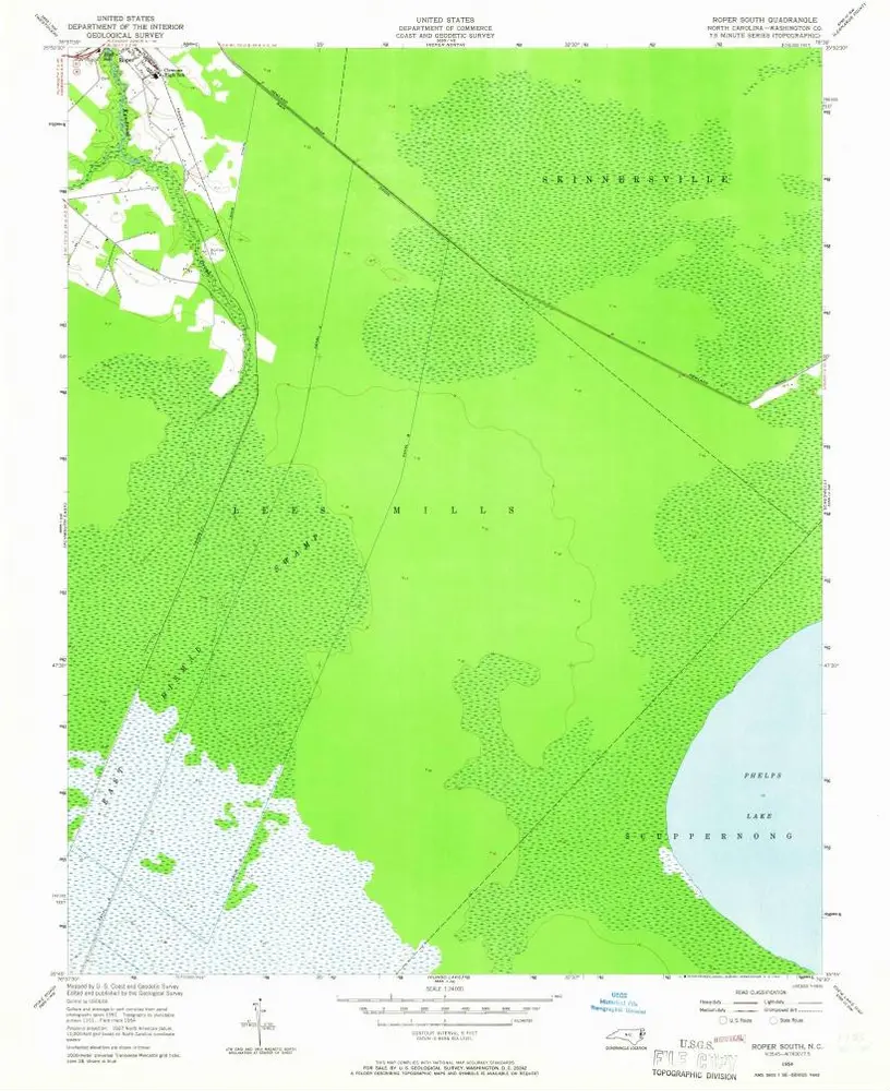
Roper South
1954
1:24k
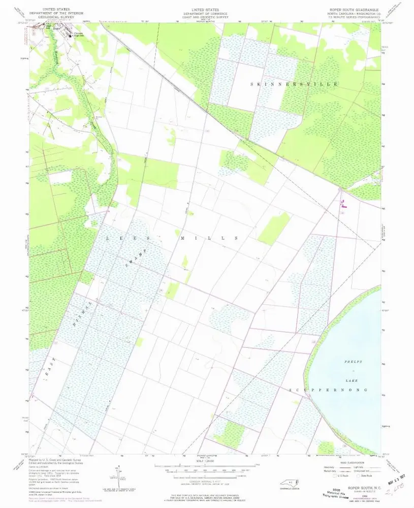
Roper South
1954
1:24k
Historia