Carte cataloguée
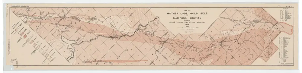
Map of Mother Lode Gold Belt in Mariposa County Showing Mining Claims and Areal Geology; Plate X

Institution:UCLA Library
Titre complet:Map of Mother Lode Gold Belt in Mariposa County Showing Mining Claims and Areal Geology; Plate X
Année de l'image:1934
Date de publication:1934
Éditeur:Sacramento : California State Division of Mines
Échelle de la carte:1:63 360
Map of Mother Lode Gold Belt in Mariposa County Showing Mining Claims and Areal Geology; Plate X
1934
Logan, C. A. (Clarence August), 1887-
1:63k
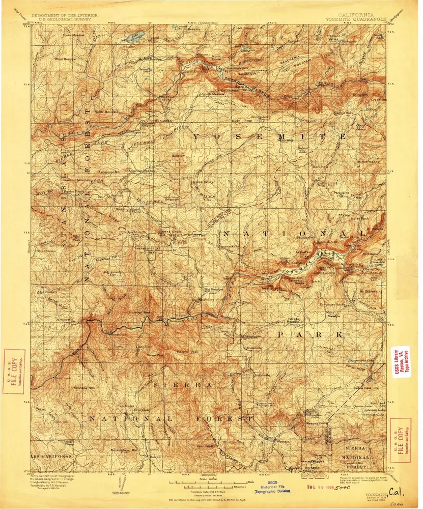
Yosemite
1909
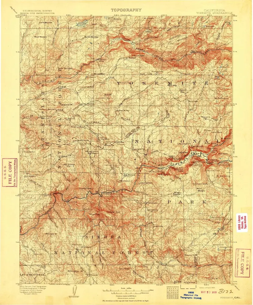
1:125k
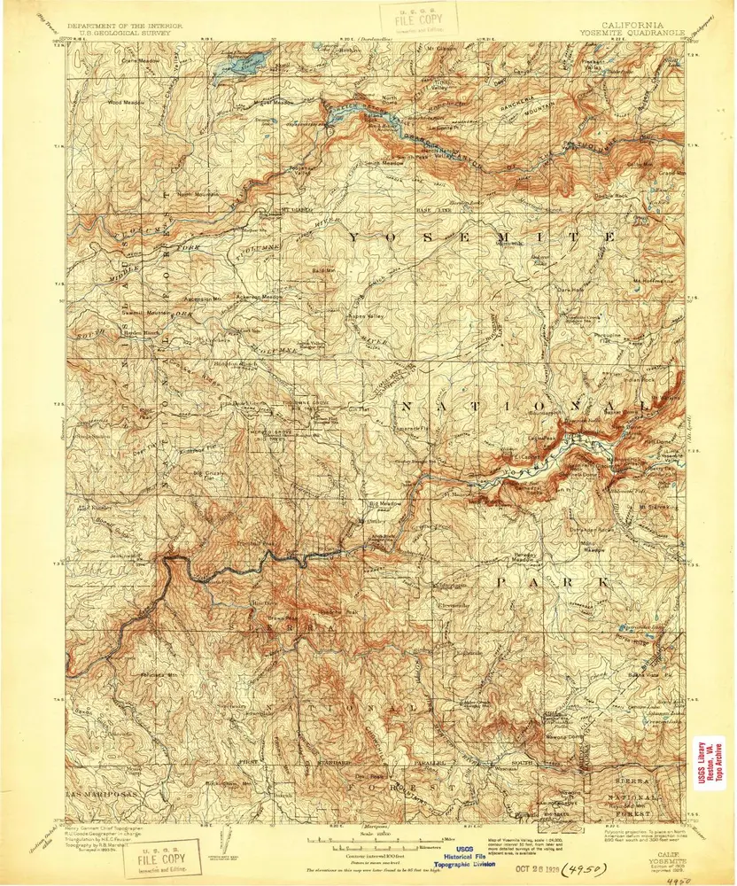
Yosemite
1909
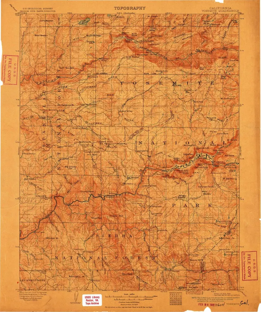
1:125k
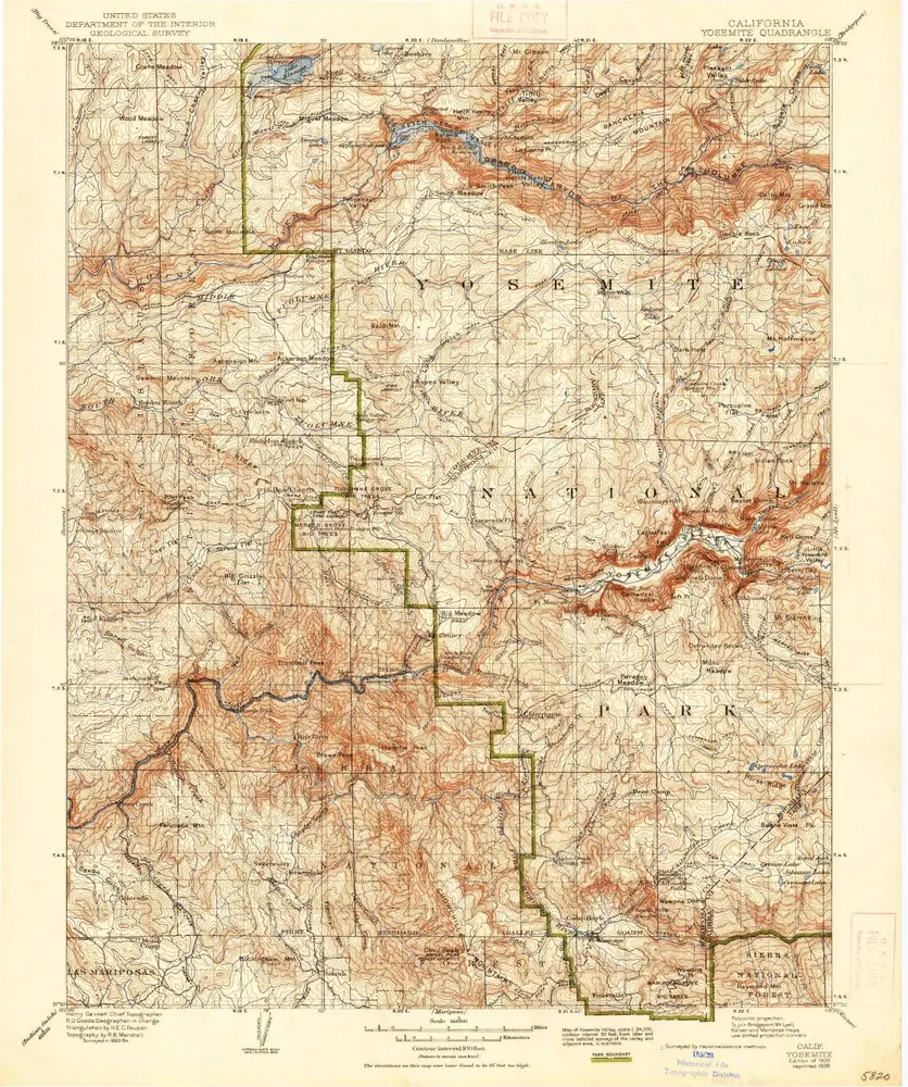
Yosemite
1909
1:125k
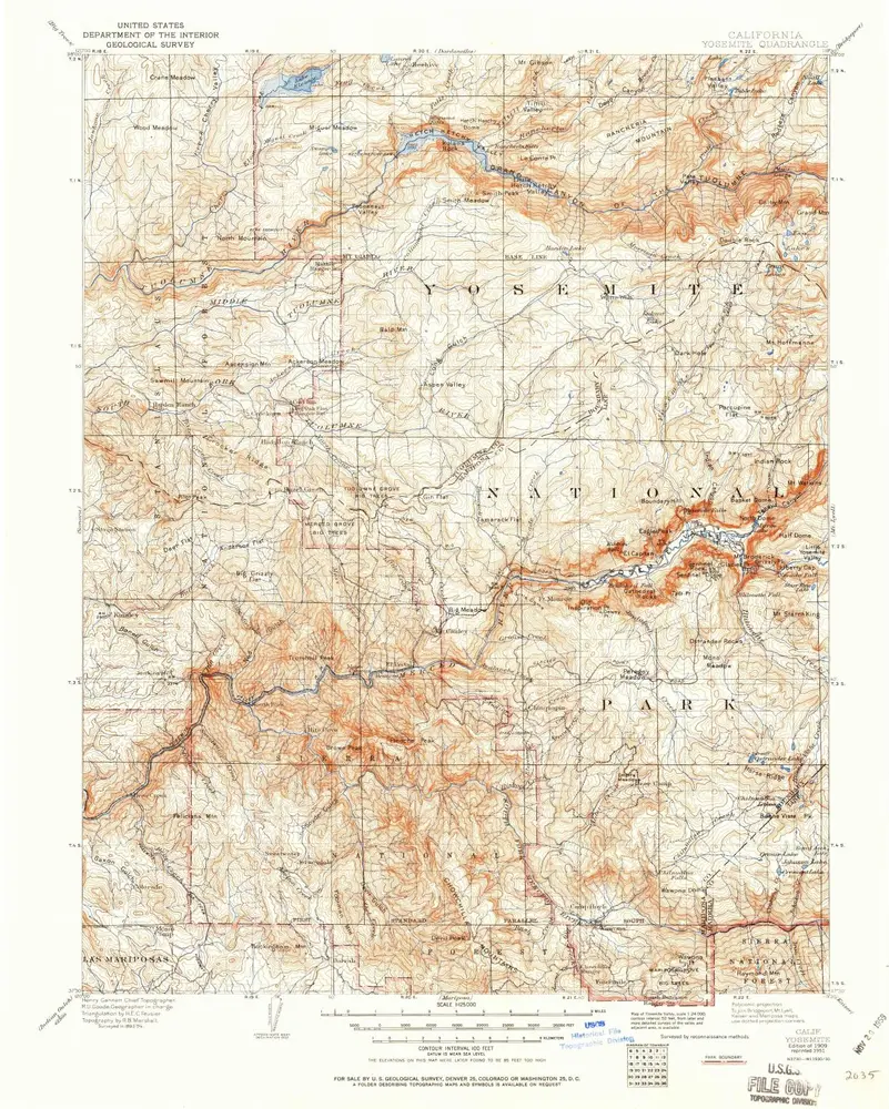
Yosemite
1909
1:125k
Yosemite
1909
1:125k
Yosemite
1909
1:125k
Yosemite
1909
1:125k
Yosemite
1909
1:125k
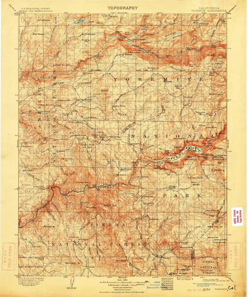
Yosemite
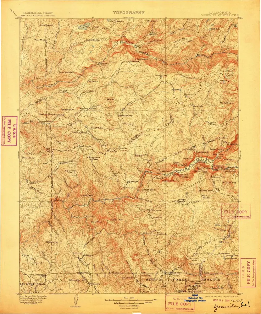
1903
1:125k
Yosemite
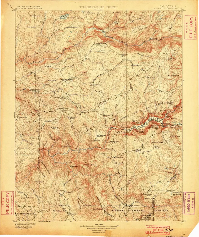
1900
1:125k
Yosemite
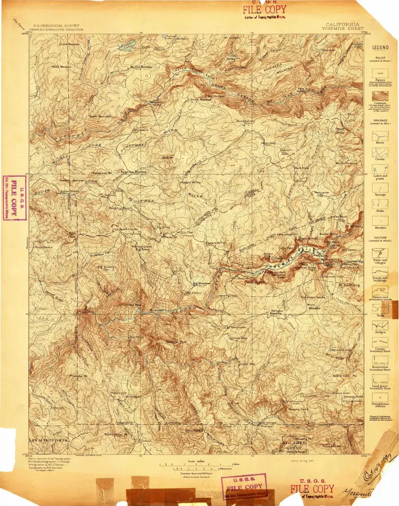
1897
1:125k