Projekt
Wspólnota
Aktualności
Moja aplikacja
Moje mapy
Katalogisierte Karte
Verndale
Wyświetlanie na zewnętrznej stronie internetowej
Zobacz zdigitalizowane
Einrichtung:
United States Geological Survey
Vollständiger Titel:
Verndale
Jahr der Abbildung:
1969
Veröffentlichungsdatum:
1971
Maßstab der Karte:
1:24 000
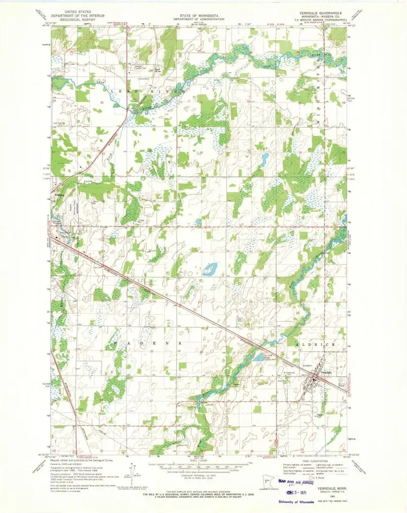
Verndale
1969
1:24k
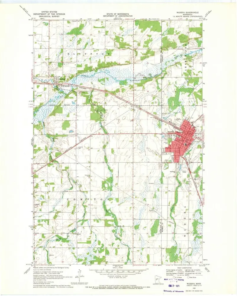
Wadena
1969
1:24k
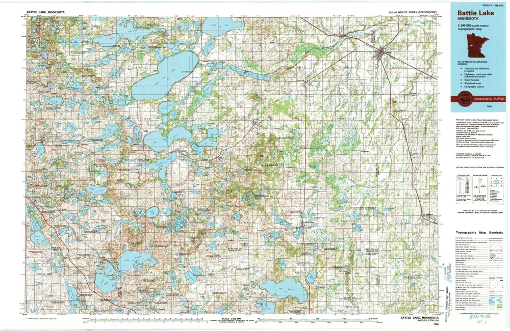
Battle Lake
1986
1:100k
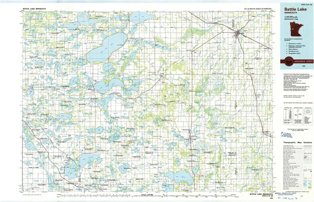
Battle Lake
1986
1:100k
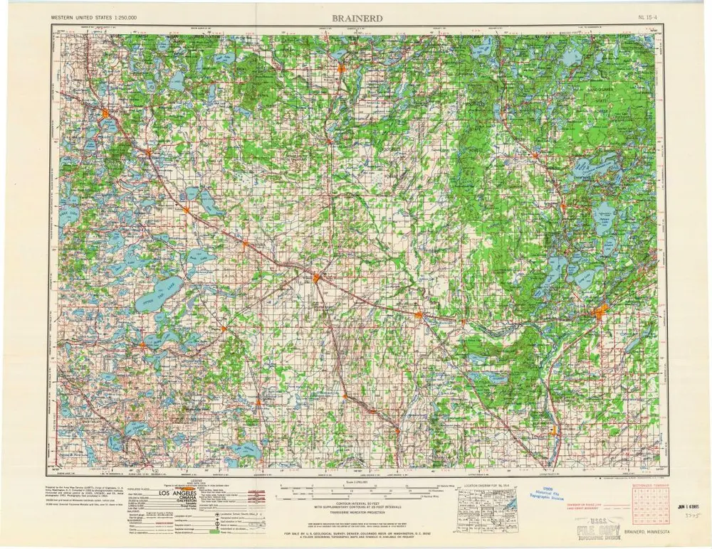
Brainerd
1965
1:250k
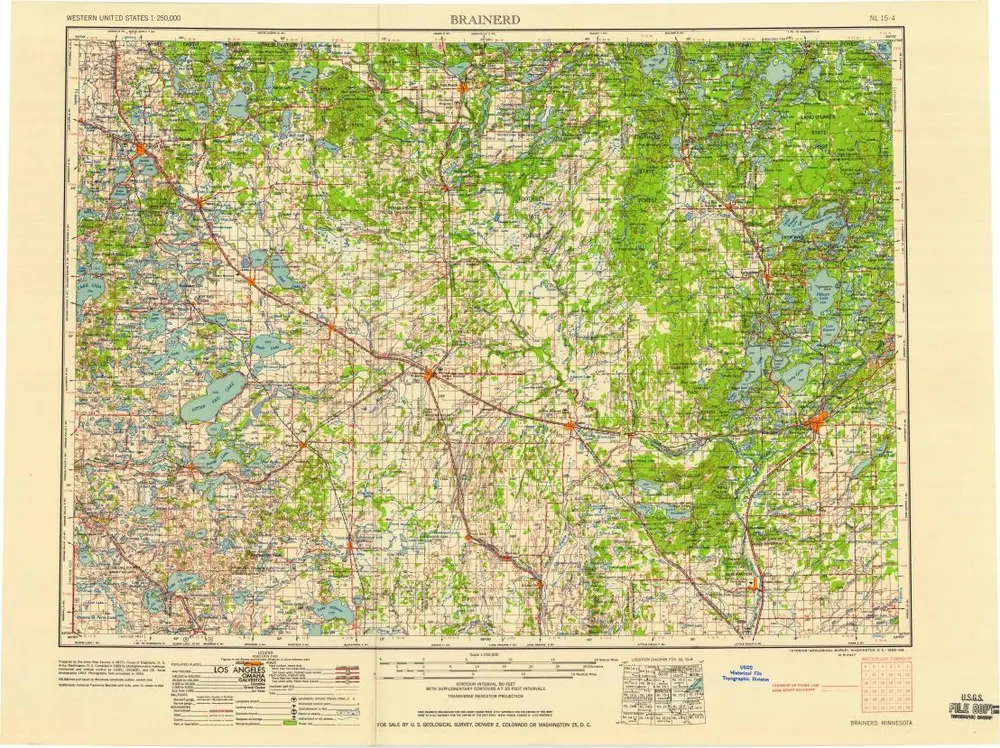
Brainerd
1958
1:250k
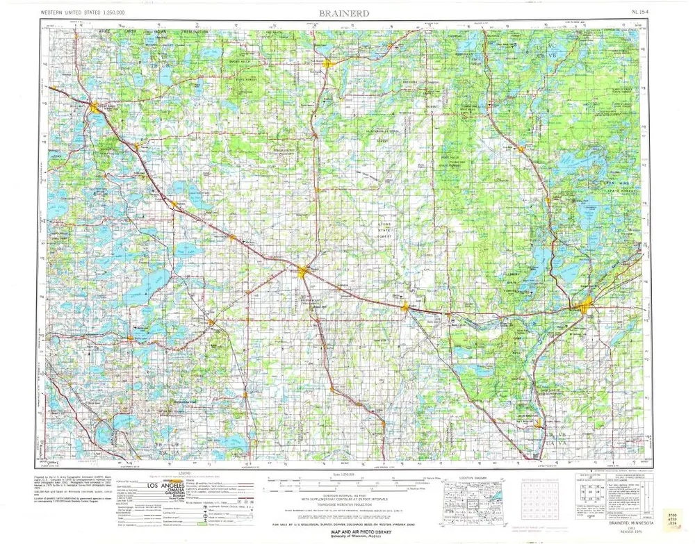
Brainerd
1953
1:250k
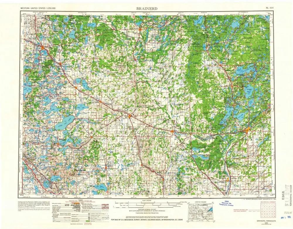
Brainerd
1953
1:250k
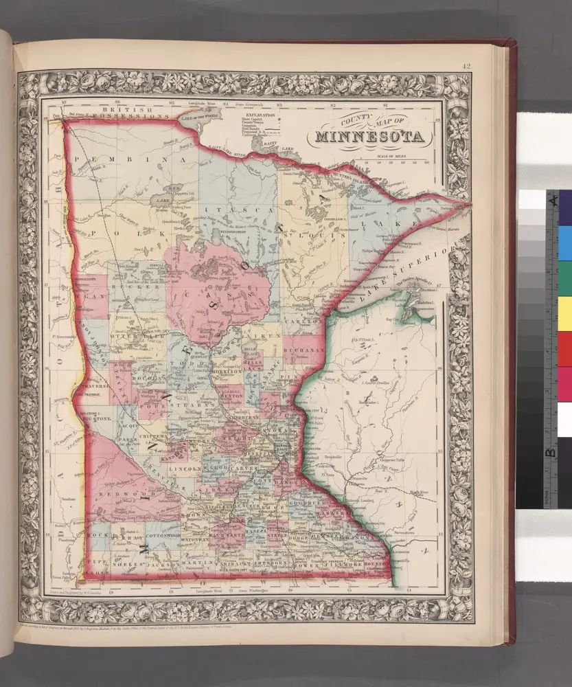
County map of Minnesota.
1860
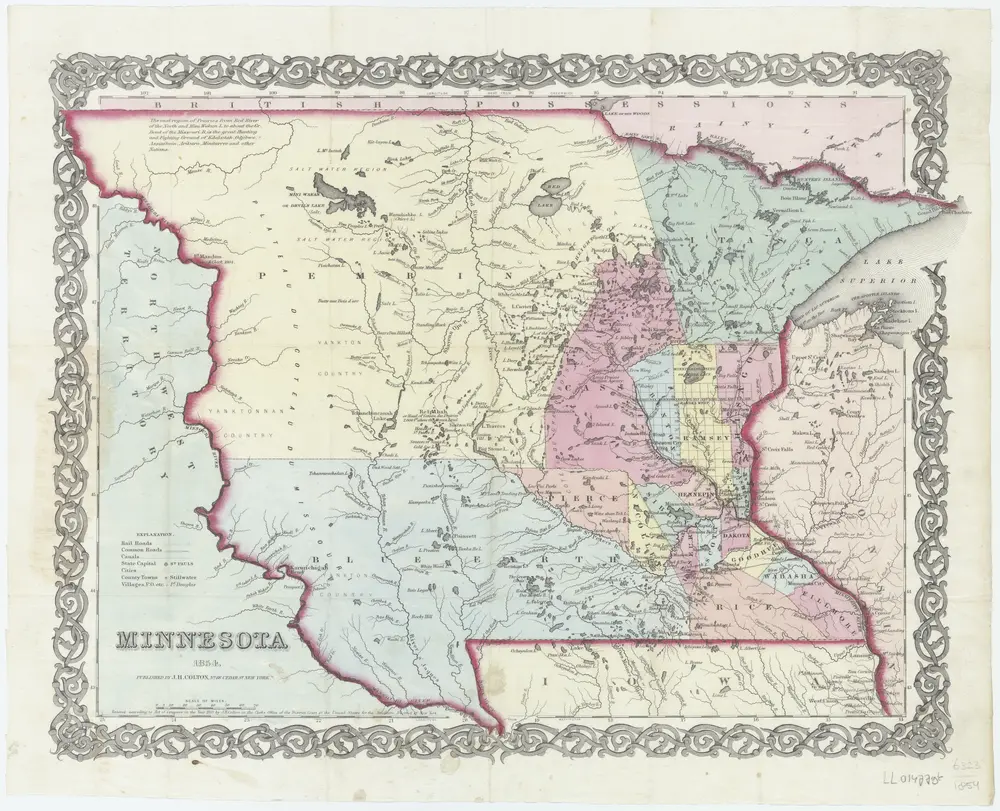
Minnesota
1854
New York, N.Y. : J.H. Colton
1:3m
Geschichte