Projekt
Wspólnota
Aktualności
Moja aplikacja
Moje mapy
Katalogisierte Karte
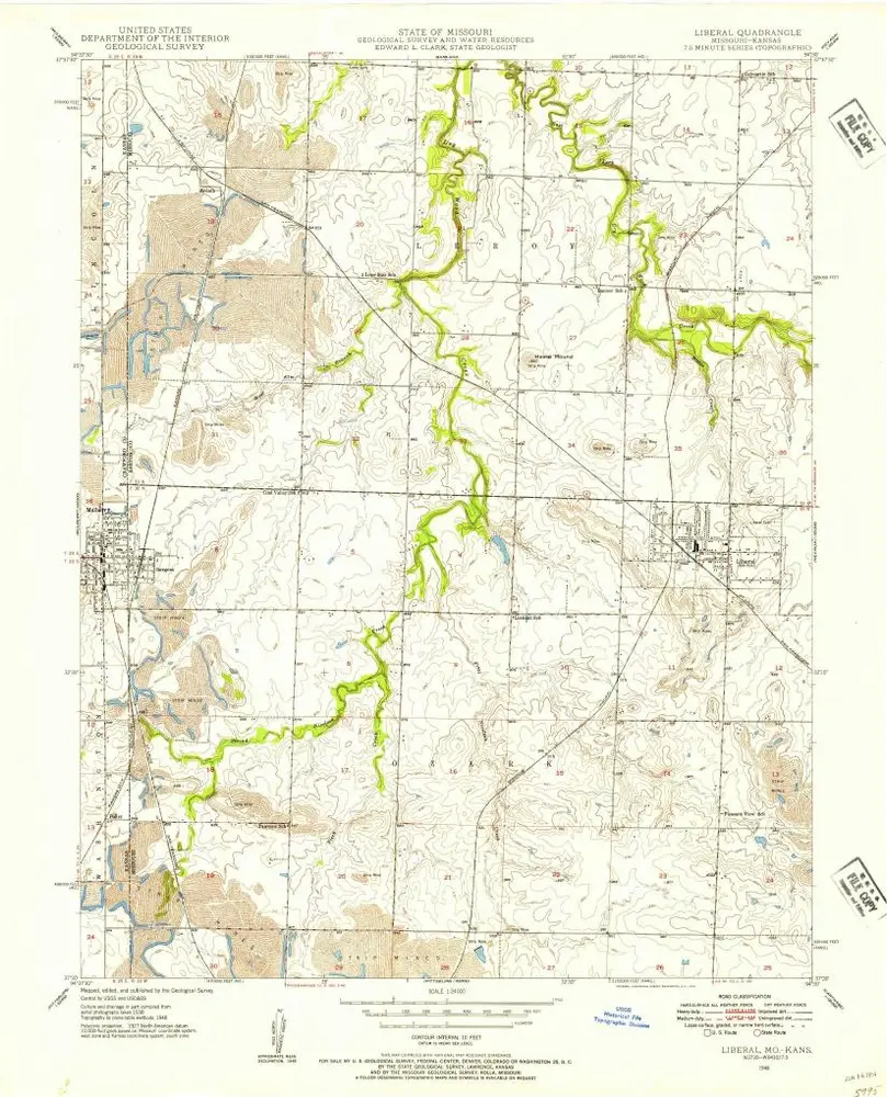
Liberal
Wyświetlanie na zewnętrznej stronie internetowej
Zobacz zdigitalizowane
Einrichtung:
United States Geological Survey
Vollständiger Titel:
Liberal
Jahr der Abbildung:
1948
Veröffentlichungsdatum:
1954
Maßstab der Karte:
1:24 000
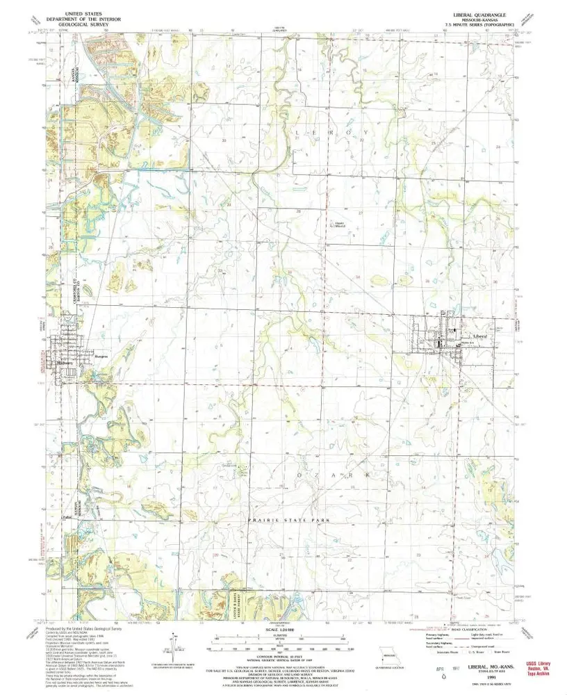
Liberal
1991
1:24k
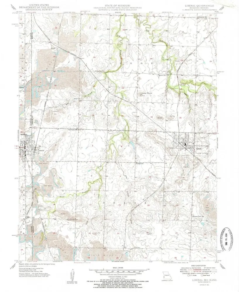
Liberal
1950
1:24k
Liberal
1950
1:24k
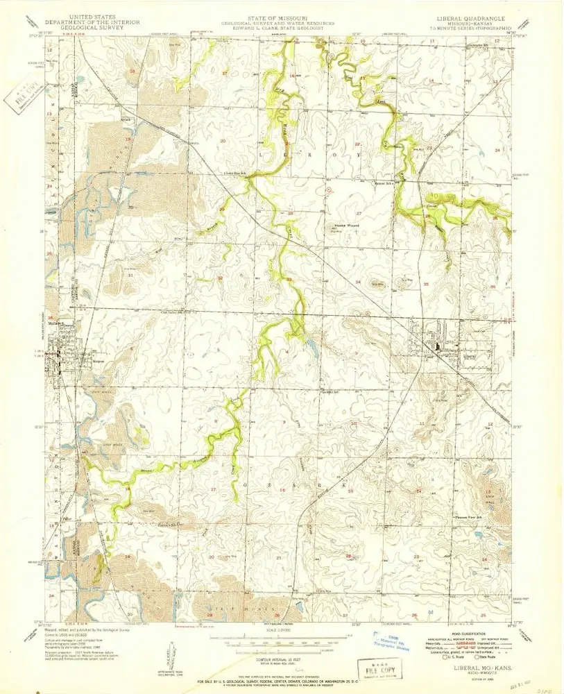
Liberal
1948
1:24k
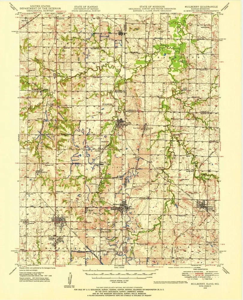
Mulberry
1950
1:63k
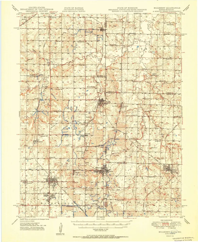
Mulberry
1948
1:63k
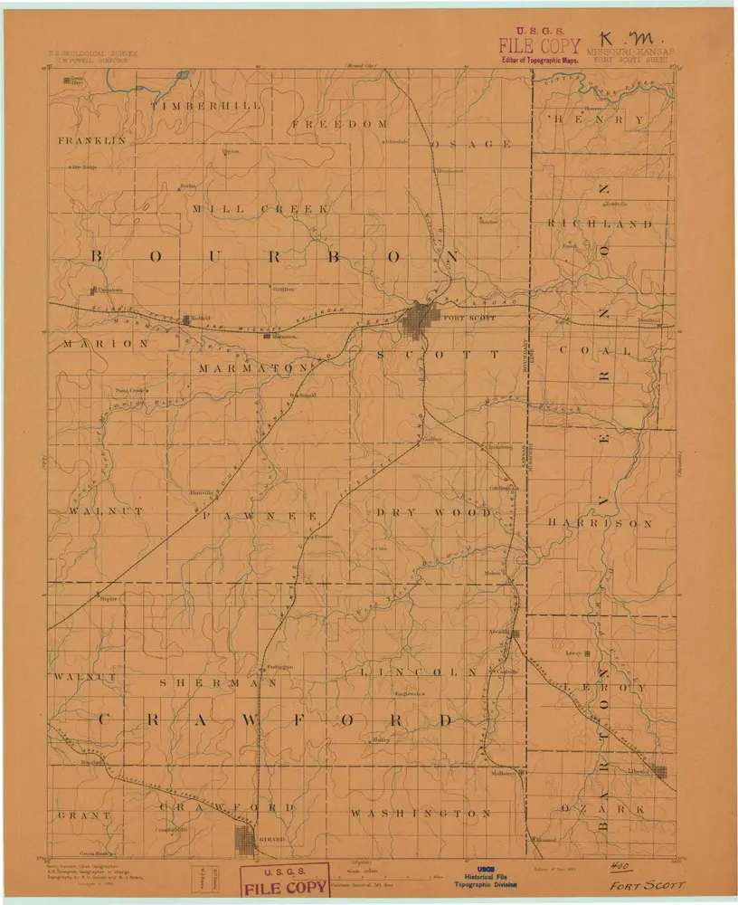
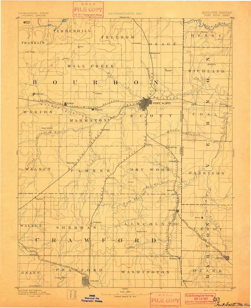
Fort Scott
1893
1:125k
Fort Scott
1893
1:125k
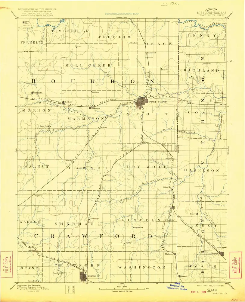
Fort Scott
1893
1:125k
Fort Scott
1893
1:125k
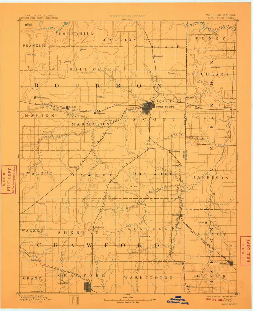
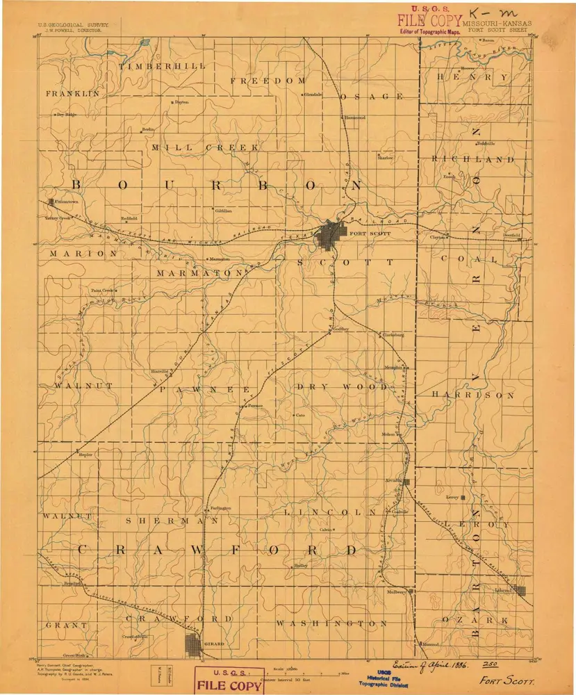
Fort Scott
1886
1:125k
Geschichte