Skatalogowana mapa
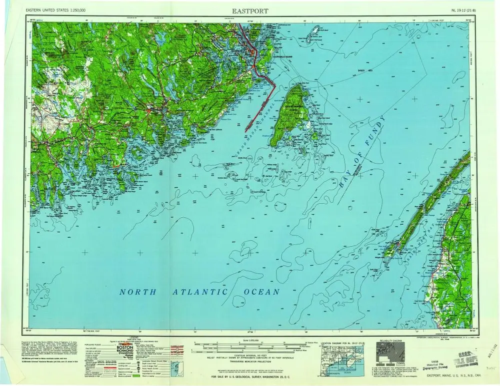
Eastport

Instytucja:United States Geological Survey
Pełny tytuł:Eastport
Rok ilustracji:1969
Data publikacji:1969
Skala mapy:1:250 000
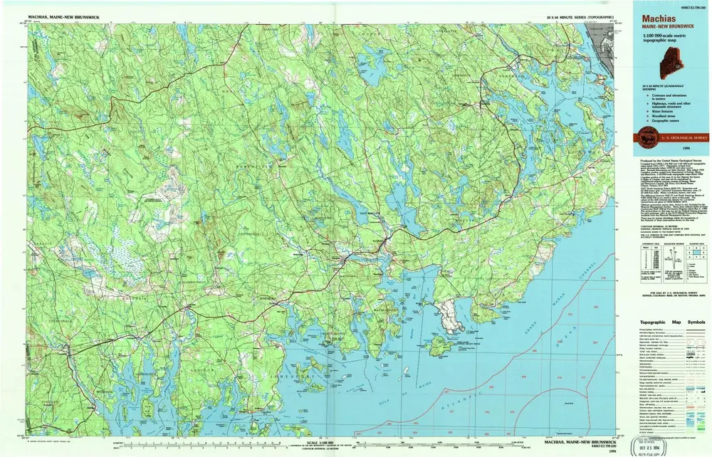
Machias
1994
1:100k
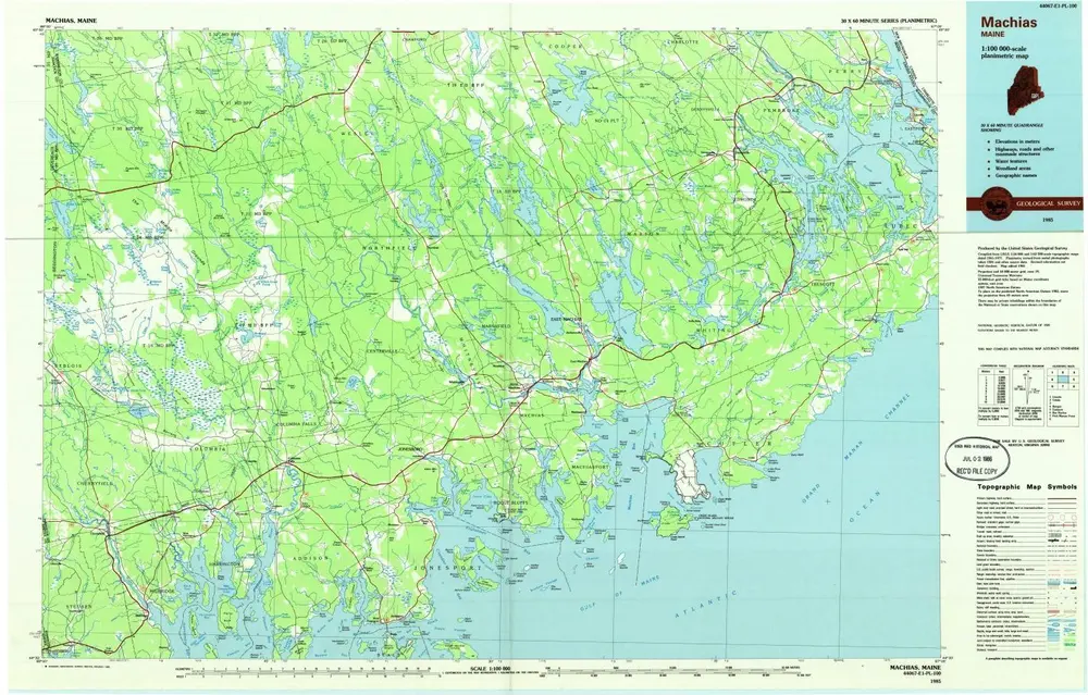
Machias
1985
1:100k
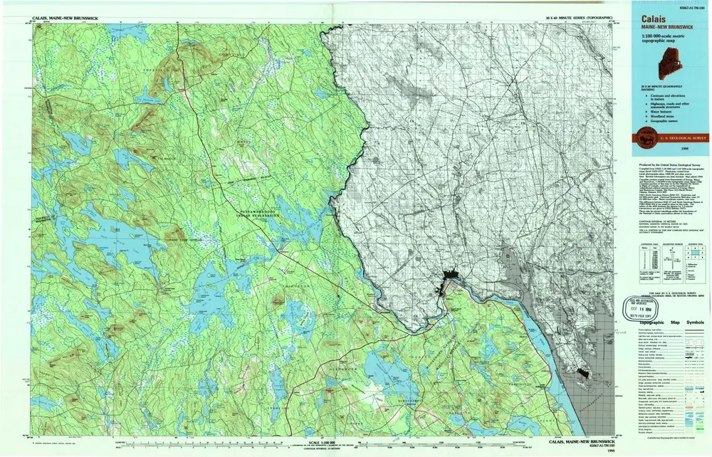
Calais
1994
1:100k
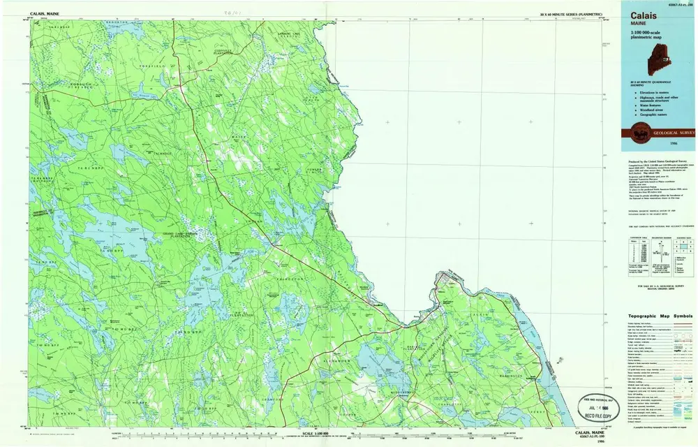
Calais
1986
1:100k
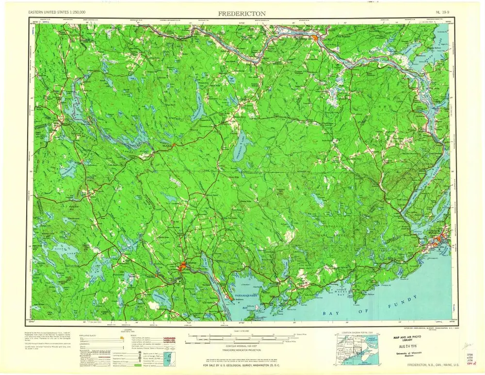
Fredericton
1963
1:250k
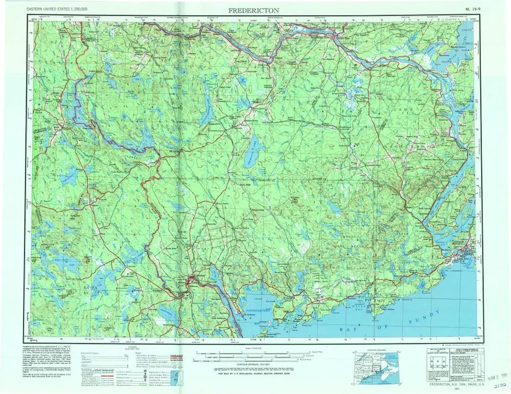
Fredericton
1957
1:250k
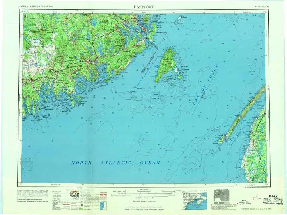
Eastport
1976
1:250k
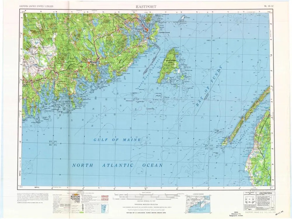
Eastport
1969
1:250k
Eastport
1961
1:250k
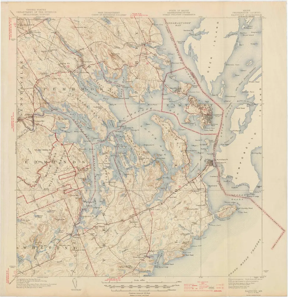
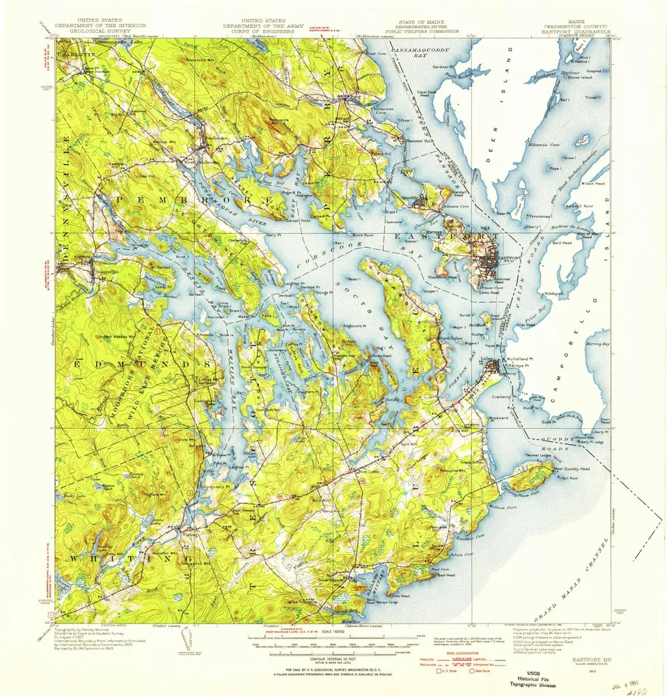
Eastport
1945
1:63k
Eastport
1945
1:63k
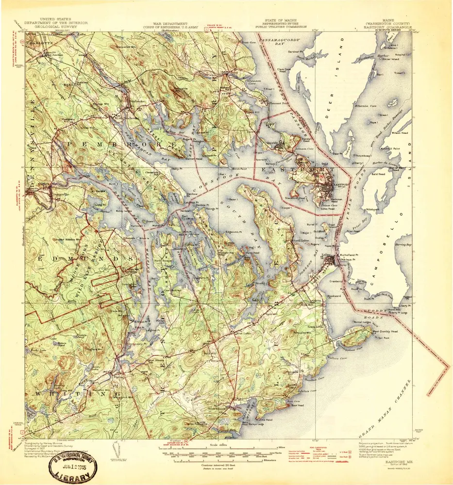
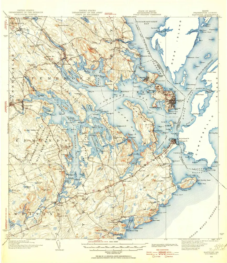
Eastport
1943
1:63k
Eastport
1943
1:63k
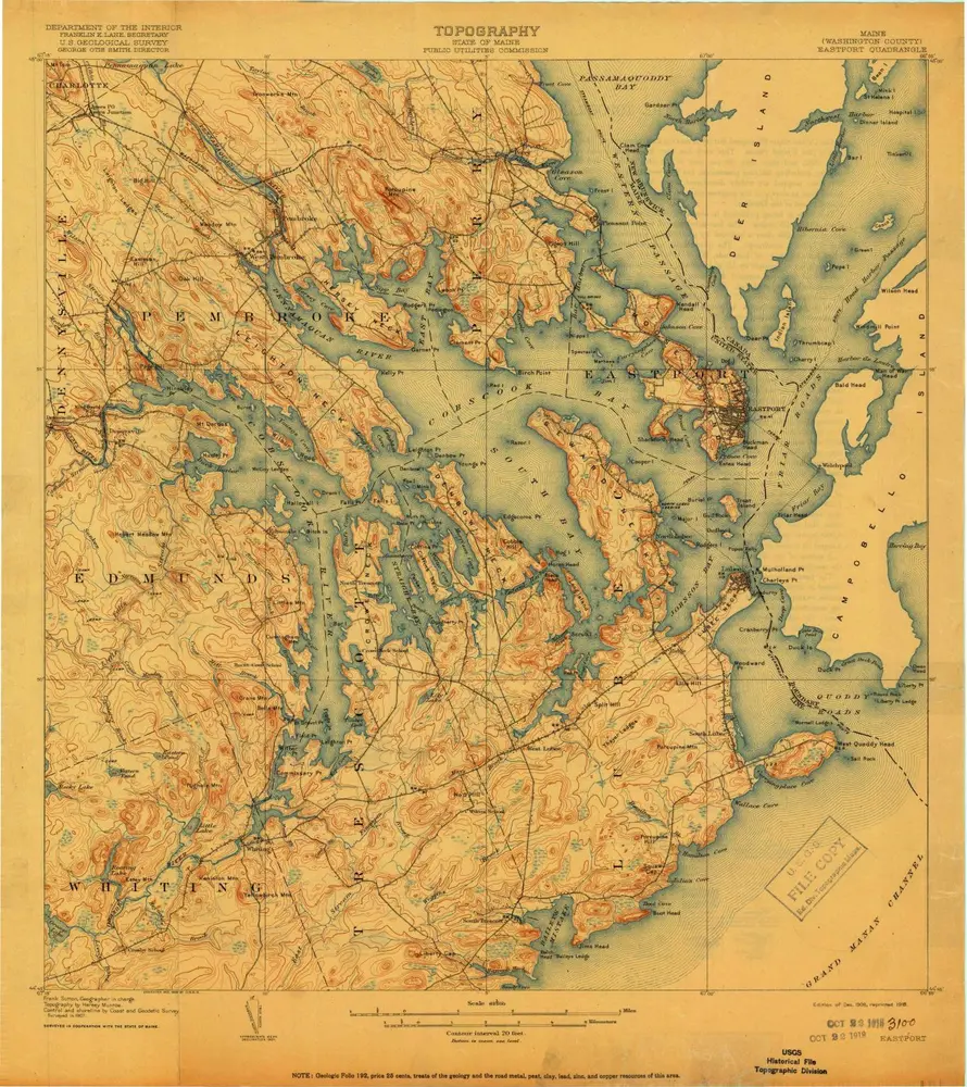
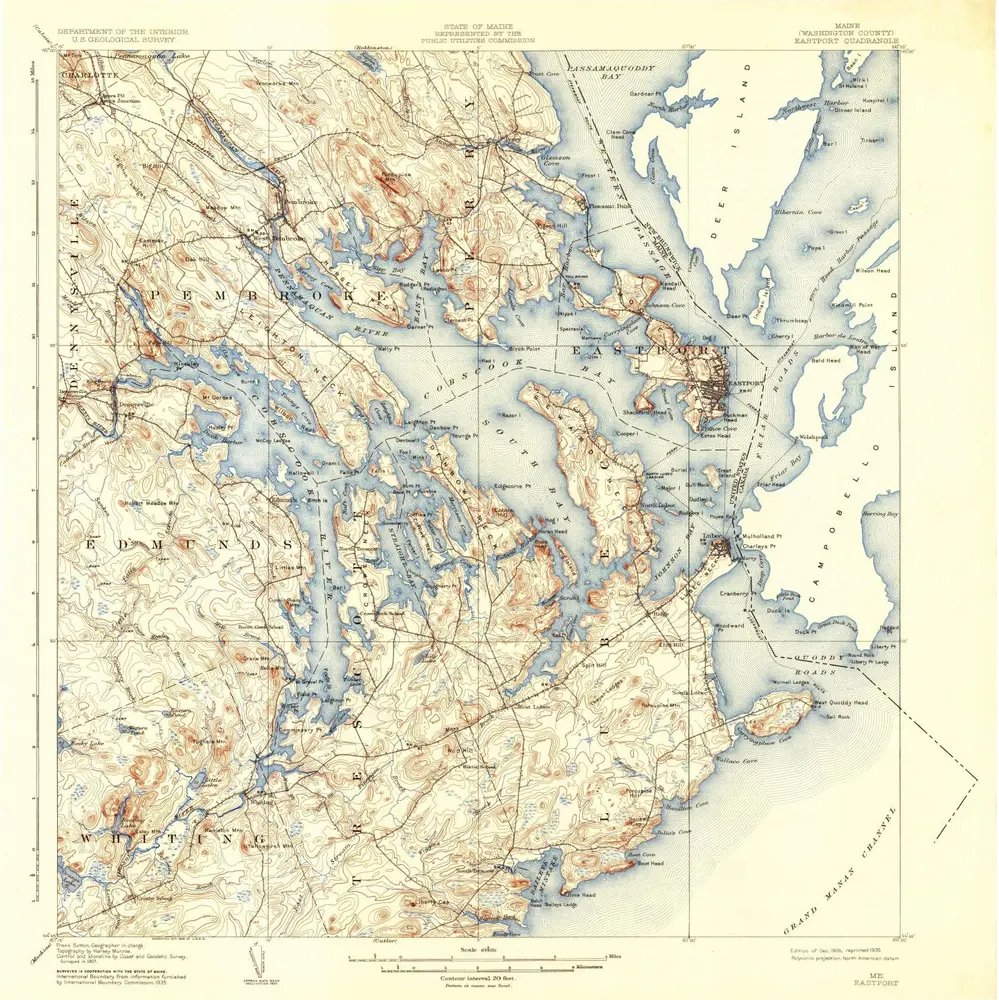
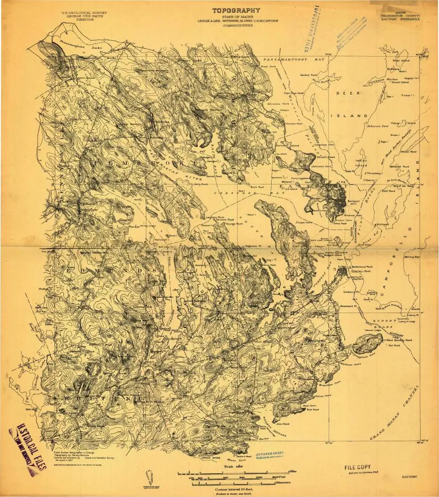
Eastport
1908
1:63k
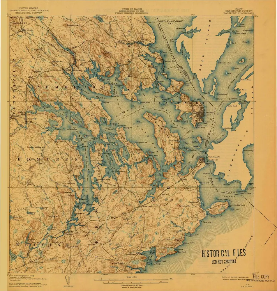
Eastport
1908
1:63k
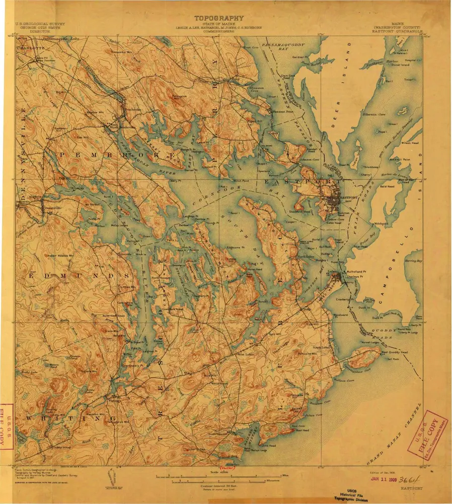
Eastport
1908
1:63k
Eastport
1908
1:63k
Eastport
1907
1:48k