3D

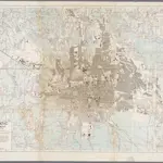
Bandoeng guide map
Annotatie: Gegevens verzameld over de periode/Data collected over the period: 1945; Kaart samengest. uit stadsplattegronden van 1933 en 1937, en uit kaarten op schaal 1:25.000 uit 1930-31. Bijgewerkt aan de hand van luchtfoto's tot aan december 1945; Annotatie geografische gegevens: Comp. from town plans dated 1933 and 1937 and 1:25.000 maps of 1930-31, rev. from air photogr. taken up to Dec. 1945; Gridded with N.E.I. Southern Zone Grid to conform to 1:50.000 sheet 39/XXXIX-C
GeoplazaSurvey Directorate Head Quarters Armed Forces Netherlands East Indies (AFNEI)
1946
[S.l. : Svy.Dte.H.Q.AFNEI]
1:10 000

