Porównaj

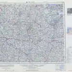
Series N501, U.S. Army Map Service, NO 34-12 Jelgava
Prepared by the Army Map Service (LU), Corps of Engineers, U.S. Army, Washington, D.C. Compiled in 1954 from: Ostland, 1:100,000, Generalstab des Heeres, 1944; and USHO Chart 4880, 1946. Relief taken in part from U.S.S.R., 1:100,000, General Staff of the Red Army, Sheets 143 and 144, 1937; Boundary data from Eastern Europe, 1:250,000, AMS, NO 34-12, 1948. Planimetric detail partially revised by photo-planimetric methods. Names processed in accordance with the rules of the U.S. Board on Geographic Names. Road classification should be referred to with caution. This sheet falls within the limits of maximum sea ice (March). Names for symbolized populated places are omitted where information is not available or where density of detail does not permit their inclusion.
OldMapsOnline CommunityU.S. Army Map Service
1954

