3D

Aberystwyth 13
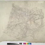
This plan of Cardigan Bay extends from Aberystwyth at the top left to Llansantffraid at the bottom left. A stretch of the Cambrian Mountains and the peat bogs of Cors-goch Glan Teifi are depicted further inland. The map's scale is noted beneath the formal title and the area of the land recorded as 117.8114 square miles. The circular hole in the top right-hand corner indicates that an 'Ordnance Office Copy' blind stamp has been removed from the sheet. Archaeological sites are named in gothic script. Colour washes depicting relief are combined with numerical annotations in black ink.
The British Library1820

