Mapa catalogado
Height District Map Section No. 8

Título completo:Height District Map Section No. 8
Ano da ilustração:1916
Tamanho físico:20 x 30 cm
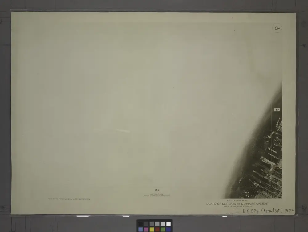
8A - N.Y. City (Aerial Set).
1924
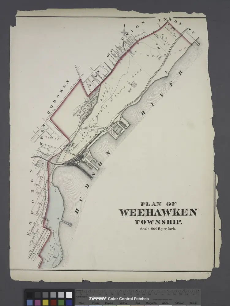
Plan of Weehawken township.
1873
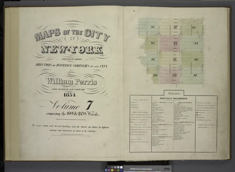
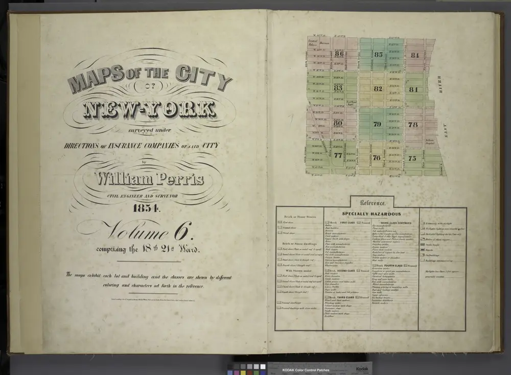
[Volume 7 Index Map.]
1854
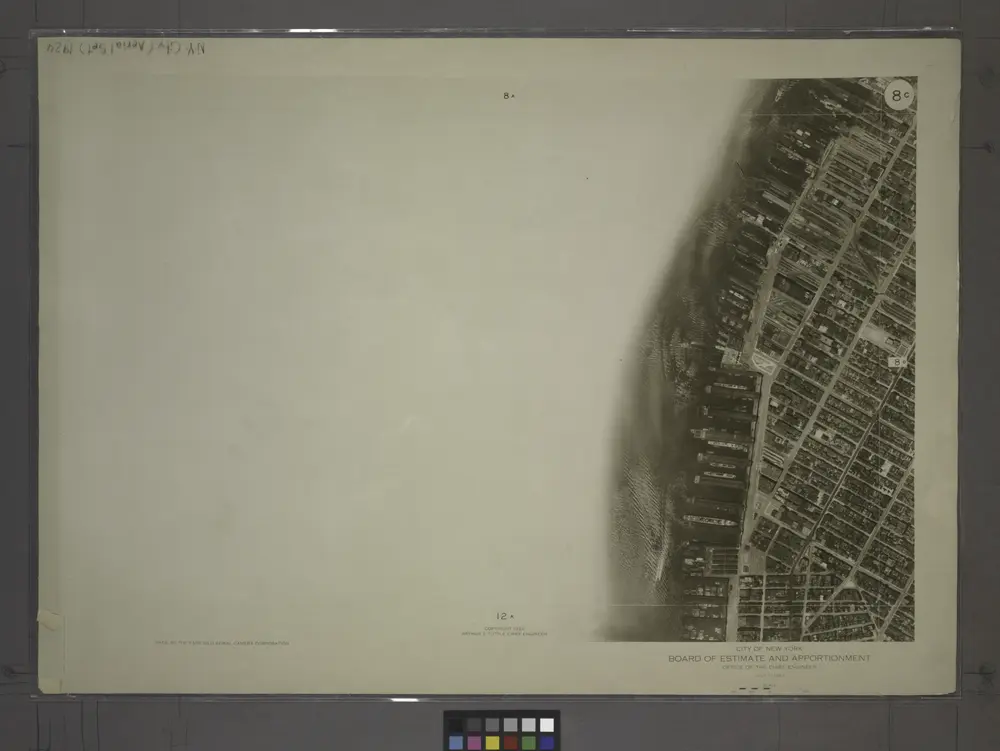
8C - N.Y. City (Aerial Set).
1924
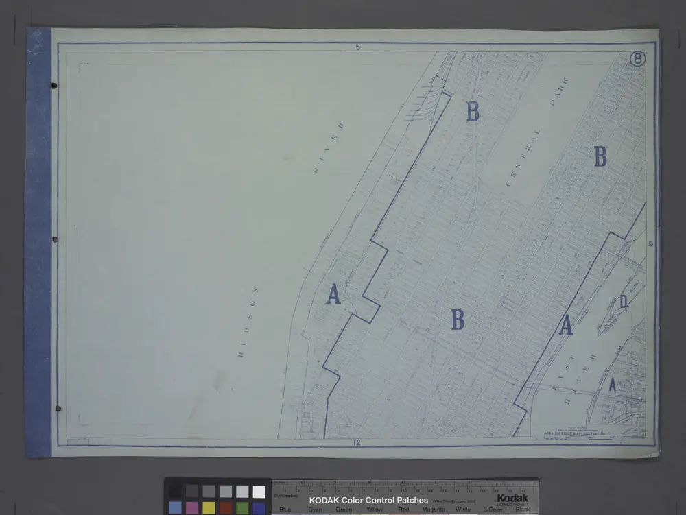
Area District Map Section No. 8
1916
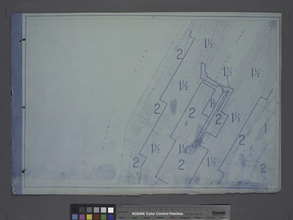
Height District Map Section No. 8
1916
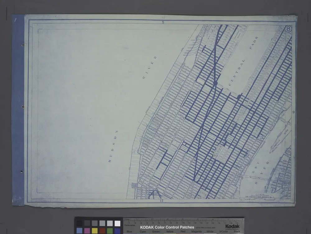
Use District Map Section No. 8
1916
[Volume 6 Index Map.]
1854
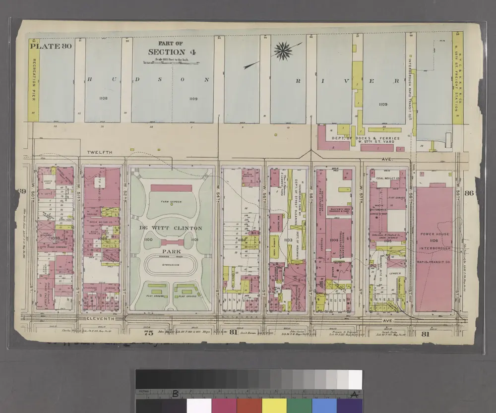
Part of Section 4 : Plate 80.
1916
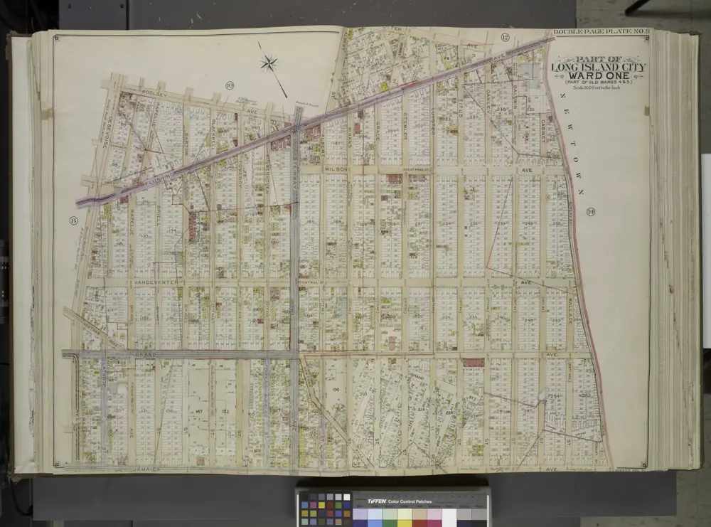
Queens, Vol. 2, Double Page Plate No. 9; Part of Long Island City Ward One (Part of Old Wards 4 and 5); [Map bounded by Woolsey Ave., Albert St., Potter Ave.; Including Old Bowery Bay Road, Jamaica Ave., Debevoise Ave.]
1912