Carte cataloguée
Map of the city of Albany

Institution:community
Titre complet:Map of the city of Albany
Année de l'image:1843
Éditeur:Merchant, George W.
Échelle de la carte:1:4 800
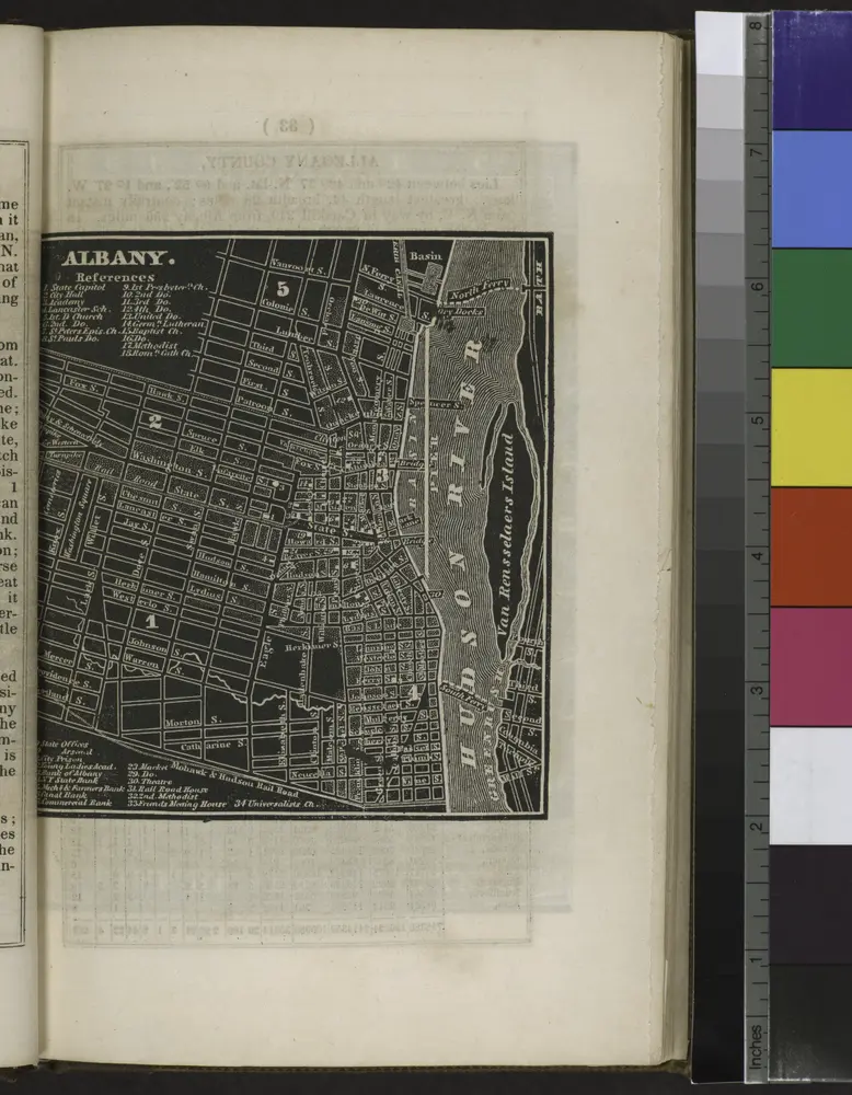
Albany.
1838
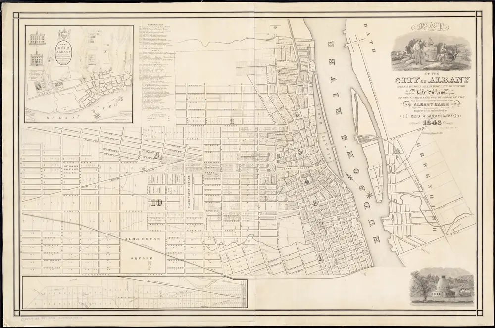
Map of the city of Albany
1843
Bradt, John
1:5k
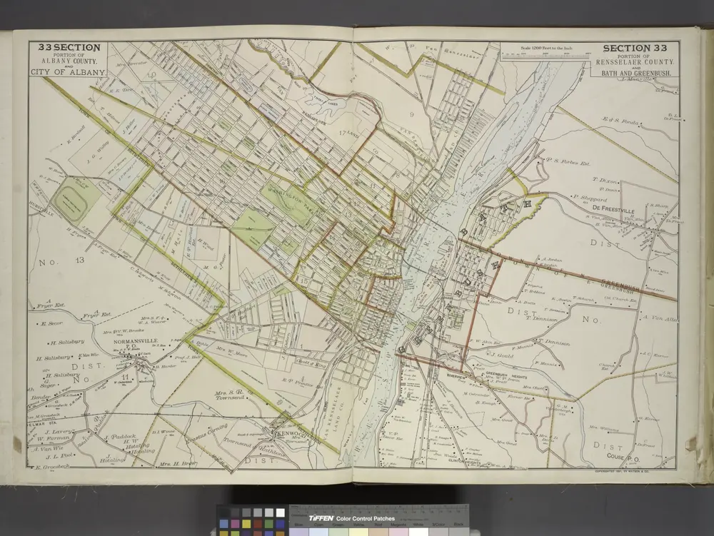
Portion of Albany County. and City of Albany. ; Portion of Rensselaer County. and Bath and Greenbush.
1891
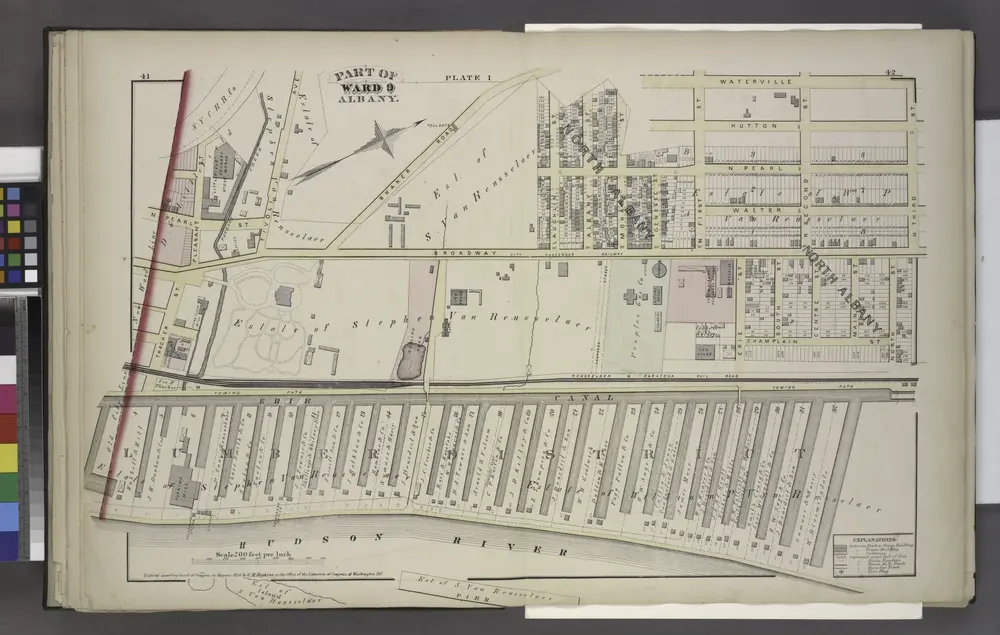
Plate I
1876
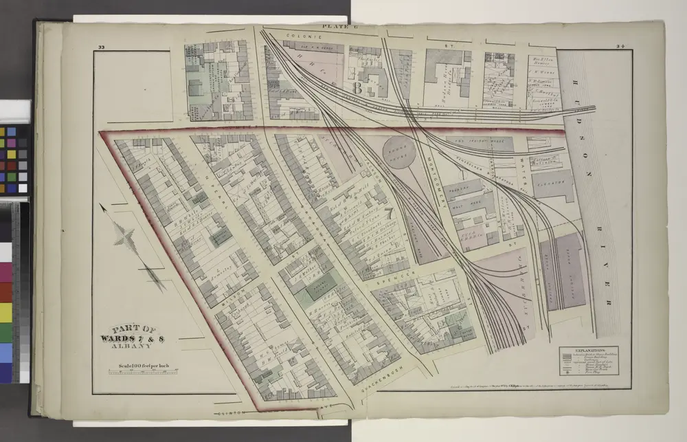
Plate G
1876
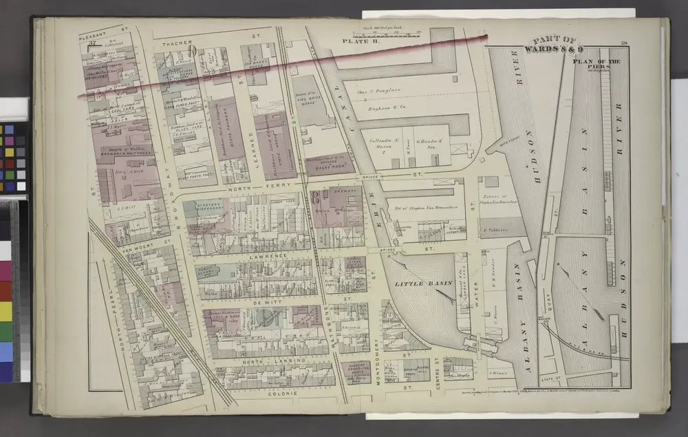
Plate H
1876
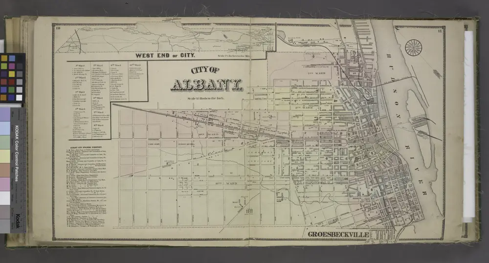
West End of City.[Village]; City of Albany.[Township]; Albany City Business Directory.
1866
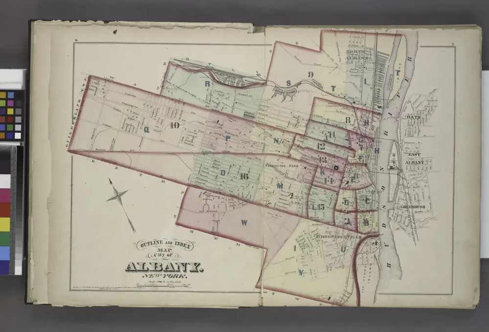
Outline and Index
1876
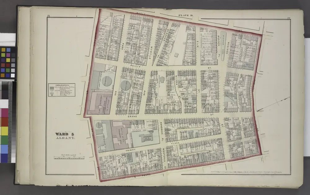
Plate D
1876
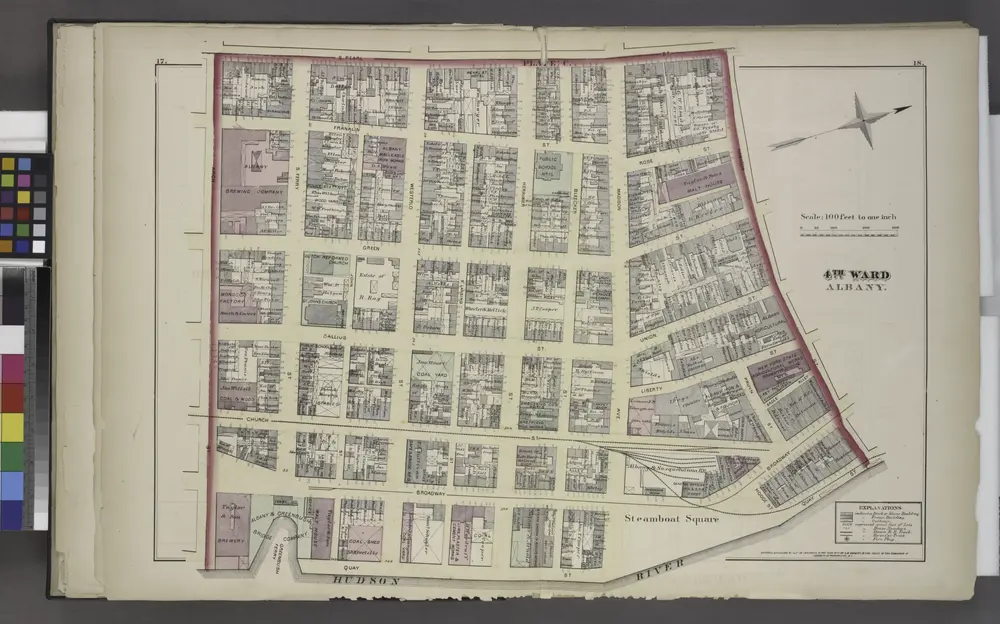
Plate C
1876