Carte cataloguée
An accurate map of the county palatine of Chester


Institution:University Library of Bern
Titre complet:An accurate map of the county palatine of Chester
Année de l'image:1752 - 1765
Éditeur:sold by I. Hinton at the Kings Arms in Newgate street
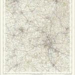
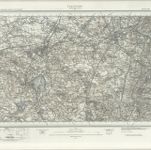
Stoke on Trent - OS One-Inch Map
1949
Ordnance Survey
1:63k
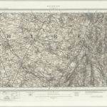
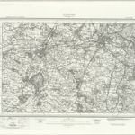
Macclesfield (Outline) - OS One-Inch Revised New Series
1895
Ordnance Survey
1:63k
Macclesfield (Hills) - OS One-Inch Revised New Series
1895
Ordnance Survey
1:63k
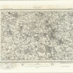
Stoke upon Trent (Outline) - OS One-Inch Revised New Series
1895
Ordnance Survey
1:63k
Stoke upon Trent (Hills) - OS One-Inch Revised New Series
1895
Ordnance Survey
1:63k
An accurate map of the county palatine of Chester
1765
Bowen; Hinton
Cestria comitatvs palatinvs
1690
Valck; Schenk
Cestria comitatvs palatinvs
1646
Blaeu
Stockport (Hills) - OS One-Inch Revised New Series
1895
Ordnance Survey
1:63k
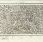
Stockport (Outline) - OS One-Inch Revised New Series
1895
Ordnance Survey
1:63k