Skatalogowana mapa
[26] Sect. Wetzlar, uit: Geologische Karte der Rheinprovinz und der Provinz Westphalen / ausgeführt durch H. von Dechen

Instytucja:Vrije University Amsterdam
Pełny tytuł:[26] Sect. Wetzlar, uit: Geologische Karte der Rheinprovinz und der Provinz Westphalen / ausgeführt durch H. von Dechen
Rok ilustracji:1855
Wydawca:Berlin : Schropp
Skala mapy:1:80 000
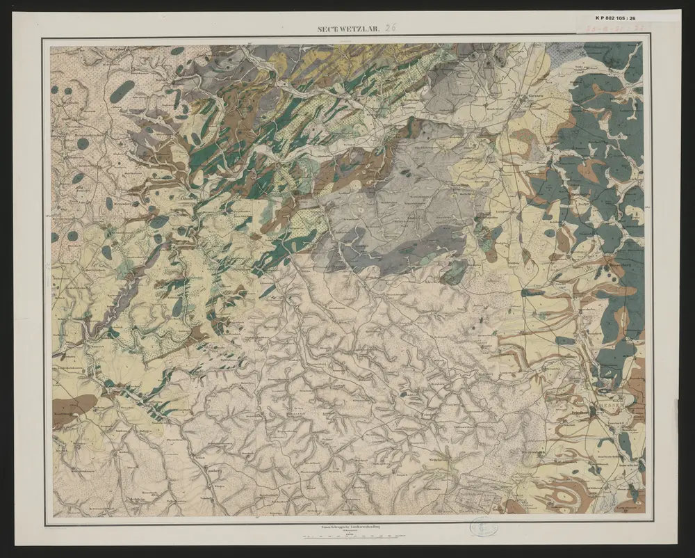
Sect. Wetzlar
1850
Berlin : bei Simon Schropp u. Comp.
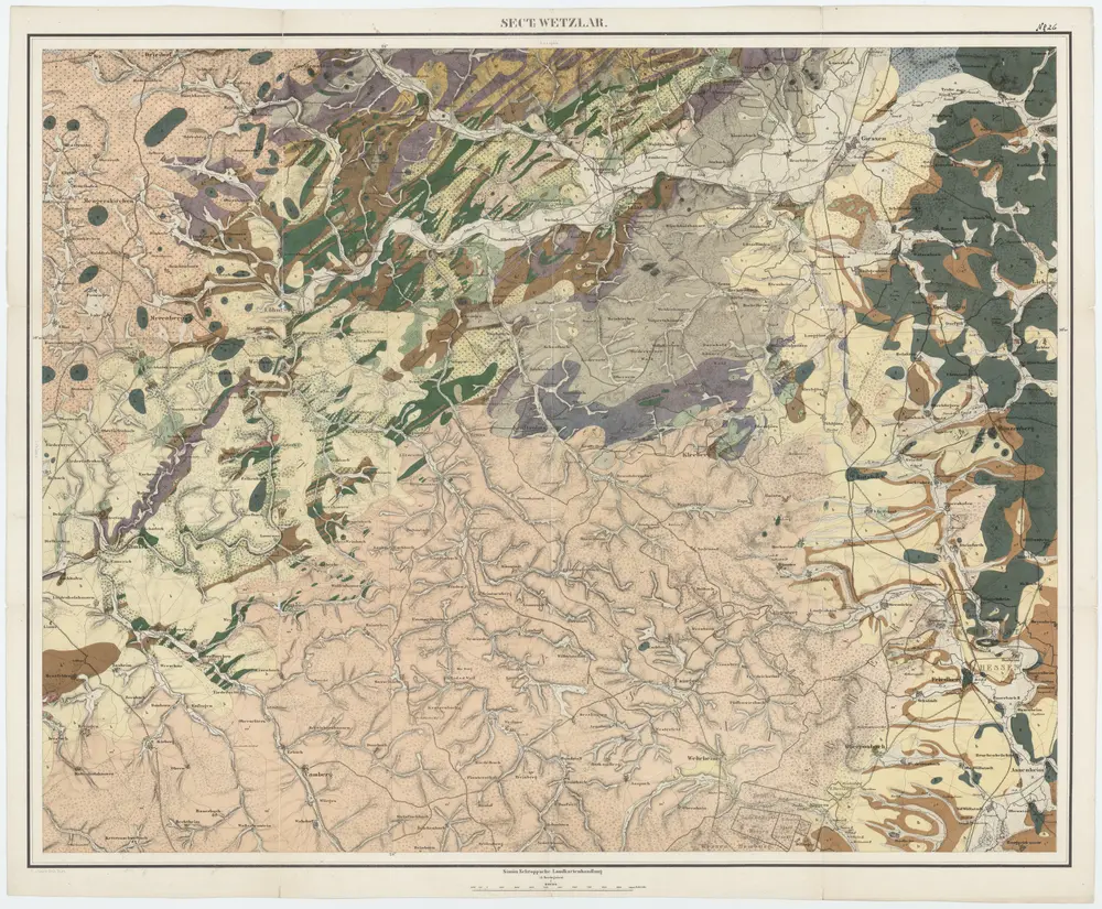
[26] Sect. Wetzlar, uit: Geologische Karte der Rheinprovinz und der Provinz Westphalen / ausgeführt durch H. von Dechen
1855
Heinrich von Dechen
1:80k
Meßtischblatt 3274 : Villmar, 1907
1907
1:250k
Meßtischblatt 3274 : Eisenbach, 1877
1877
1:250k
Meßtischblatt 3276 : Limburg, 1907
1907
1:250k
Meßtischblatt 27 : Limburg, 1877
1877
1:250k
Meßtischblatt 3219 : Weilburg, 1907
1907
1:250k
Meßtischblatt 3219 : Weilburg, 1877
1877
1:250k
Meßtischblatt 3218 : Hadamar, 1907
1907
1:250k
Meßtischblatt Hadamar
1886
1:250k