Cataloged map
Meßtischblatt 3531 : Oebisfelde, 1939
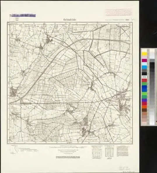

Full title:Meßtischblatt 3531 : Oebisfelde, 1939
Depicted:1939
Pubdate:1939
Map scale:1:250 000
Meßtischblatt 3531 : Oebisfelde, 1939
1939
1:250k

87. Braunschweig, uit: Topographische Uebersichtskarte des Deutschen Reiches / herausgegeben v. d. Kartogr. Abt. d. Königl. Preuß. Landesaufnahme
1899
Königlich Preußische Landesaufnahme. Kartographische Abtheilung
1:200k
n/a
1791
n/a
1791

Magdeburg 59, uit: Special-Karte von Mittel-Europa / nach amtlichen Quellen bearbeitet von W. Liebenow
1899
Johannes Wilhelm Liebenow 1822-1897
1:300k
n/a
1791
n/a
1791
n/a
1791

Straßen im Herzogtum Braunschweig 1848
1848
Kunz, Andreas ; Treiling, Thomas
n/a
1791