3D

Cader Idris
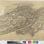
This plan of south Snowdonia runs from Cardigan Bay inland to the Cader Idris. Types of land use are indistinguishable in this drawing as no clear symbols have been used. The purple 'Ordnance Survey Manuscript Store' stamp at the top right margin is dated 9th April 1881.
The British Library1816
1816

