Documento

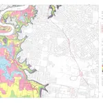
Brisbane River flood plain map of Brisbane and suburbs sheet 5
Brisbane River flood plain map of Brisbane and suburbs sheet 5 showing areas likely to be inundated by Brisbane River floods rising to various heights on the Brisbane City Gauge and showing the probable frequencies of such flooding. Localities covered include Fairfield Tennyson Rocklea Salisbury and Long Pocket
Historical Maps QLD1975
Department of Natural Resources Mines and Energy

