Katalogisierte Karte
[Plate 38: Bounded by Hillside Avenue, Rocky Hill Road, Hamilton Avenue, Jericho Turnpike, & Hempstead and Jamaica Plank Road.]

Vollständiger Titel:[Plate 38: Bounded by Hillside Avenue, Rocky Hill Road, Hamilton Avenue, Jericho Turnpike, & Hempstead and Jamaica Plank Road.]
Jahr der Abbildung:1909
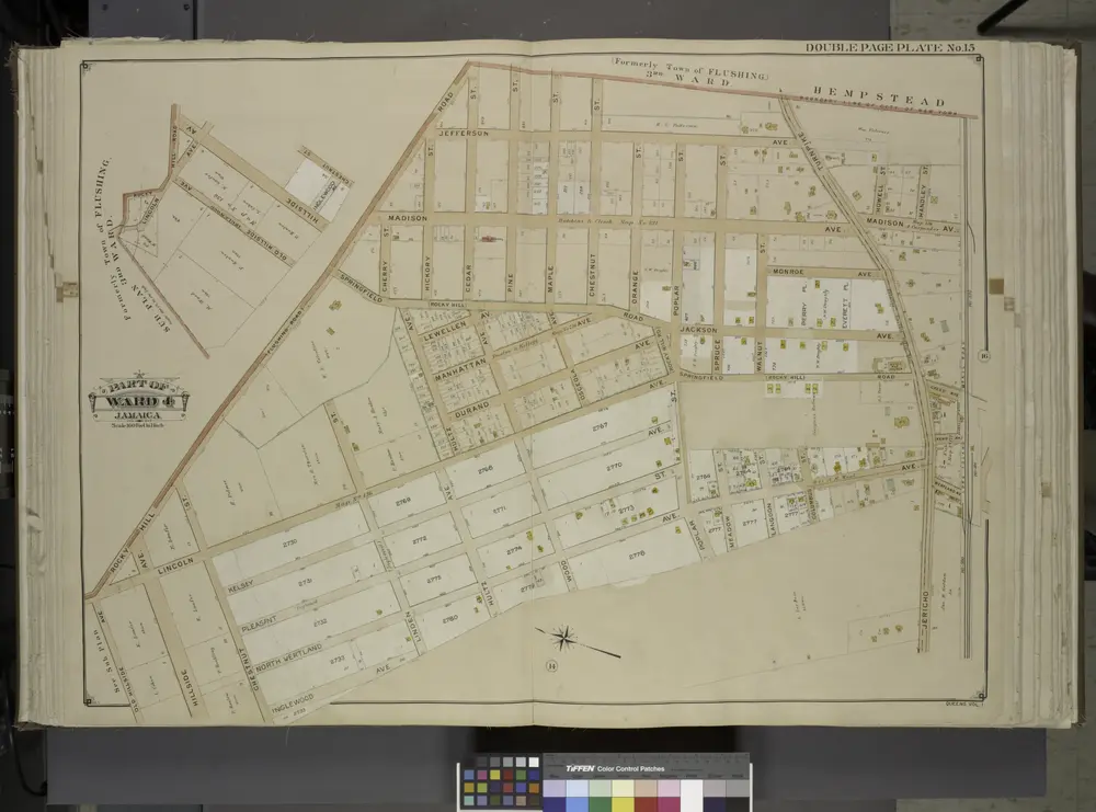
Queens, Vol. 1, Double Page Plate No. 15; Sub Plan; Formerly Town of Flushing 3rd Ward; [Map bounded by Rocky Ave., Lincoln Ave., Hill Road, Old Hillside Ave., Hillside Ave., Inglewood Ave., Chestnut St.]; Part of Ward 4; Jamaica; [Map bounded by
1912
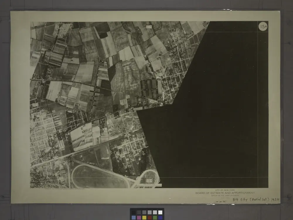
15B - N.Y. City (Aerial Set).
1924
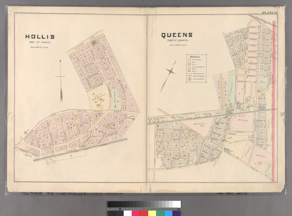
Plate 20: Hollis, Town of Jamaica. - Queens, Town of Jamaica.
1891
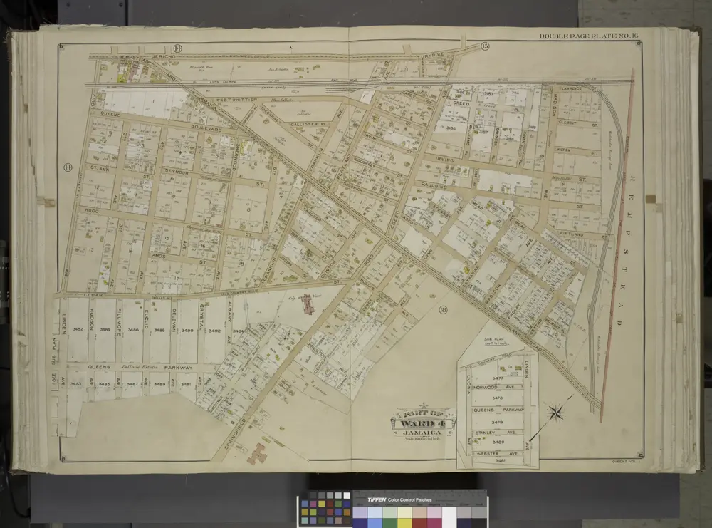
Queens, Vol. 1, Double Page Plate No. 16; Part of Ward 4; Jamaica; [Map bounded by Jericho Turnpike, Hempstead and Jamaica Plank Road, First Ave., Queens Boulevard, 2nd Ave., 3rd Ave., 4th Ave., 5th Ave., Sherwood Ave., 6th Ave., Franklin A
1912
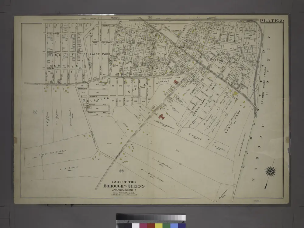
[Plate 39: Bounded by Chichester Ave., Claremont Ave., Queens Blvd., Hempstead and Jamaica Plank Rd., W. Whittier St., Wertland Ave., (Queens Court) Creed Ave., Hempstead and Jamaica Plank Rd., Springfield Rd., Little Plain, Hollis Ave. & Cummings St.]
1909
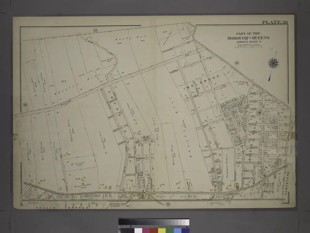
[Plate 38: Bounded by Hillside Avenue, Rocky Hill Road, Hamilton Avenue, Jericho Turnpike, & Hempstead and Jamaica Plank Road.]
1909
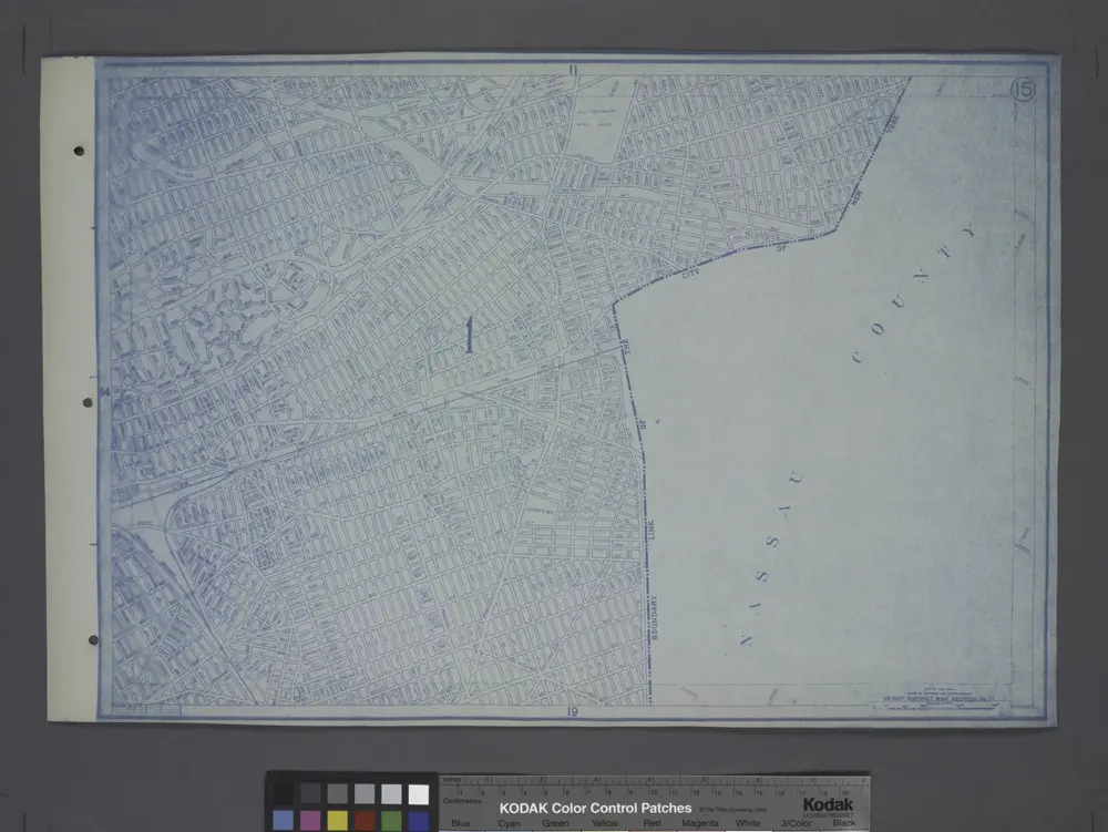
Height District Map Section No. 15; Height district map / City of New York, Board of Estimate and Apportionment.
1916
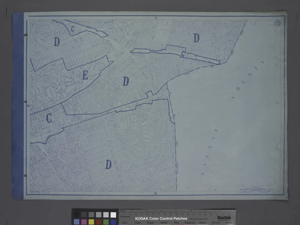
Area District Map Section No. 15; Area district map / City of New York, Board of Estimate and Apportionment.
1916
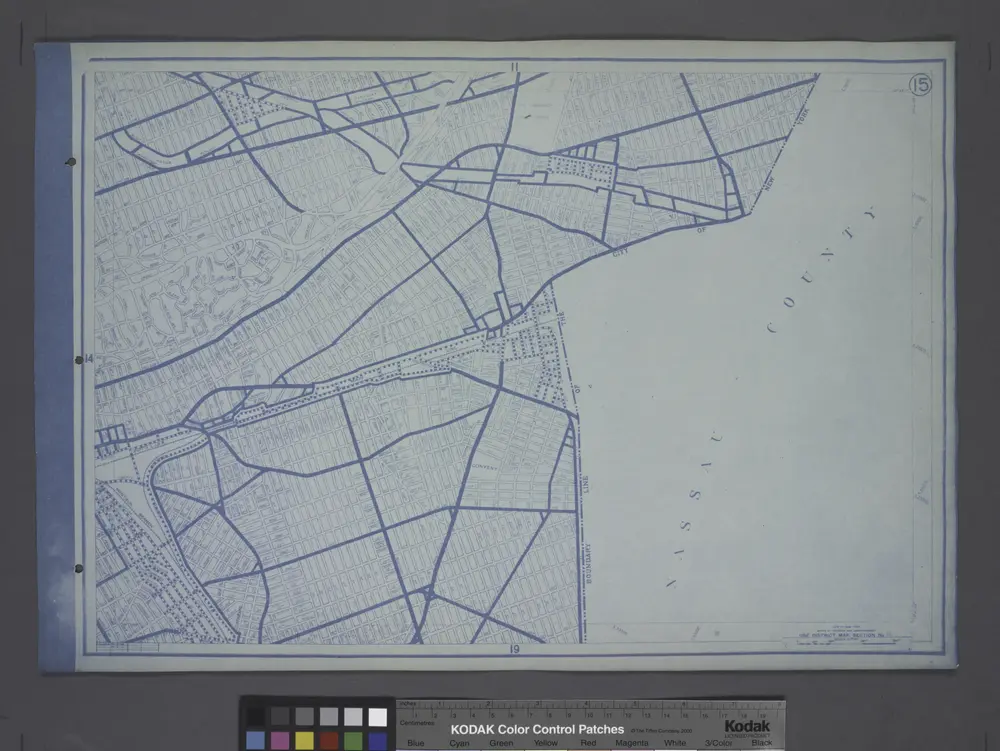
Use District Map Section No. 15; Use district map / City of New York, Board of Estimate and Apportionment.
1916
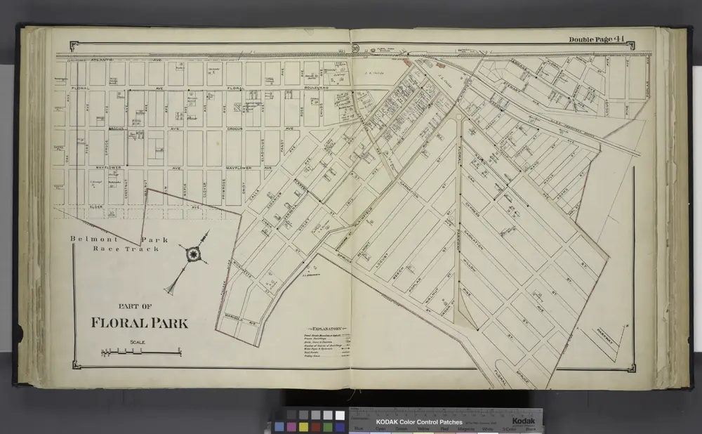
Part of Floral Park
1914