Proyecto
Comunidad
Noticias
Mi aplicación
Mis mapas
Cataloged map
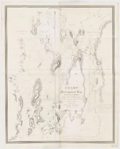
Chart of Narraganset Bay : surveyed in 1832
Ver en sitio web externo
Ver digitalizado
Institution:
Harvard Library
Full title:
Chart of Narraganset Bay : surveyed in 1832
Depicted:
1832
Pubdate:
1832
Publisher:
U.S. Navy
Map scale:
1:24 000
Catálogo
Harvard Library
nrs.harvard.edu
Chart of Narraganset Bay : surveyed in 1832
1832
Wadsworth, Alexander S
1:24k
Newport
1935
1:63k
Newport
1931
1:63k
Newport
1922
1:63k
Newport
1920
1:63k
Newport
1920
1:63k
Newport
1904
1:63k
Newport
1894
1:63k
Newport
1894
1:63k
Newport
1894
1:63k
History