Compara

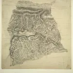
Kingsclere
There were no definitive guidelines in the early 1800s for recording relief, so each draughtsman differs in his representation. Contour lines were not introduced until 1839-40. Here, Budgen uses dense clusters of short, dark strokes ('hachures') to indicate relief. Although the recording of archaeological sites did not become obligatory until 1816, he also illustrates a Roman road, running diagonally upwards from the lower left of the map, noting its local name: 'Devil's Bank'.
The British Library1808

