Compara

Woodstock
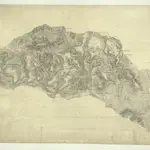
The map of the area surrounding the Royal Wychwood Forest and Oxford was drawn by teaching draughtsman at the Tower of London, William Stanley. After inaccuracies were found in the plan during routine checks in 1820, Stanley hastened to explain that the employment by the Board of Ordnance of local civilian surveyors "of various abilities" to carry out much of the mapping meant that accuracy was often sacrificed for speed as these civilian personnel were paid according to the number of miles surveyed and drawn. An ochre-coloured turnpike road forms a boundary from Shipton Down at the top left of the map to Yarnton at the centre right. The cumulative mileage appears alongside the route in figures. The close attention Stanley pays to communication routes emphasises the military focus of these studies.
The British Library1811

