编目地图

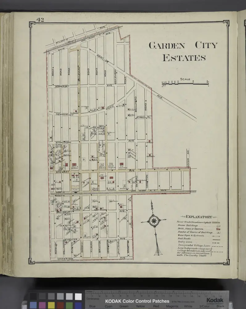
Garden City Estates
1914
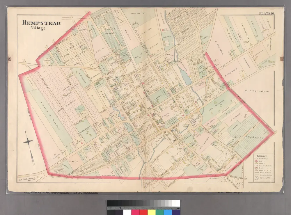
Plate 10: [Bounded by Intersection Street, Franklin Street, Stevens Avenue, Main Street, Columbia Street, Stewart Avenue, Bennett Avenue, Fulton Street, William Street, Gerard Street, Greenwich Street, Grove Street, Prospect Street, Franklin Street, Fron
1891
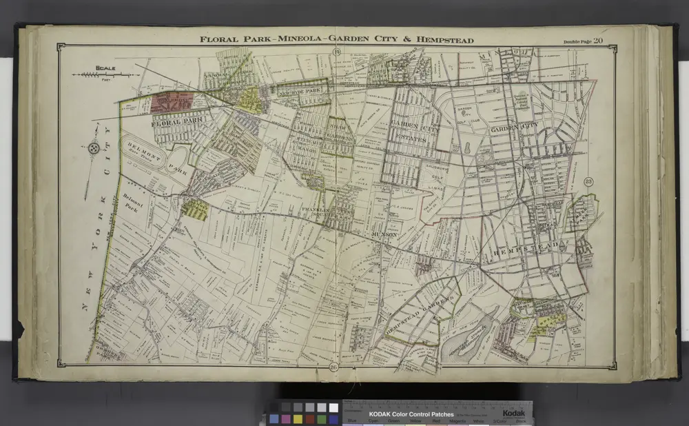
Floral Park - Mineola - Garden City & Hempstead
1914
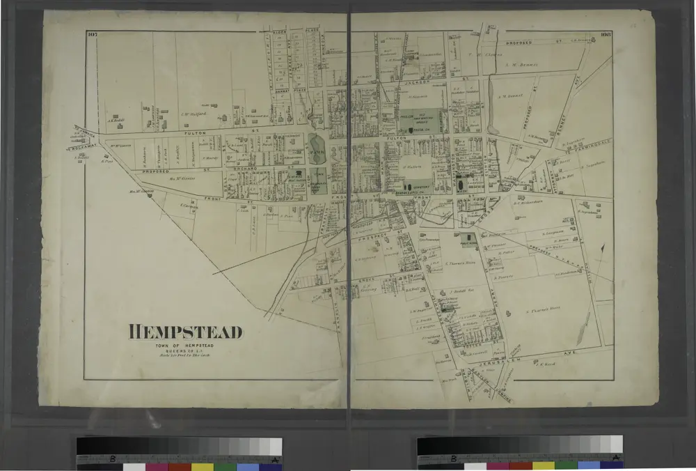
Hempstead, Town of Hempstead, Queens Co. L.I.
1873
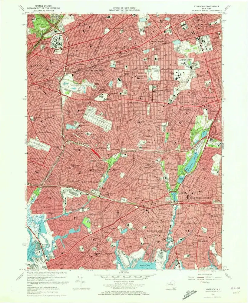
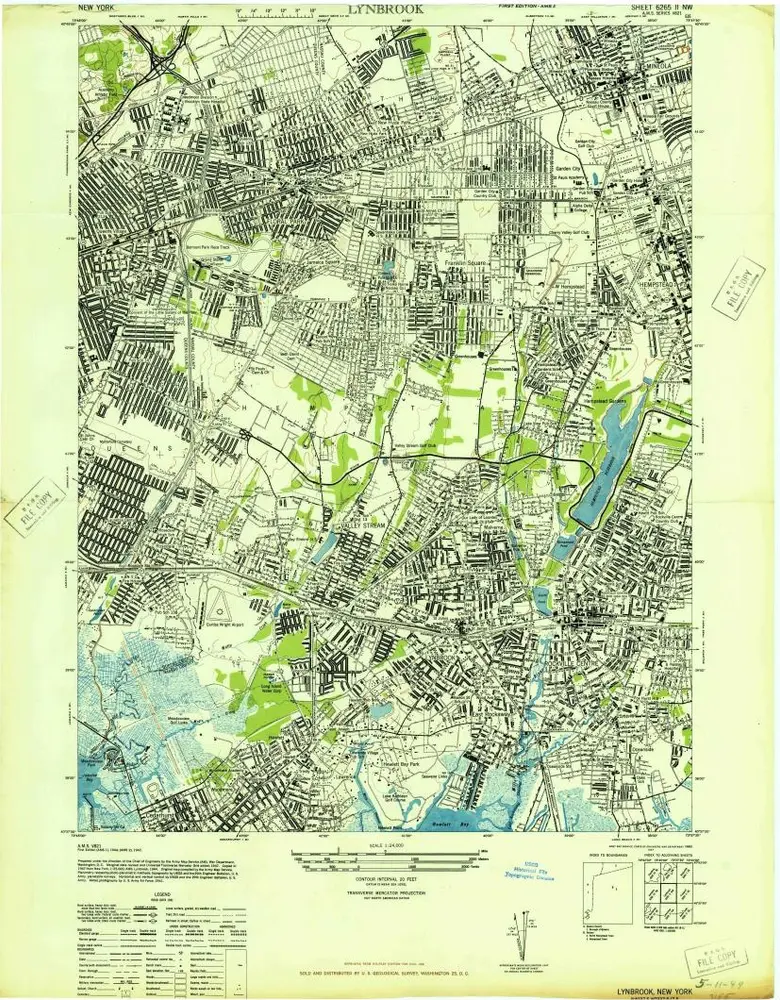
Lynbrook
1969
1:24k
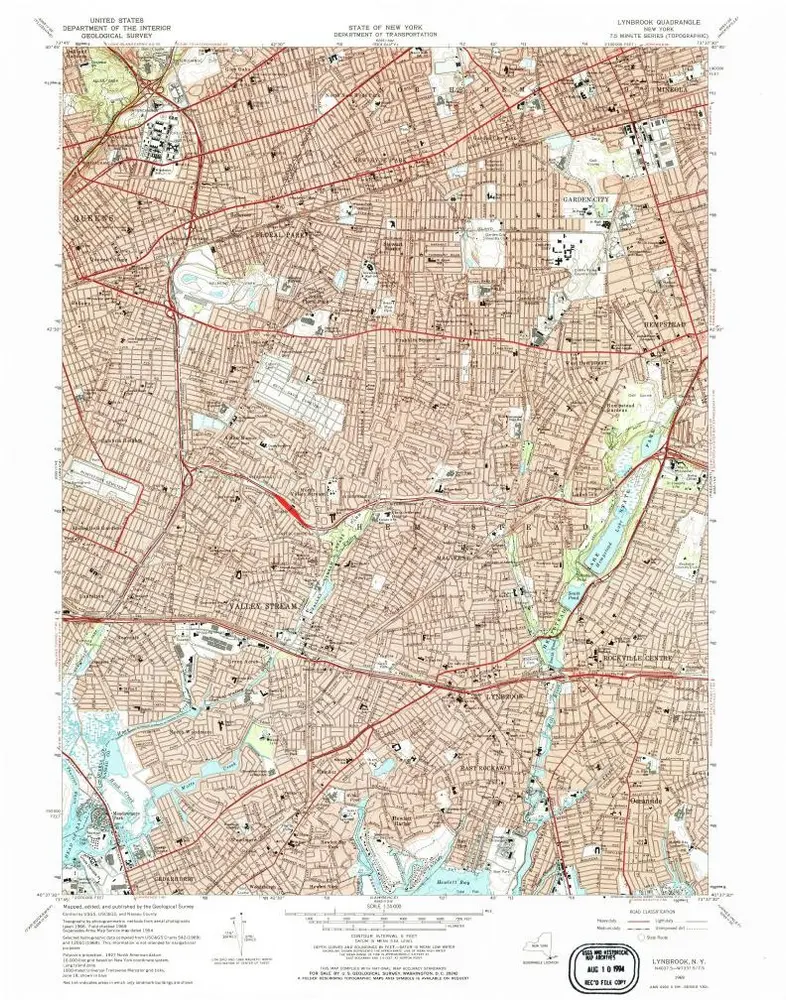
Lynbrook
1969
1:24k
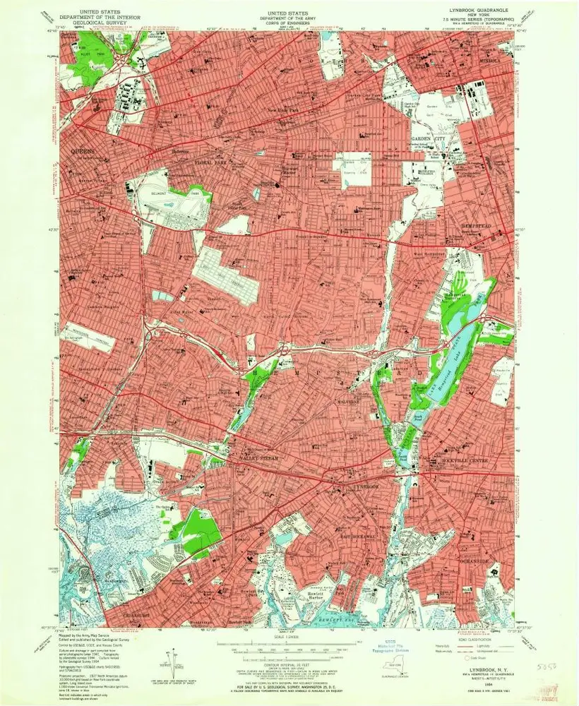
Lynbrook
1954
1:24k
Lynbrook
1954
1:24k
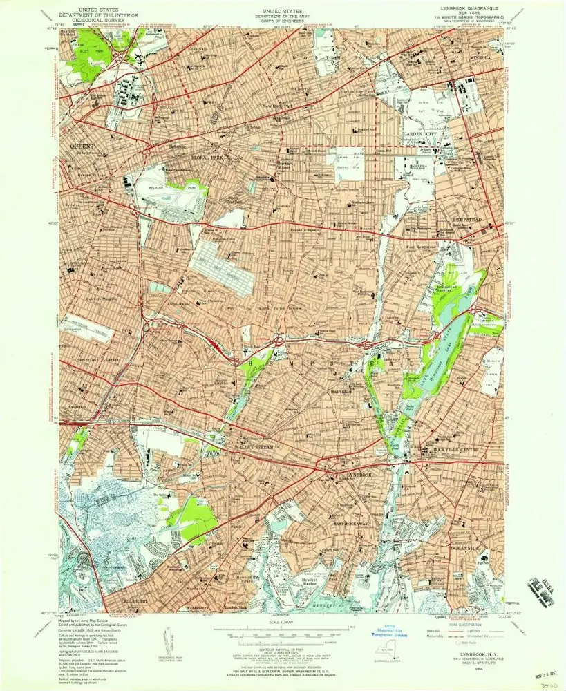
Lynbrook
1947
1:24k
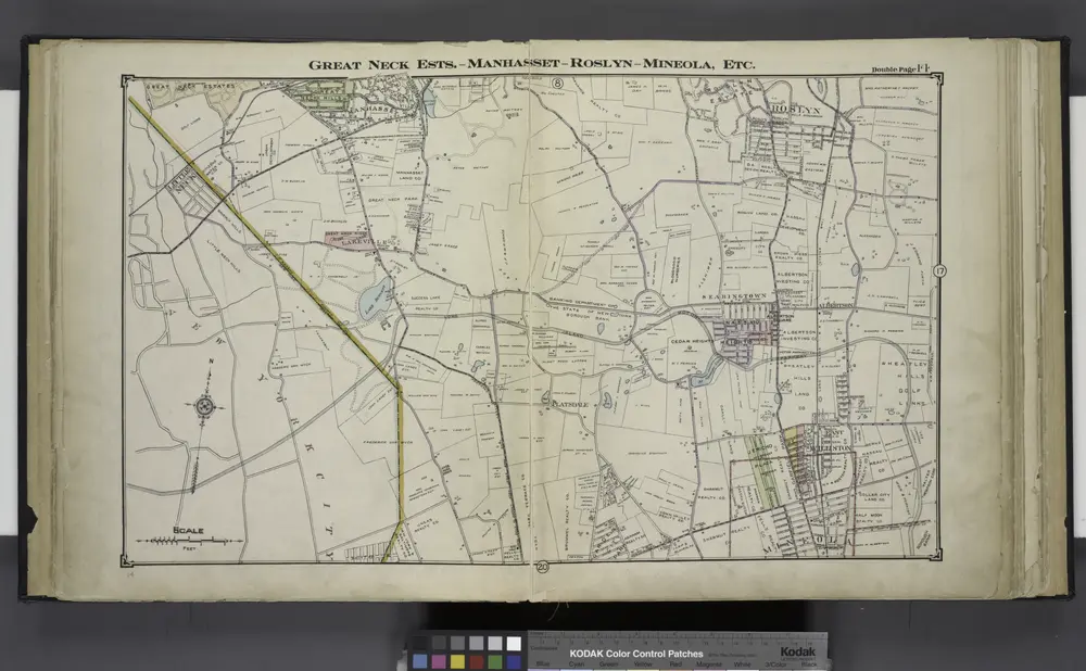
Great Neck Ests. - Manhasset - Roslyn - Mineola, Etc.
1914