Cataloged map

n/a
1791
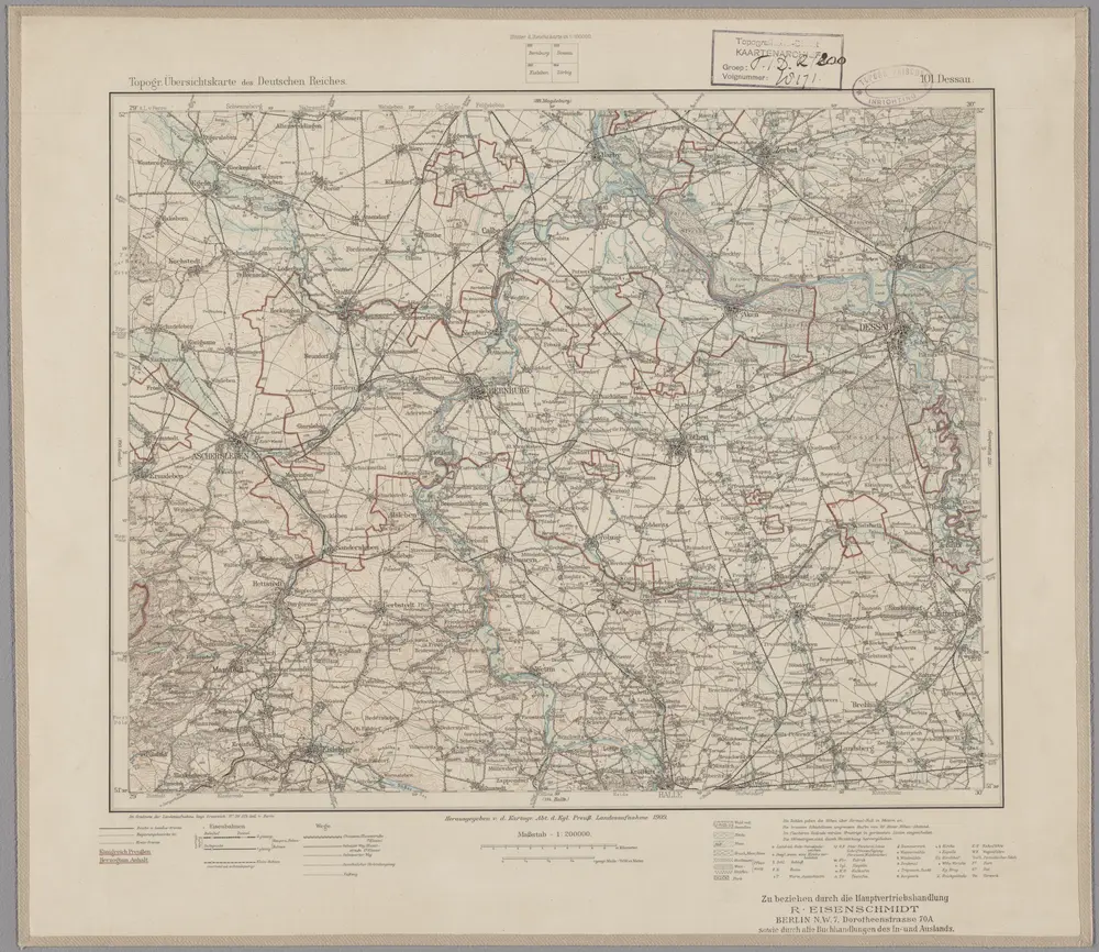
101. Dessau, uit: Topographische Uebersichtskarte des Deutschen Reiches / herausgegeben v. d. Kartogr. Abt. d. Königl. Preuß. Landesaufnahme
1899
Königlich Preußische Landesaufnahme. Kartographische Abtheilung
1:200k
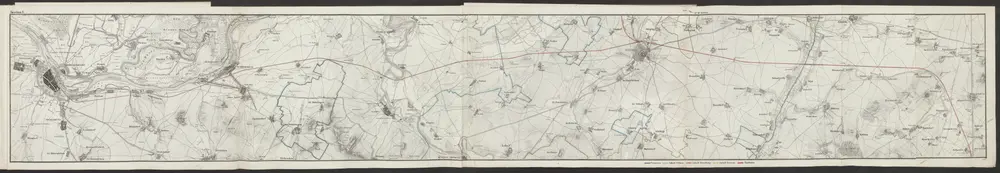
Topographische Karte von der Gegend zwischen Magdeburg, Leipzig u. Dresden, welche die Eisenbahn berührt
1841
Platt, Albrecht
1:50k
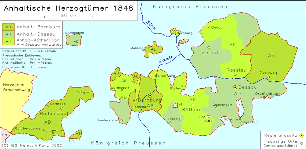
Anhaltische Herzogtümer 1848
1848
Kunz, Andreas ; Moeschl, Joachim Robert
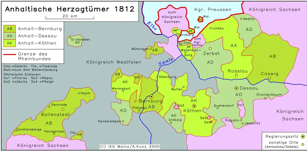
Anhaltische Herzogtümer 1812
1812
Hundt, Michael

Anhaltische Herzogtümer 1820
1820
Hundt, Michael
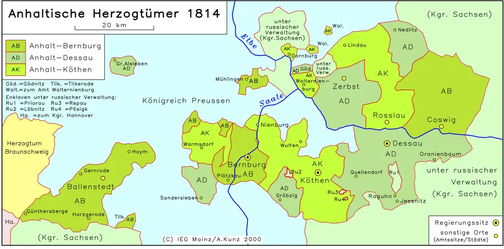
Anhaltische Herzogtümer 1814
1814
Hundt, Michael

Anhaltische Herzogtümer 1867
1867
Kunz, Andreas ; Moeschl, Joachim Robert
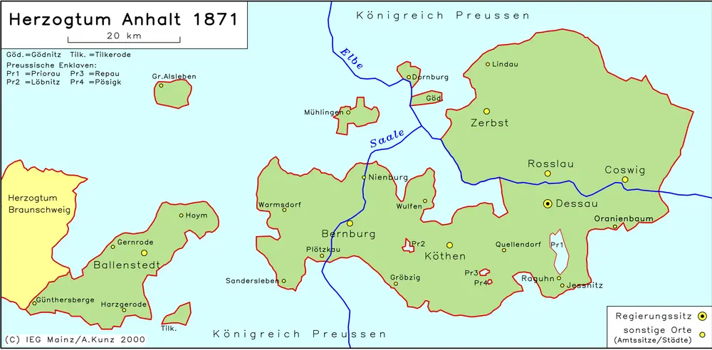
Anhaltische Herzogtümer 1871
1871
Kunz, Andreas ; Moeschl, Joachim Robert
n/a
1791