Mapa catalogado
Borough of Richmond, Topographical Survey.

Título completo:Borough of Richmond, Topographical Survey.
Ano da ilustração:1913
Tamanho físico:20 x 30 cm
General map of the borough of Richmond (Staten Island) in the city of New York : showing in addition to the existing topographical features of the borough a tentative and preliminary plan for a street system of the same.
1901
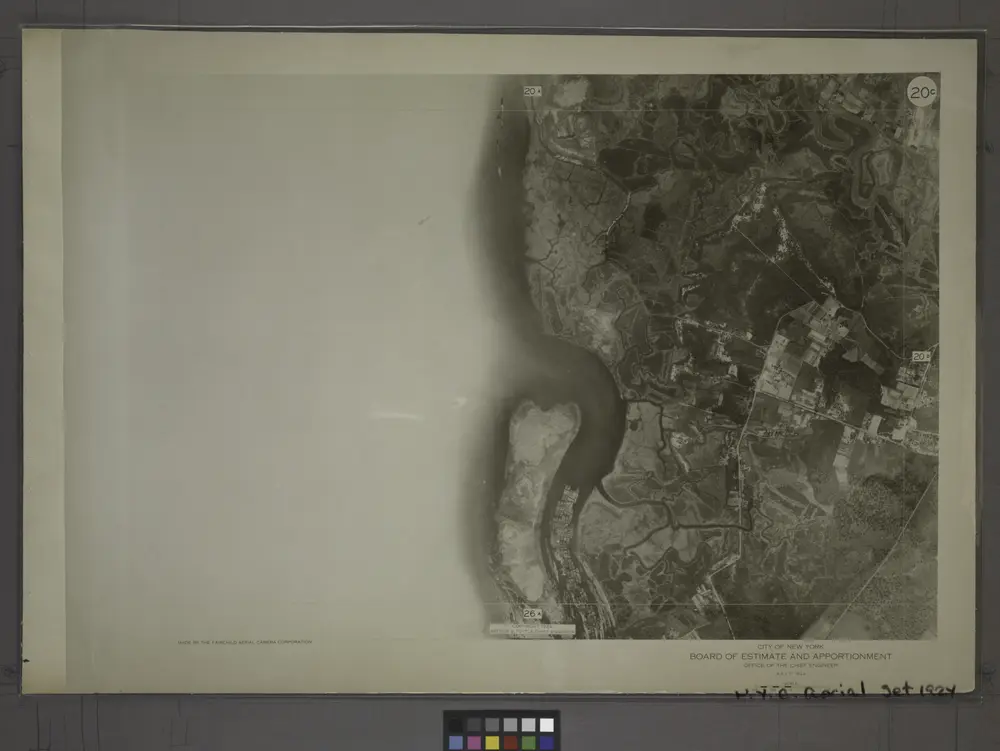
20C - N.Y. City (Aerial Set).
1924
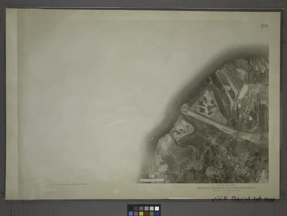
20A - N.Y. City (Aerial Set).
1924
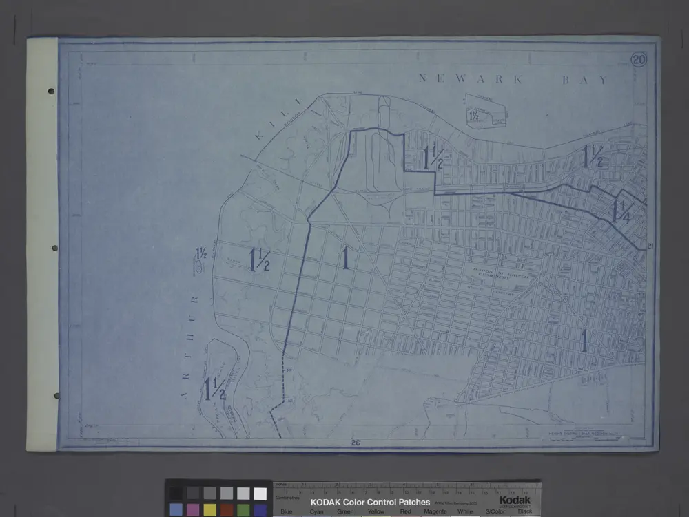
Height District Map Section No. 20; Height district map / City of New York, Board of Estimate and Apportionment.
1916
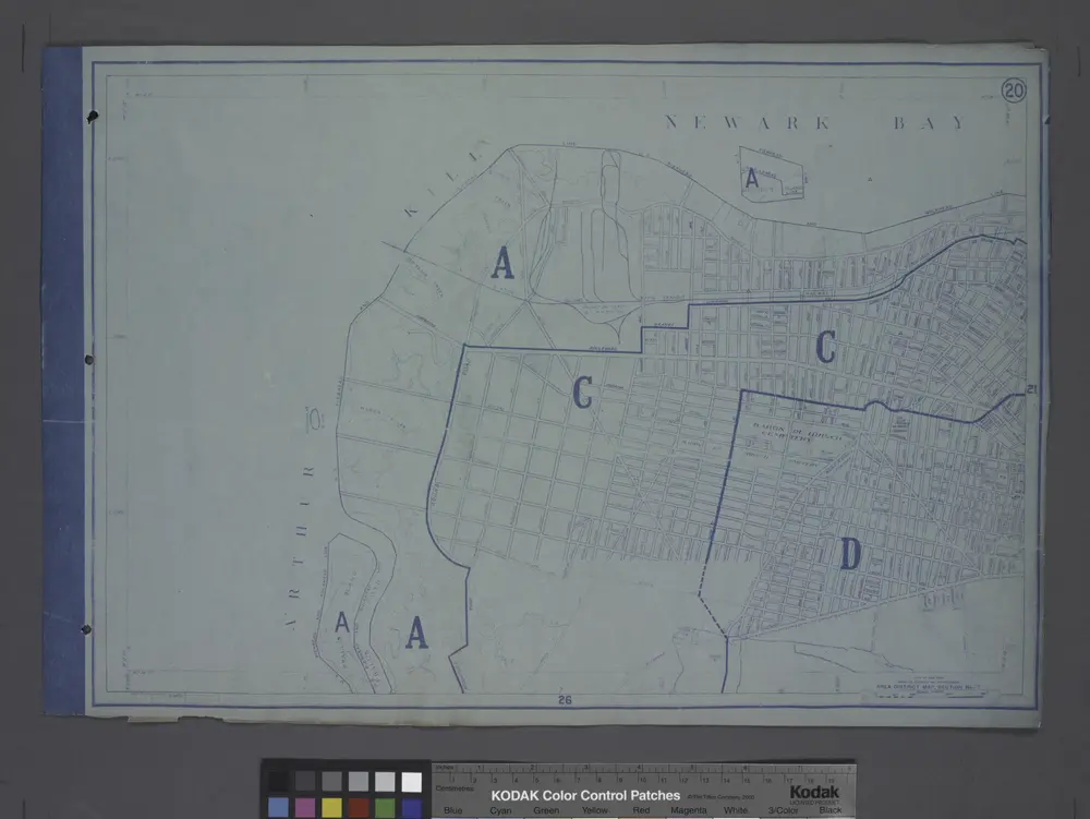
Area District Map Section No. 20; Area district map / City of New York, Board of Estimate and Apportionment.
1916
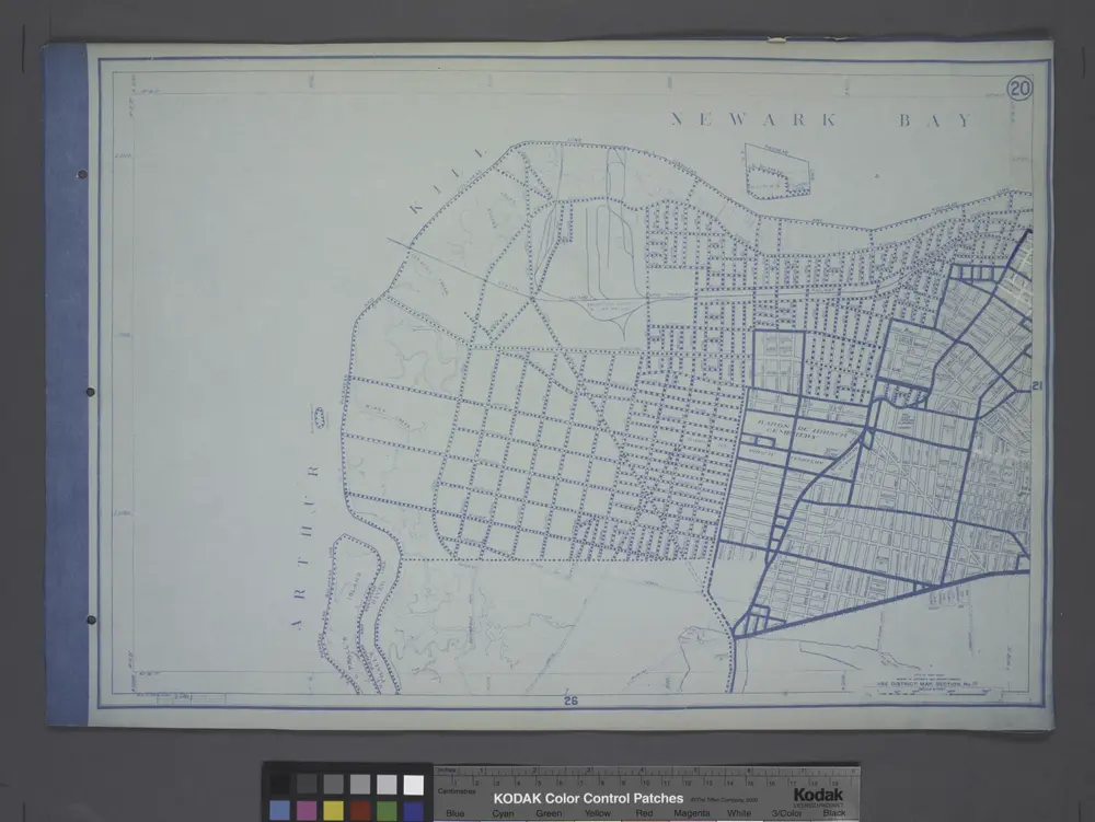
Use District Map Section No. 20; Use district map / City of New York, Board of Estimate and Apportionment.
1916
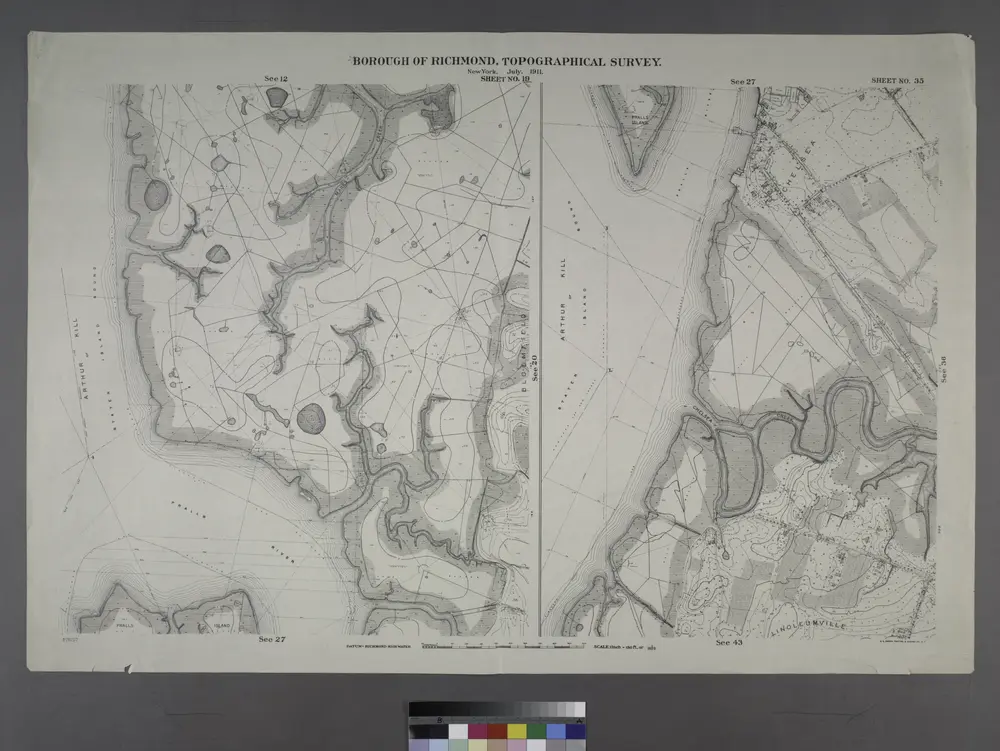
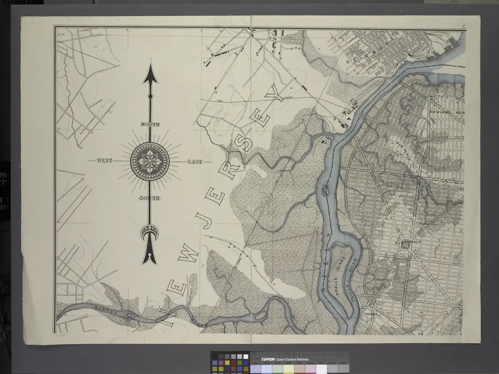
Sheet No. 19. [Includes Marks Creek, Prall's River and part of Bloomfield.] - Sheet No. 35. [Includes Chelsea and part of Prall's Island.]
1913
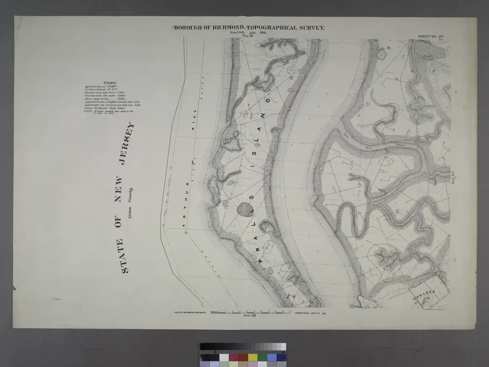
Borough of Richmond, Topographical Survey.
1913
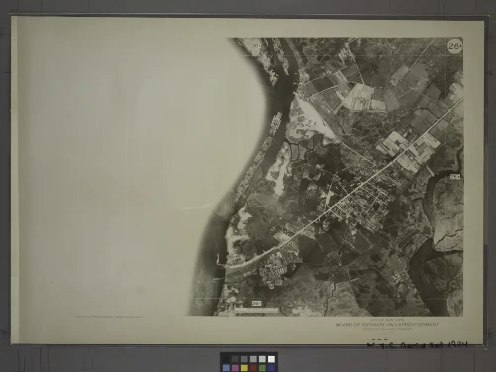
26A - N.Y. City (Aerial Set).
1924
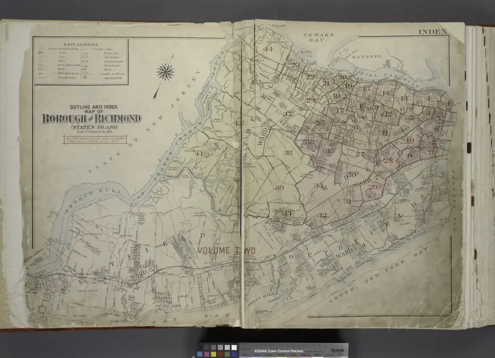
Outline & Index Map of The Borough of Richmond (Staten Island); Explanation; Note.
1917