Carte cataloguée
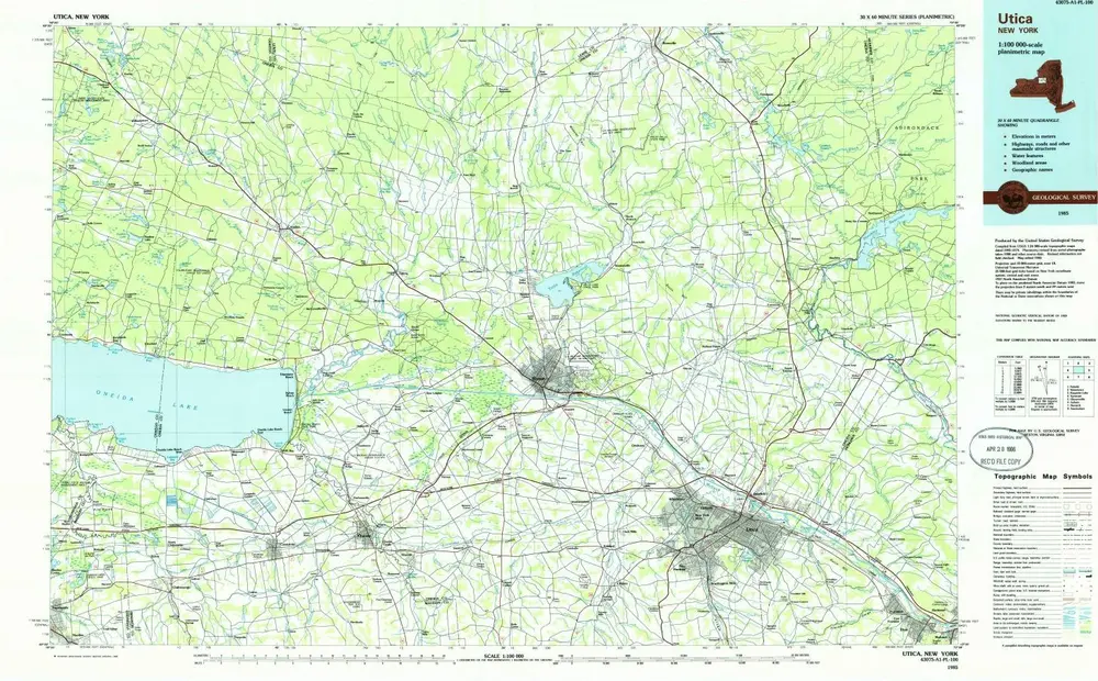
Utica

Institution:United States Geological Survey
Titre complet:Utica
Année de l'image:1985
Date de publication:1994
Échelle de la carte:1:100 000
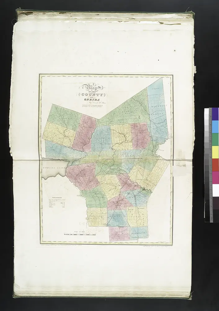
Map of the county of Oneida / by David H. Burr; engd. by Rawdon, Clark & Co., Albany, & Rawdon, Wright & Co., N.Y.; An atlas of the state of New York: containing a map of the state and of the several counties / by David H. Burr.
1841
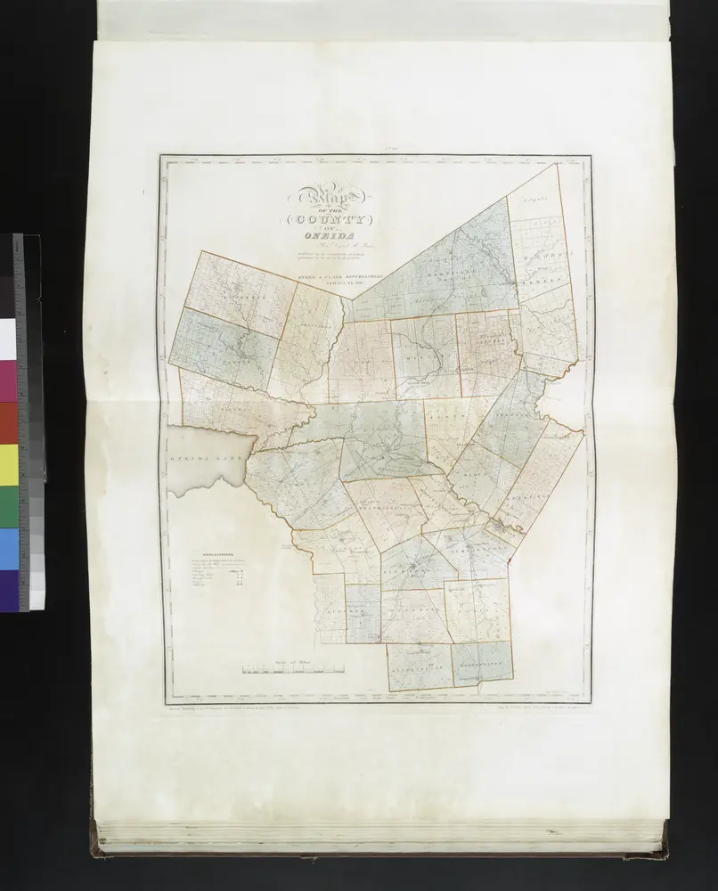
Map of the county of Oneida / by David H. Burr; engd. by Rawdon, Clark &; Co., Albany, & Rawdon, Wright & Co., N.Y.; An atlas of the state of New York: containing a map of the state and of the several counties. / Projected and drawn under the superintendence and direction of Simeon de Witt ... And also the physical geography of the State ...
1829
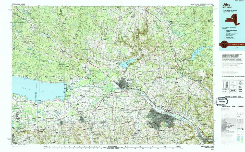
Utica
1985
1:100k
Utica
1985
1:100k
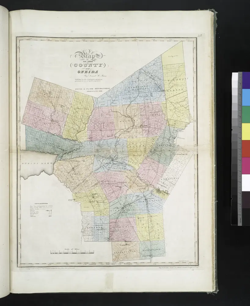
Map of the county of Oneida / by David H. Burr; engd. by Rawdon, Clark & Co., Albany, & Rawdon, Wright & Co., N.Y.; An atlas of the state of New York, designed for the use of engineers, containing a map of the state and of the several counties. / Projected and drawn ... under the superintendence and direction of Simeon de Witt.
1839
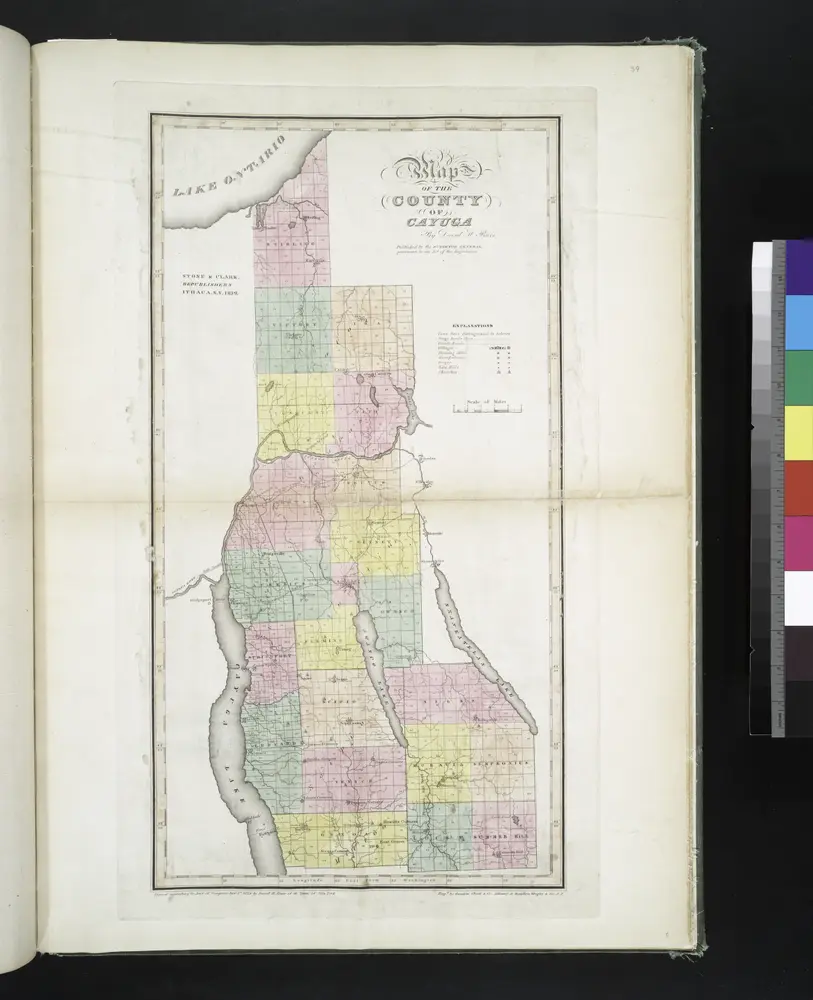
Map of the county of Cayuga / by David H. Burr; engd. by Rawdon, Clark & Co., Albany, & Rawdon, Wright & Co., N.Y.; An atlas of the state of New York, designed for the use of engineers, containing a map of the state and of the several counties. / Projected and drawn ... under the superintendence and direction of Simeon de Witt.
1839
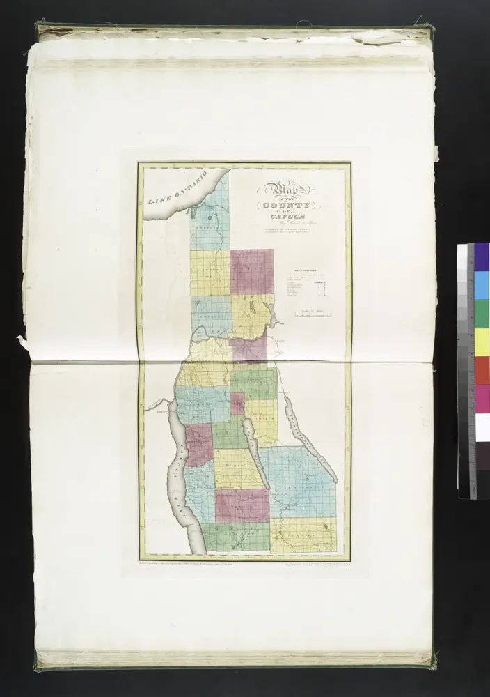
Map of the county of Cayuga / by David H. Burr; engd. by Rawdon, Clark & Co., Albany, & Rawdon, Wright & Co., N.Y.; An atlas of the state of New York: containing a map of the state and of the several counties. / Projected and drawn under the superintendence and direction of Simeon de Witt ... And also the physical geography of the State ...
1829
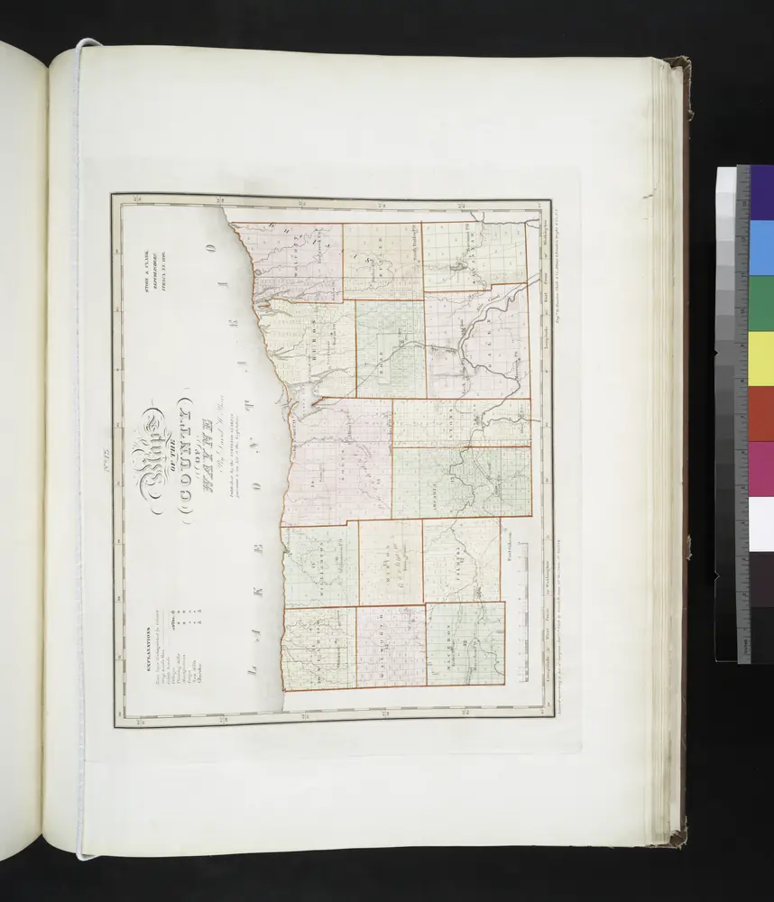
Map of the county of Wayne / by David H. Burr; engd. by Rawdon, Clark & Co., Albany, & Rawdon, Wright & Co., New York.; An atlas of the state of New York: containing a map of the state and of the several counties / by David H. Burr.
1841
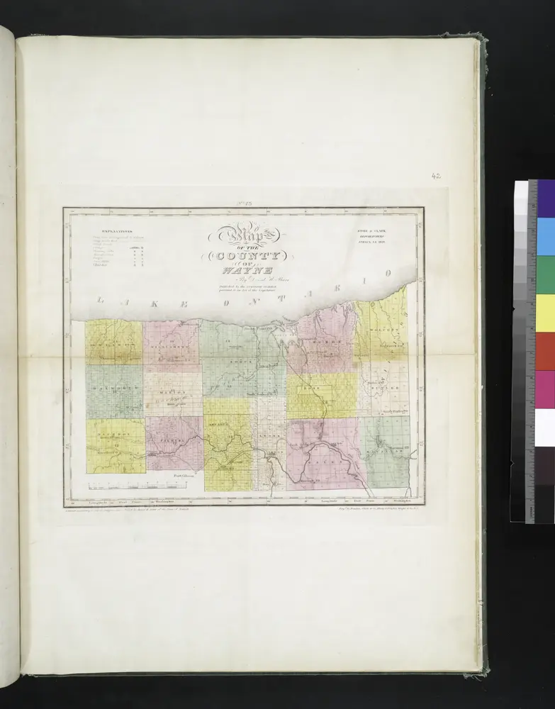
Map of the county of Wayne / by David H. Burr; engd. by Rawdon, Clark & Co., Albany, & Rawdon, Wright & Co., N.Y.; An atlas of the state of New York, designed for the use of engineers, containing a map of the state and of the several counties. / Projected and drawn ... under the superintendence and direction of Simeon de Witt.
1839
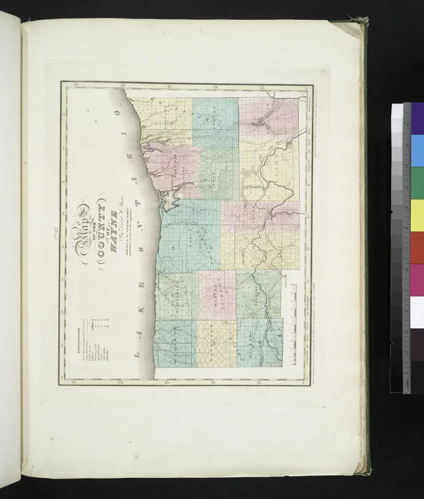
Map of the county of Wayne / by David H. Burr; engd. by Rawdon, Clark & Co., Albany, & Rawdon, Wright & Co., N.Y.; An atlas of the state of New York: containing a map of the state and of the several counties. / Projected and drawn under the superintendence and direction of Simeon de Witt ... And also the physical geography of the State ...
1829