Carte cataloguée
Saba

Institution:Leiden University
Titre complet:Saba
Année de l'image:1903
Éditeur:s-Gravenhage : Ministerie van Marine, Afdeeling Hydrographie
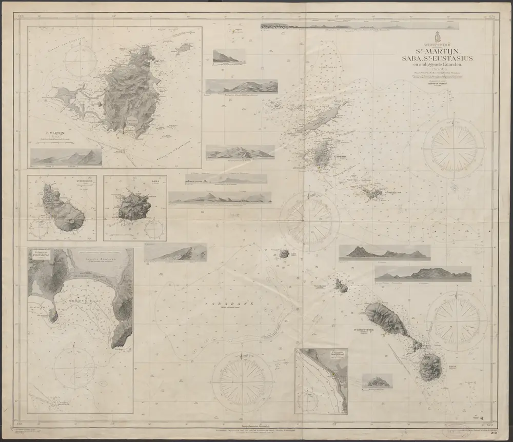
Saba
1903
J.G. den Engelse Wiemans
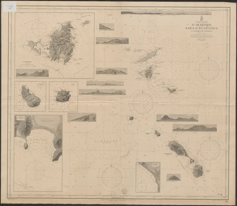
West-Indië St. Martijn, Saba, St.-Eustatius en omliggende eilanden : naar Nederlandsche en Engelsche bronnen / Hydrographisch Bureau ; J. den Engelse Wiemans sculps
1903
J.G. den Engelse Wiemans

Eil. St. Vincent
1785
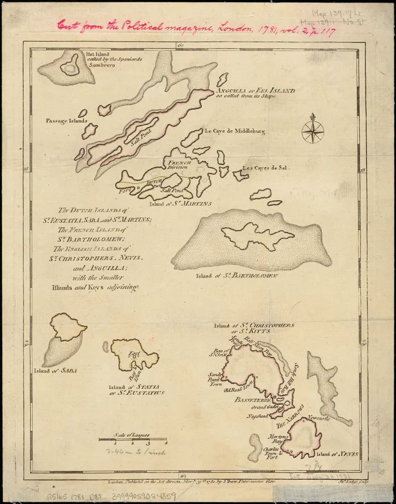
The Dutch islands of St. Eustatia, Saba, and St. Martins ; the French island of St. Bartholomew ; the English islands of St. Christophers, Nevis, and Anguilla ; with the smaller islands and keys adjoining
1781
1:430k

Eil. St. Christoffel
1785
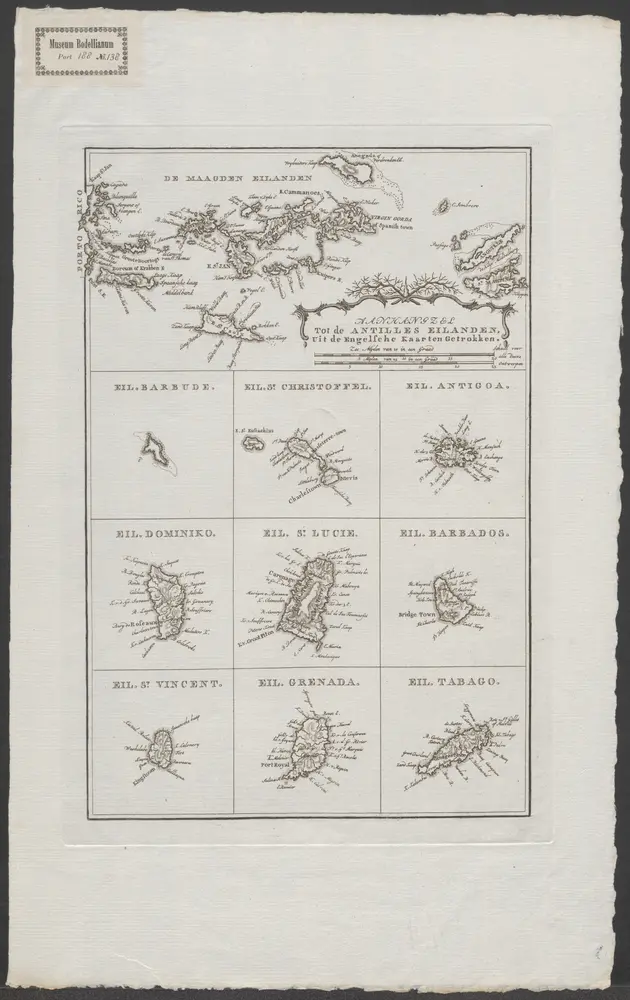
Eil. Dominiko
1785

Aanhangsel tot de Antilles eilanden, uit de Engelsche kaarten getrokken
1785

Eil. Barbados
1785
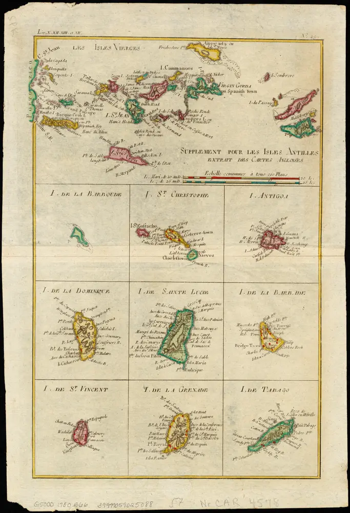
Supplement pour les Isles Antilles, extrait des carte Angloises
1780
1:1m
The Virgin Islands from English and Danish surveys
1775
Jefferys, Thomas, d. 1771
1:490k