Carte cataloguée
Long Island East

Institution:United States Geological Survey
Titre complet:Long Island East
Année de l'image:1984
Date de publication:1985
Échelle de la carte:1:100 000
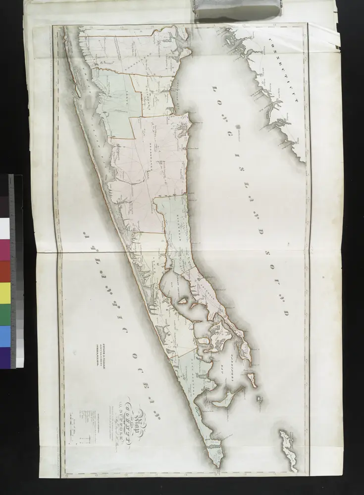
Map of the county of Suffolk / by David H. Burr ; engd. by Rawdon Clark & Co., Albany, & Rawdon, Wright & Co., N. York.
1841

Index Map No. 1 of a part of Suffolk County. South Side - Ocean Shore, Long Island. Southampton. Published by E. Belcher Hyde. 97 Liberty Street, Brooklyn. 5 Beekman Street, Manhattan. 1916. Volume Two.
1915

Long Island West
1984
1:100k

Long Island West
1984
1:100k

Long Island East
1984
1:100k

Long Island East
1984
1:100k

Long Island East
1984
1:100k
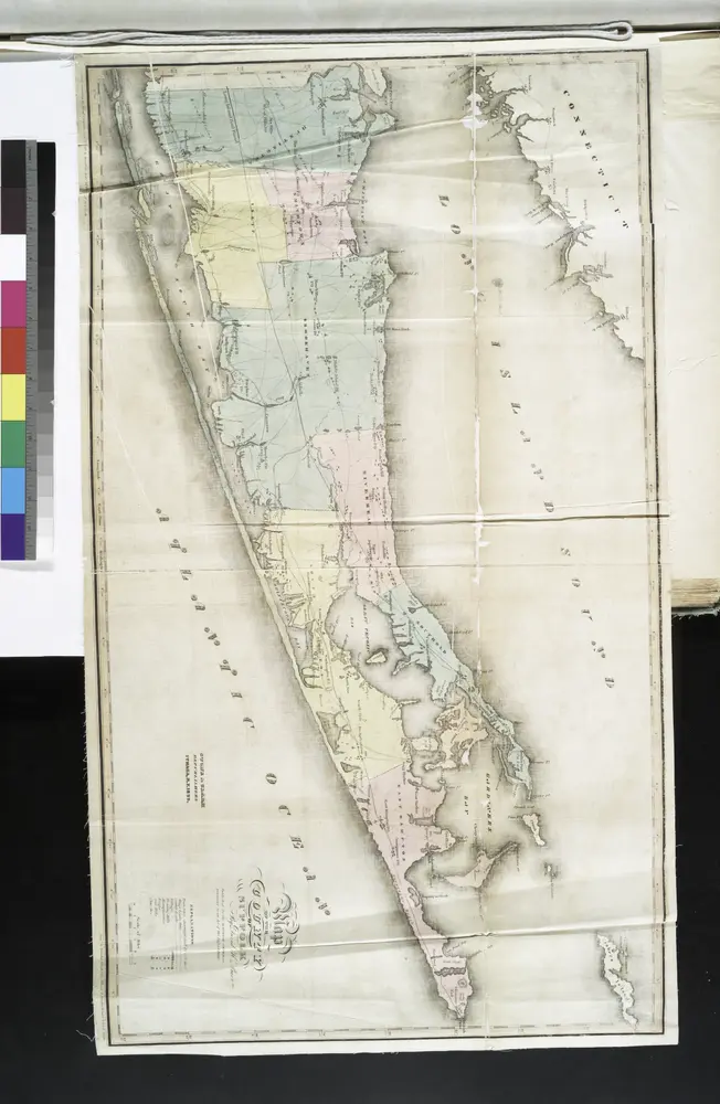
Map of the county of Suffolk / by David H. Burr ; engd. by Rawdon Clark & Co., Albany, & Rawdon, Wright & Co., N. York.
1829
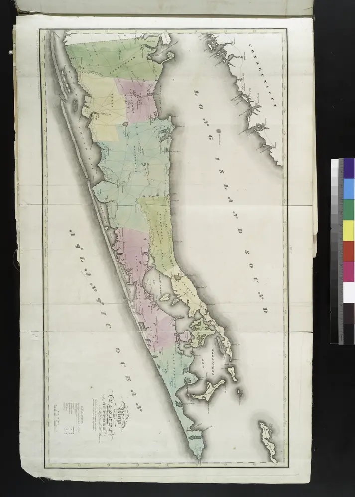
Map of the county of Suffolk / by David H. Burr ; engd. by Rawdon Clark & Co., Albany, & Rawdon, Wright & Co., N. York.
1829
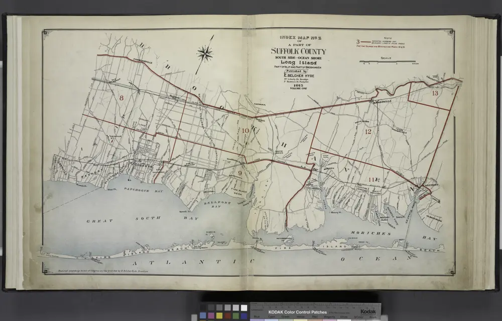
Index Map No.2 of a part of Suffolk County. South Side - Ocean Shore, Long Island. Part of Islip and Part of Brookhaven. Published by E. Belcher Hyde. 97 Liberty Street, Brooklyn. 5 Beekman Street, Manhattan. 1915. Volume One.
1915