Gecatalogiseerde kaart
Star City

Volledige titel:Star City
Jaar illustratie:1962
Pubdatum:1964
Schaal kaart:1:24 000
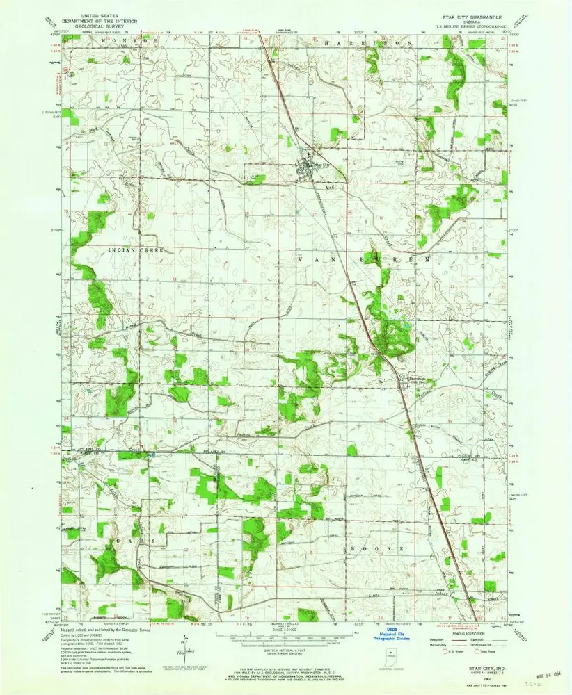
Star City
1962
1:24k
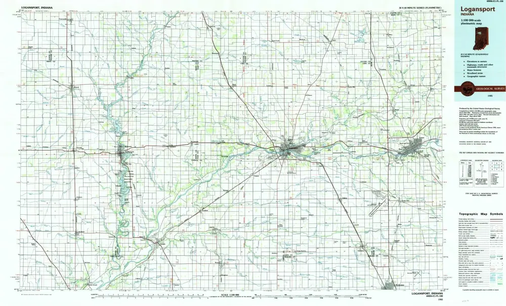
Logansport
1985
1:100k
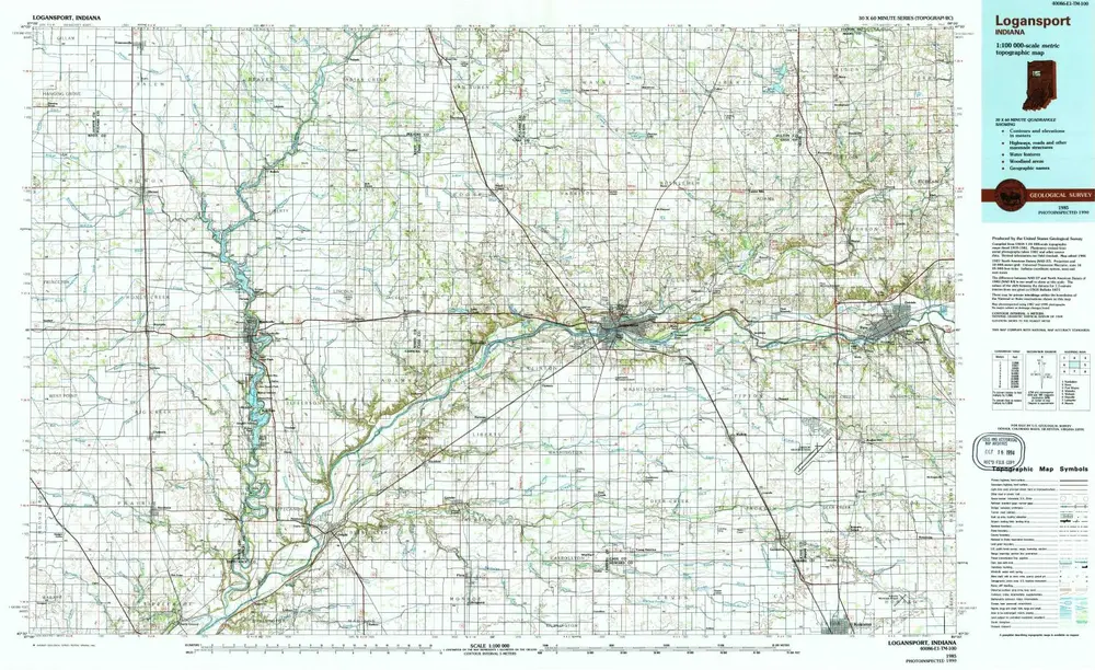
Logansport
1985
1:100k
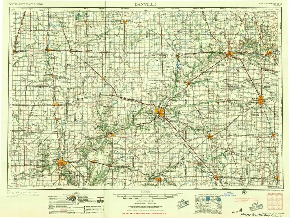
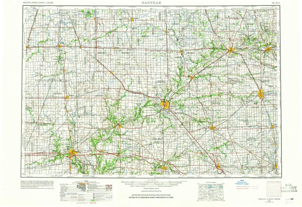
Danville
1956
1:250k
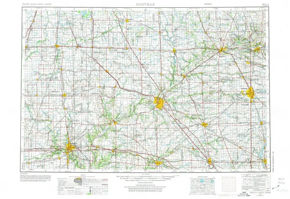
Danville
1953
1:250k
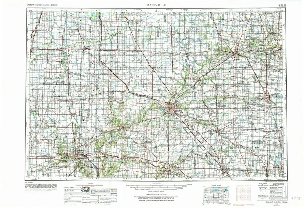
Danville
1953
1:250k
Danville
1953
1:250k
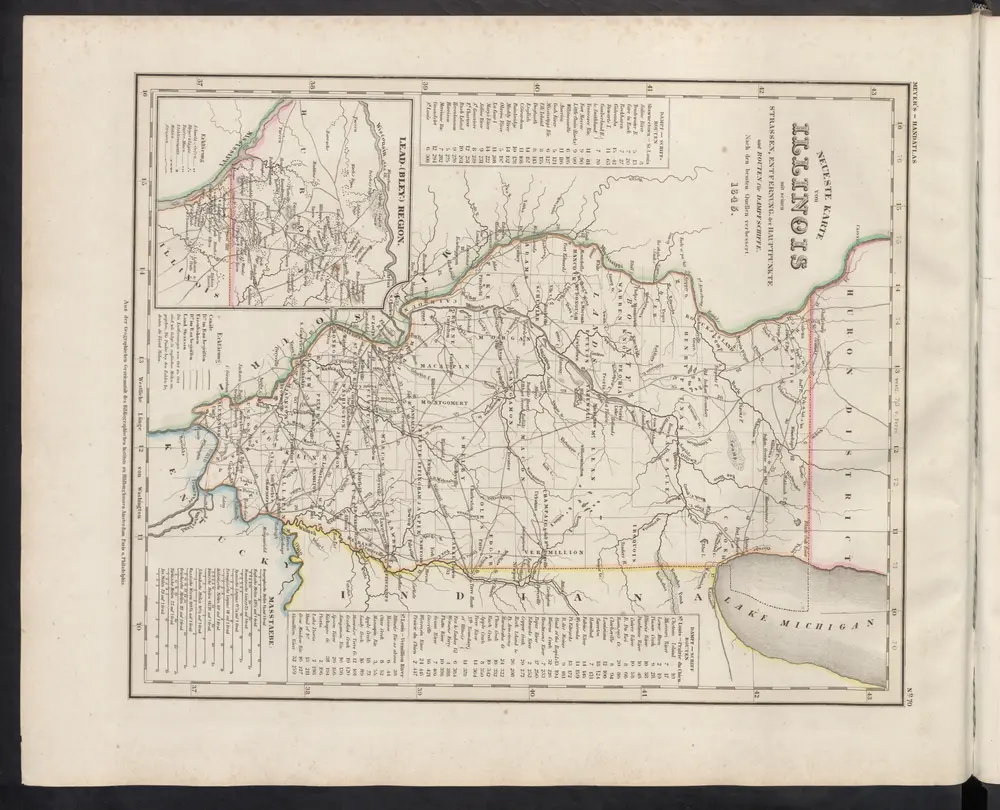
[Neueste Karte von Illionois mit seinen Strassen, Entfernungen der Hauptpunkte und Routen für Dampfschiffe]
1860
Meyer, J.
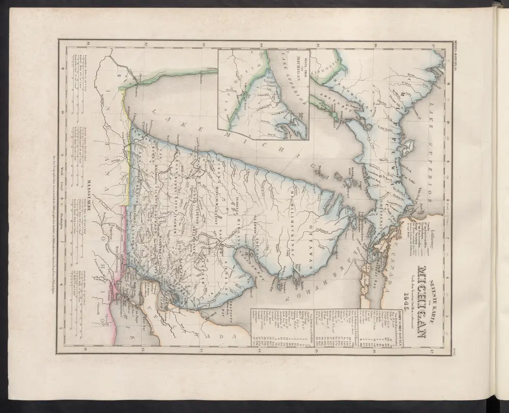
Neueste Karte von Michigan
1860
Meyer, J.
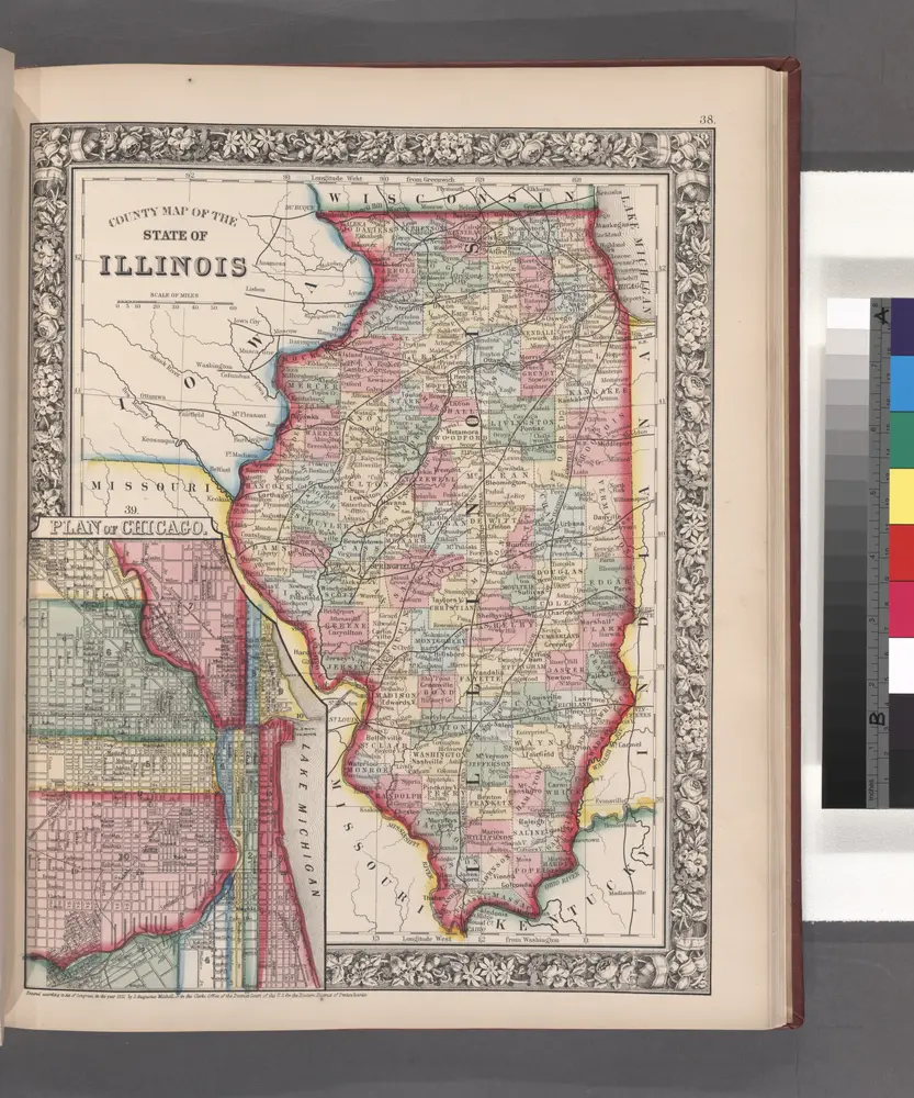
County map of the State of Illinois ; Plan of Chicago [inset].
1860