المستند

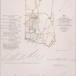
Plan of a Proposed TURNPIKE ROAD From St. JOHN'S CHAPEL, ST. MARYLEBONE into the Great North Road Near the 8 Mile Stone at Finchley
Plan of the proposed turnpike road from Regent's Park to Finchley, today's Finchley Road. The plan features title at top right, scale bars at lower right and sections of the road in elevation at the foot of the plate, with the new road represented by a double dotted line coloured red. Down the left of the plate a table gives distances between stations along the road and shows the savings in milage generated by the new road.
The British LibraryPhillips, Henry
1824
1824

