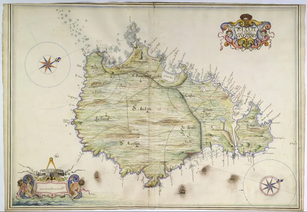
A colored plan of the island of "Sarnia et vulgo Guernsey;" drawn in 1680, by Thomas Phillips, on a scale of 2 3/16 inches to a mile.
1680
Thomas Phillips
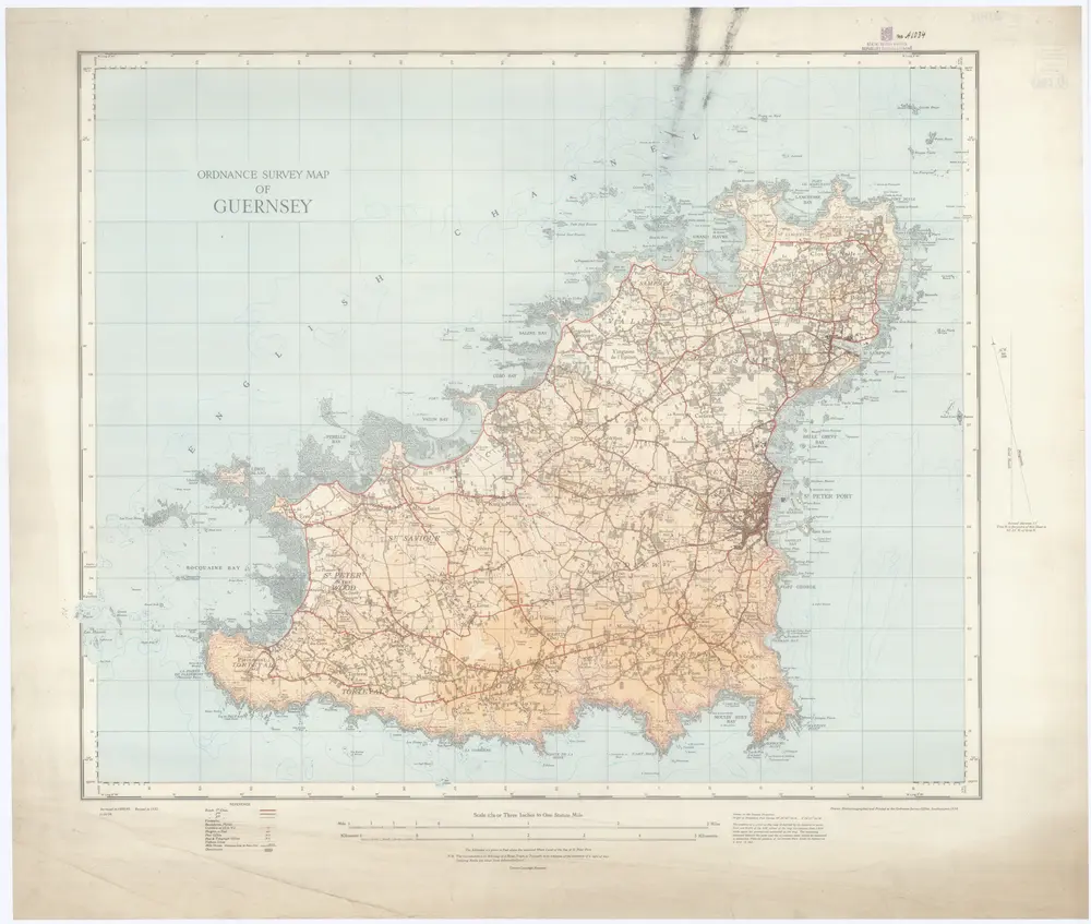
Ordnance survey map of Guernsey
1934
Ordnance survey office
1:21k
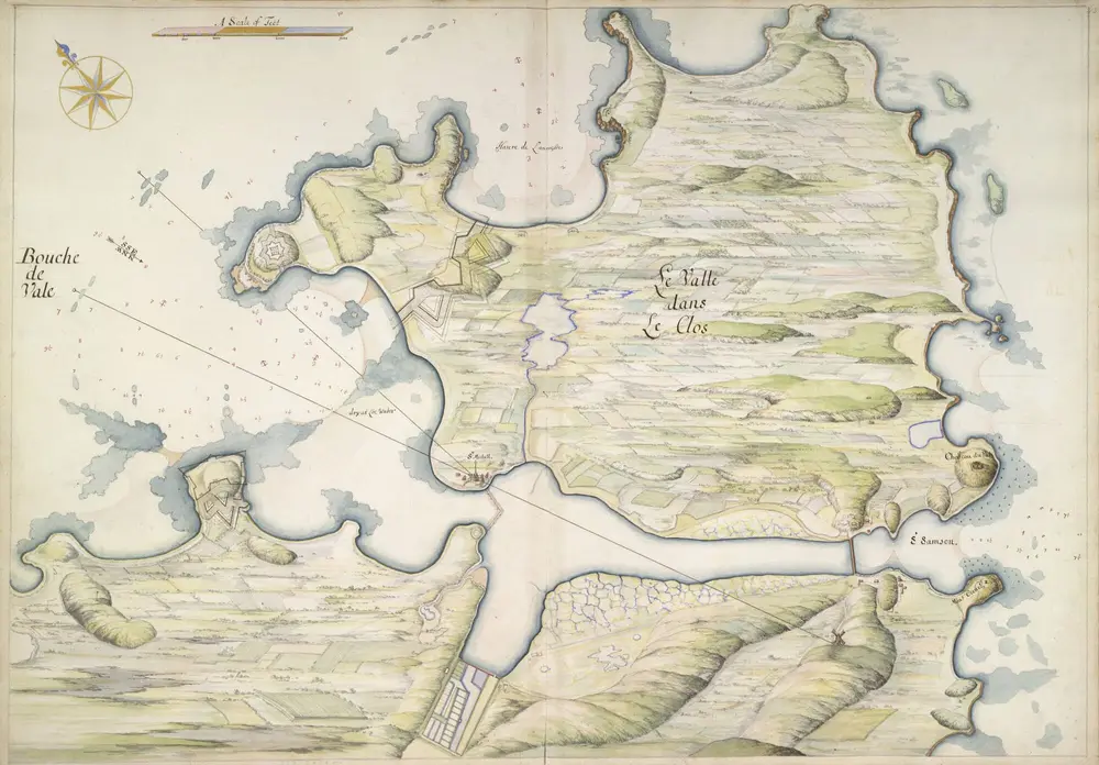
A colored plan of Le Valle dans le Clos, on the north-west coast of the island of Guernsey; shewing the soundings of the Bouche de Vale on the east, and the Pent or bay of St. Samson on the west, with various projected fortifications; drawn in 1680, by Thomas Phillips, on a scale of 600 feet to an inch.
1680
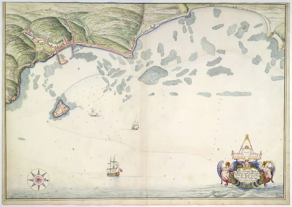
"The ground plott of the Towne [of St. Peter's] and Castle Cornet, with the rocks and soundings thereof; truly layd down as they wear survey'd and measured by T.P., anno 90;" drawn by Thomas Phillips, on a scale of 135 yards to an inch.
1680
Thomas Phillips
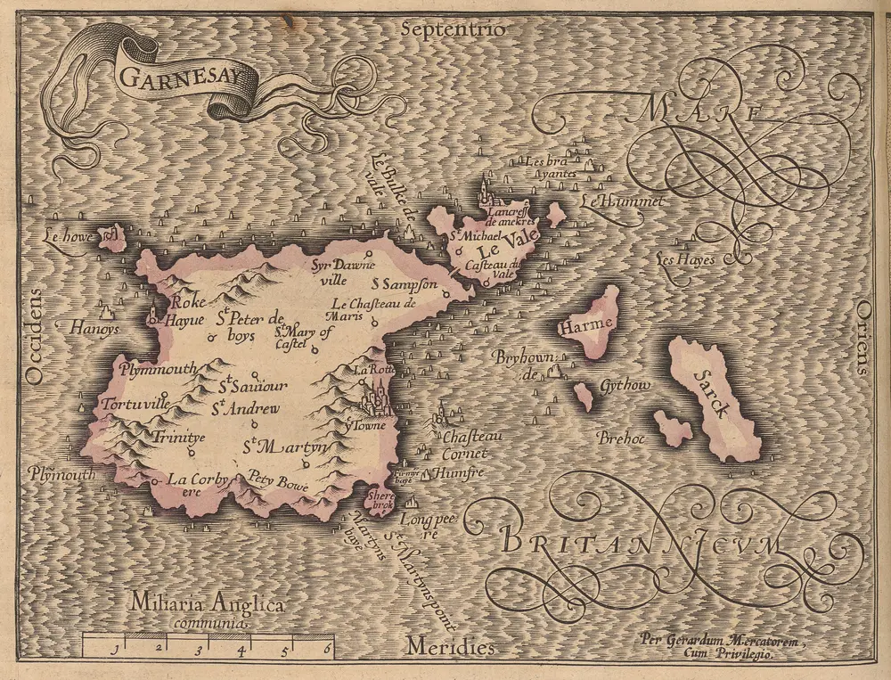
Garnesay [Karte], in: Gerardi Mercatoris Atlas, sive, Cosmographicae meditationes de fabrica mundi et fabricati figura, S. 130.
1607
Mercator, Gerhard
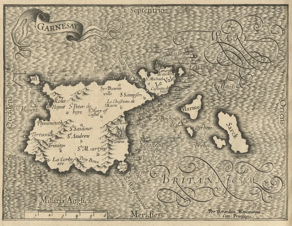
Garnesay [Karte], in: Atlas, sive, Cosmographicae meditationes de fabrica mundi et fabricati figura, S. 125.
1595
Mercator, Gerhard
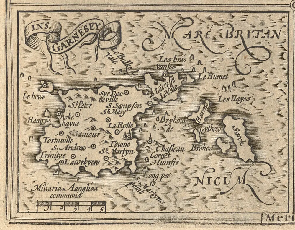
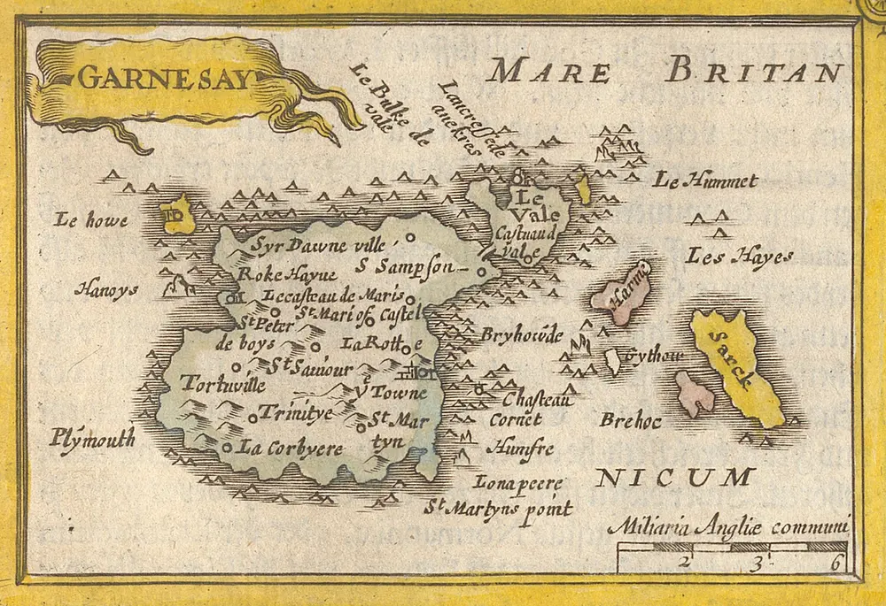
Ins. Garnesay [Karte], in: Atlas Minor, S. 122.
1609
Mercator, Gerhard und Hondius, Jodocus
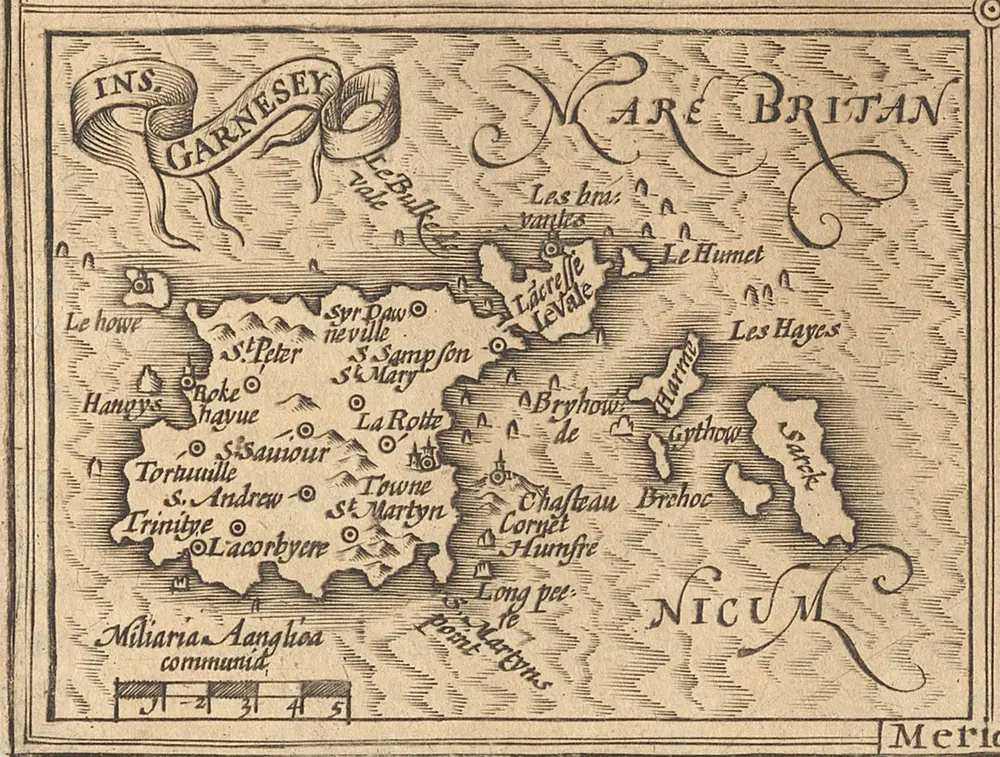
Garnesey [Karte], in: [Atlas Minor], S. 122.
1609
Mercator, Gerhard und Hondius, Jodocus
Garnesay [Karte], in: Atlas Minor [2. Teil], S. 96.
1648
Mercator, Gerhard
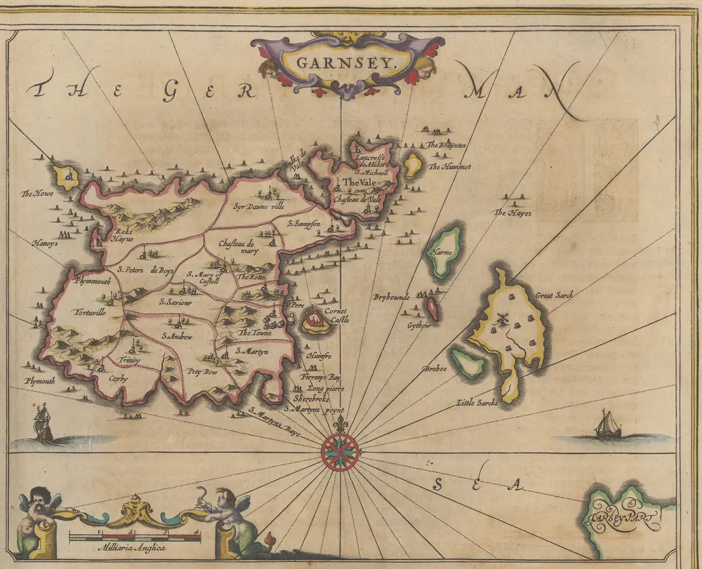
Garnsey.[Karte], in: Novus atlas absolutissimus, Bd. 8, S. 115.
1647
Janssonius Offizin
根西的老地图
在历史地图上发现 根西 的过去
根西的老地图
在历史地图上发现 根西 的过去
寻找 谷歌地图应用程序接口替代方案?