Carte cataloguée
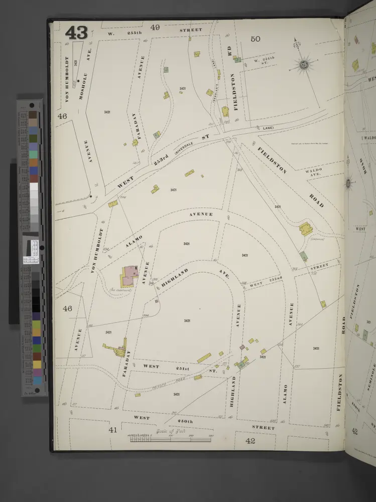
Manhattan, V. 12, Plate No. 43 [Map bounded by W. 255th St., Fieldston Rd., W. 250th St., Avenue Von Humboldt]

Institution:New York Public Library
Titre complet:Manhattan, V. 12, Plate No. 43 [Map bounded by W. 255th St., Fieldston Rd., W. 250th St., Avenue Von Humboldt]
Année de l'image:1900
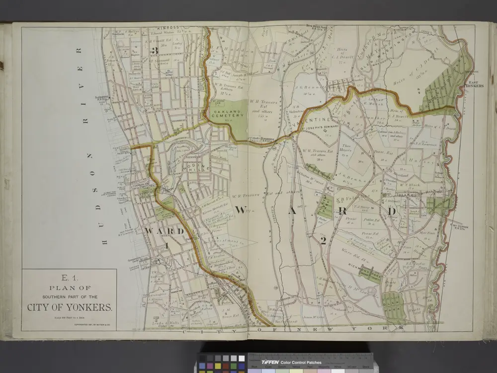
Plan of Southern part of the City of Yonkers.
1891
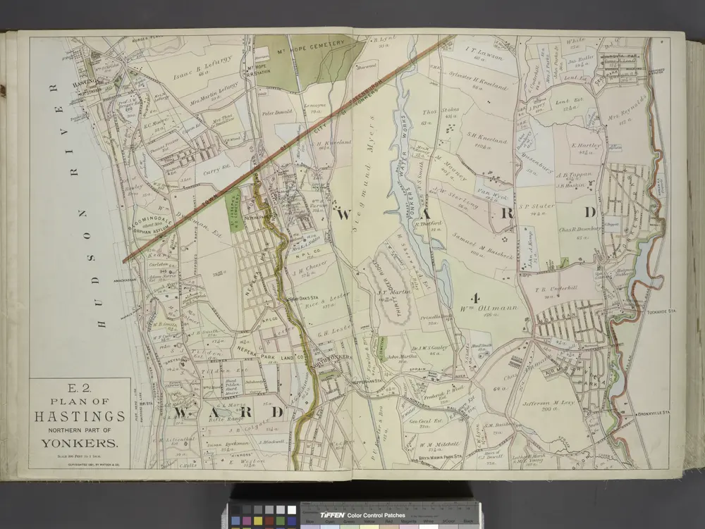
Plan of Hastings Northern part of Yonkers.
1891
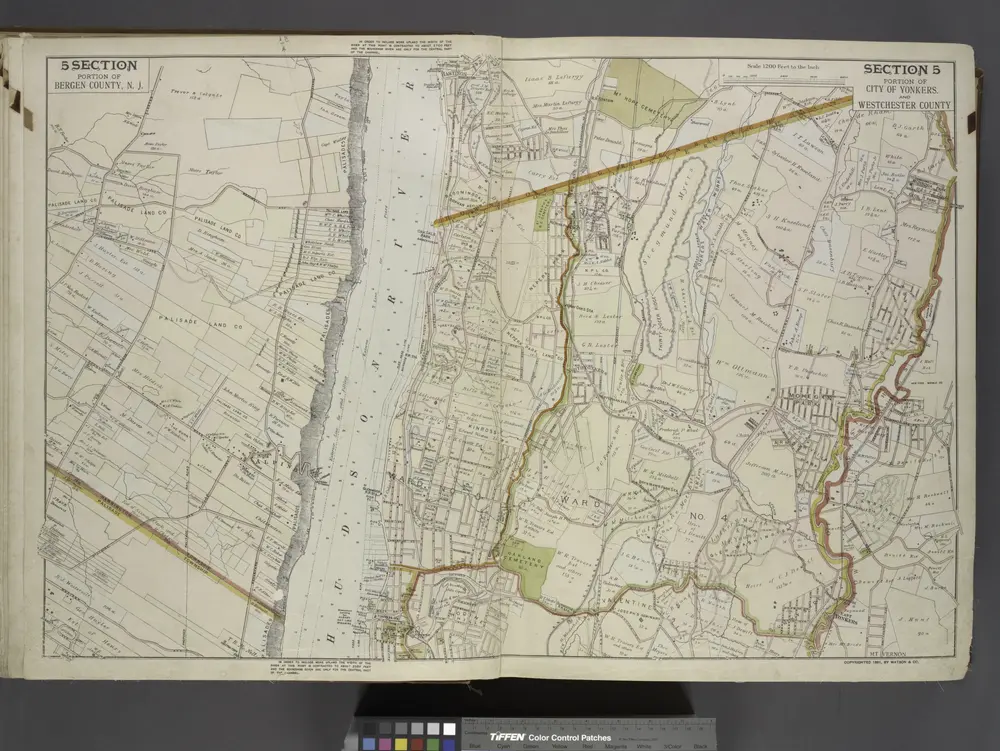
Portion of Bergen County, N.J.; Portion of City of Yonkers. And Westchester County
1891
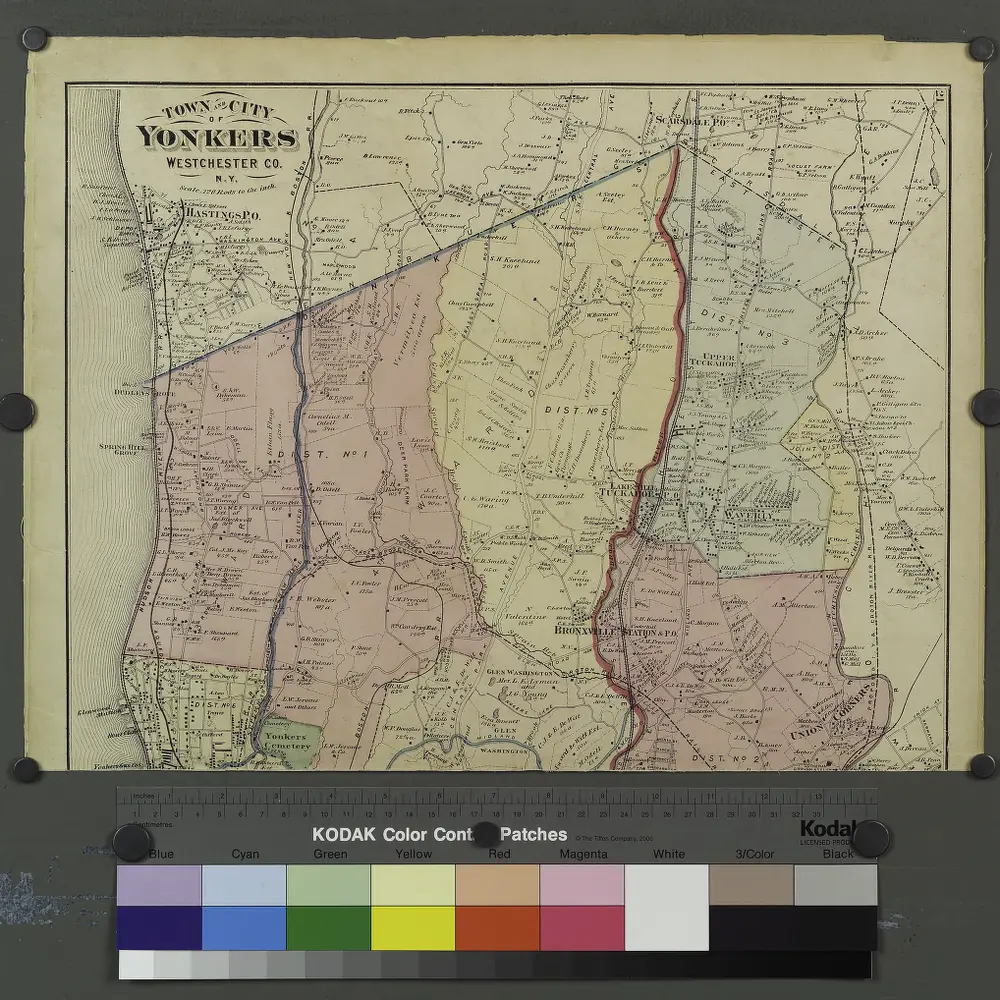
Plates 21 & 22: Town and City of Yonkers, Westchester Co. N.Y. - Town of East Chester, Westchester Co. N.Y.
1872
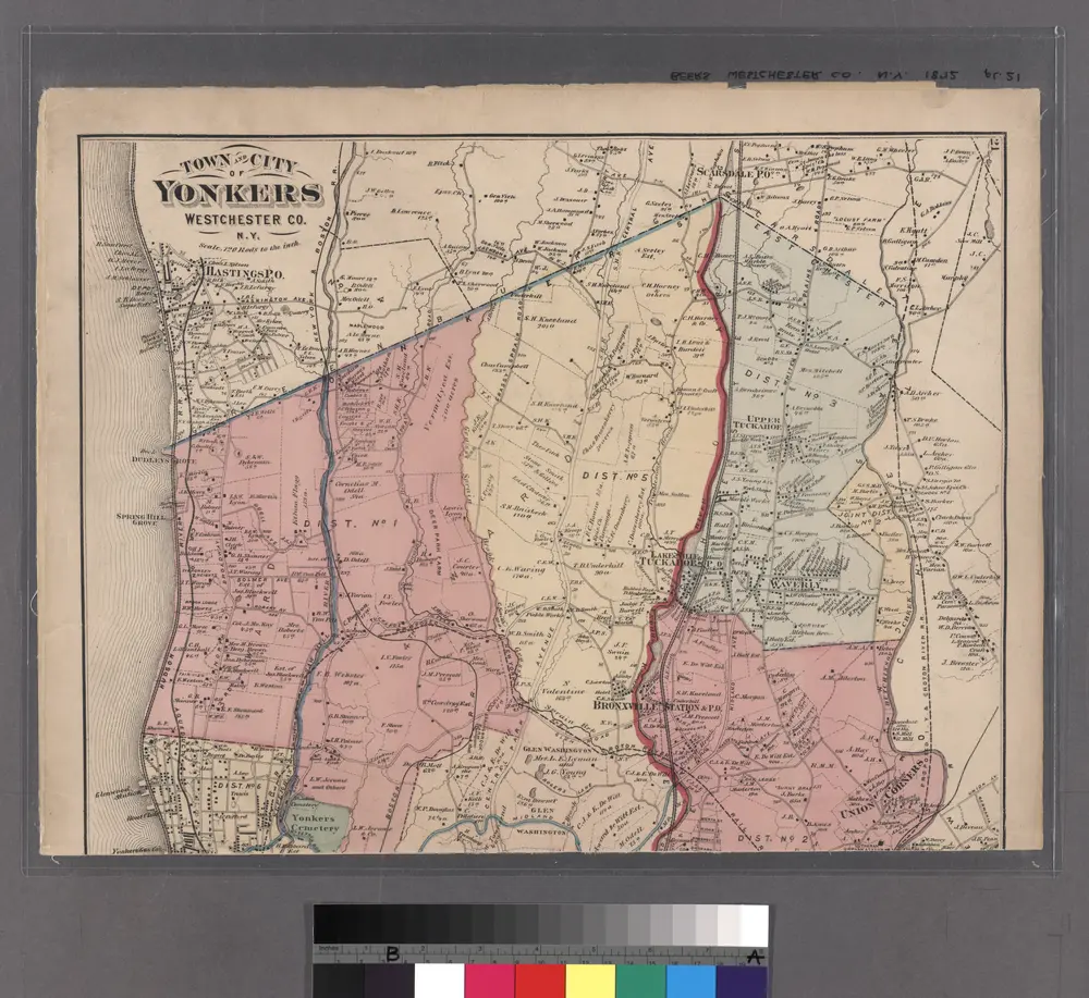
Plates 21 & 22: Town and City of Yonkers, Westchester Co. N.Y. - Town of East Chester, Westchester Co. N.Y.
1872
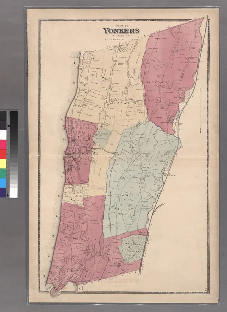
Large folder - L1
1868

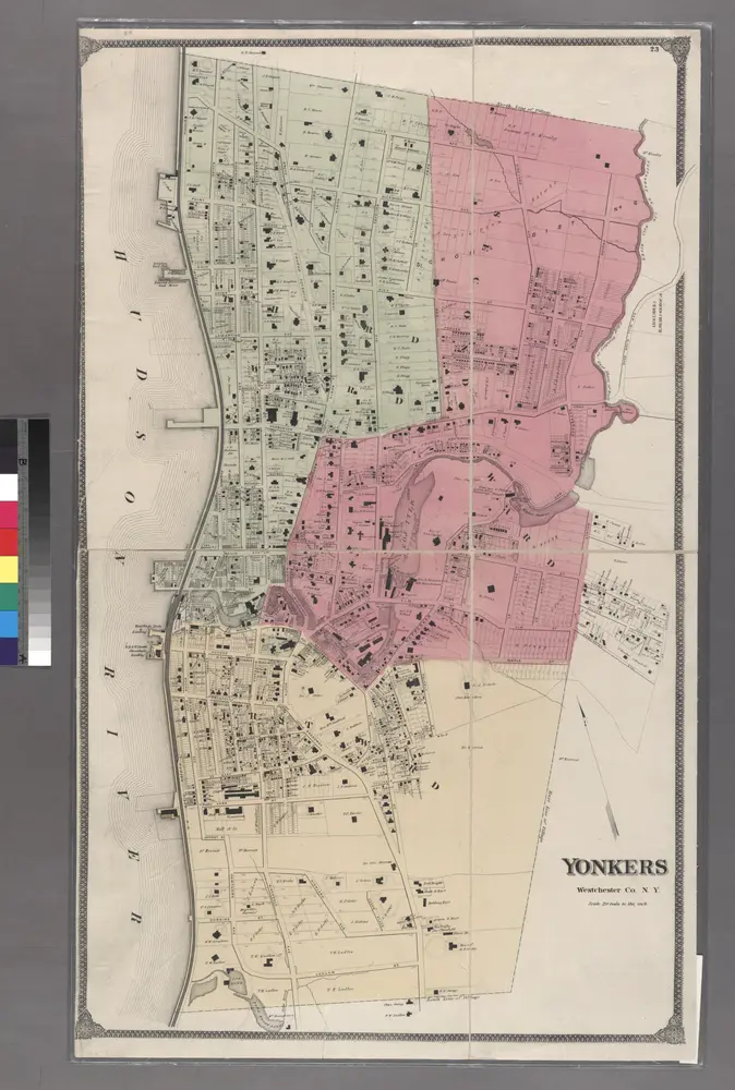
Plate 24: Northern part of Town of Yonkers, adjacent to the River.
1868
Large folder - L1
1868
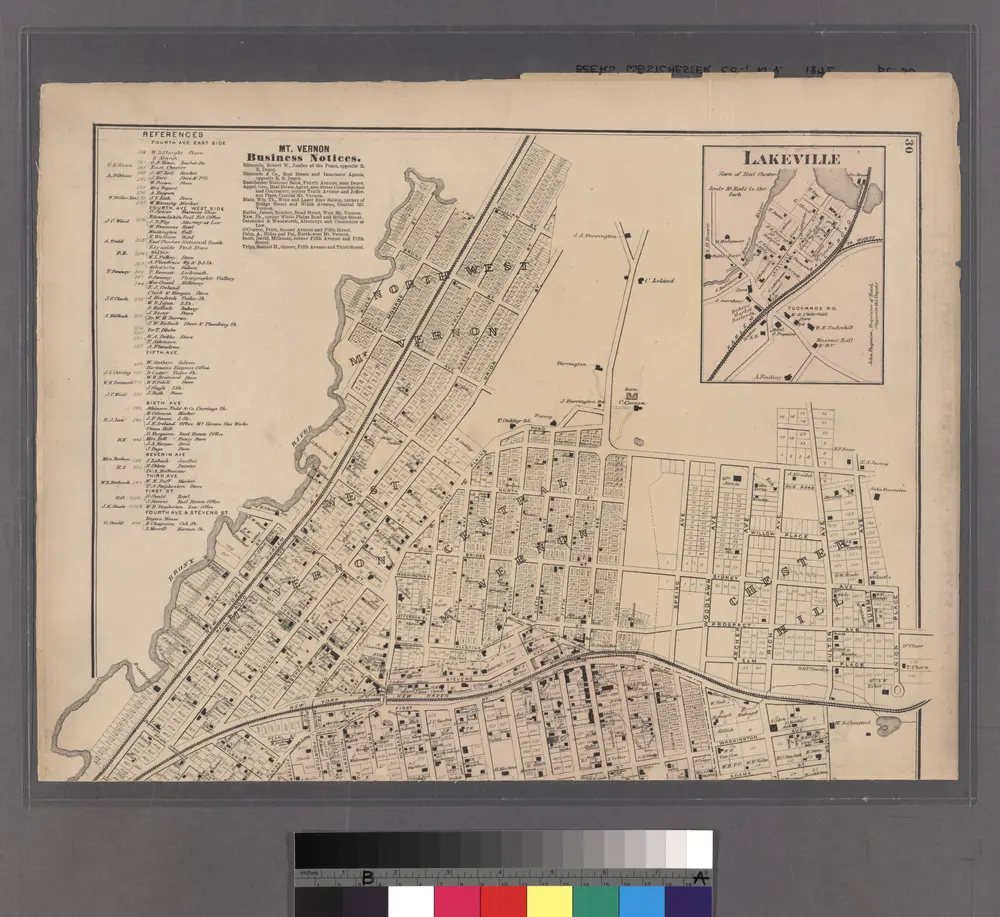
Lakeville - Washingtonville - East Chester.
1872
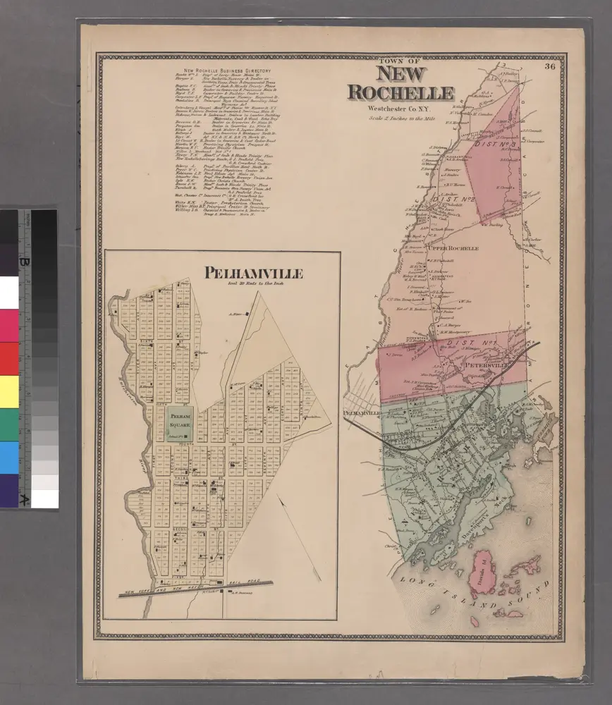
Plate 36: Town of New Rochelle, Westchester Co. N.Y.
1868