项目
社区
新闻
我的应用程序
我的地图
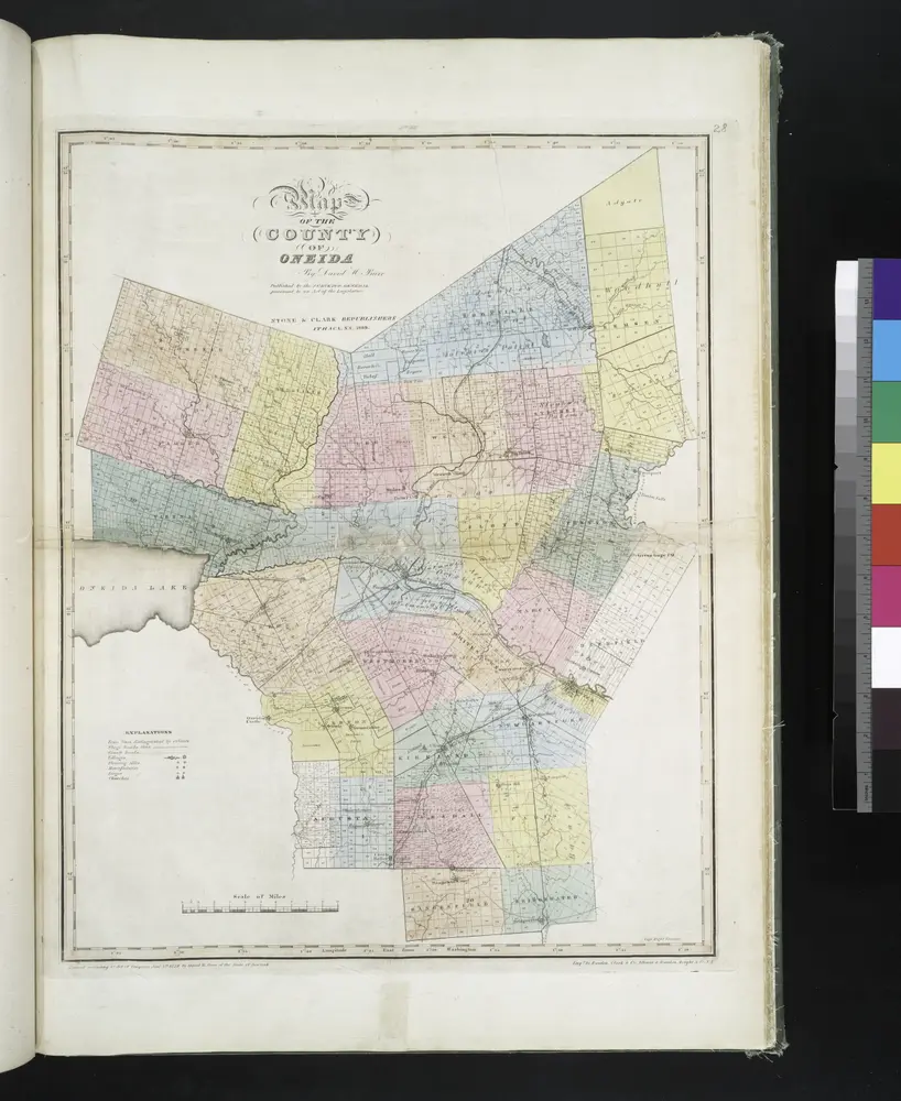
Map of the county of Oneida / by David H. Burr; engd. by Rawdon, Clark & Co., Albany, & Rawdon, Wright & Co., N.Y.; An atlas of the state of New York, designed for the use of engineers, containing a map of the state and of the several counties. / Projected and drawn ... under the superintendence and direction of Simeon de Witt.
1839
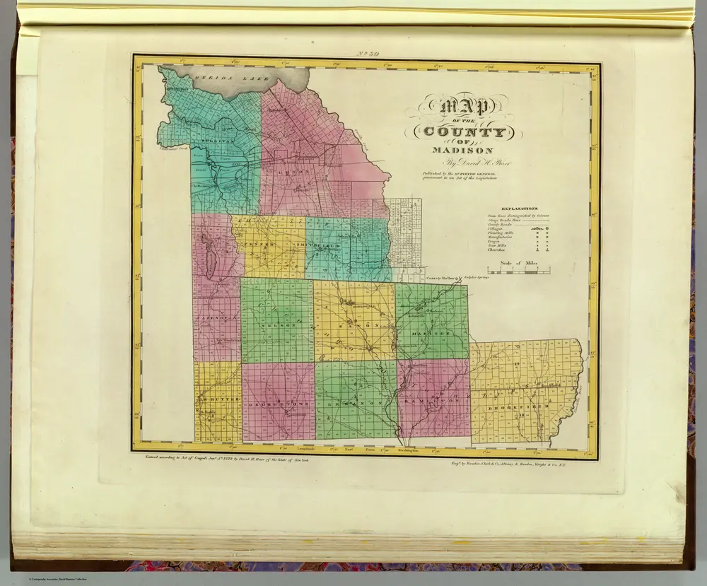
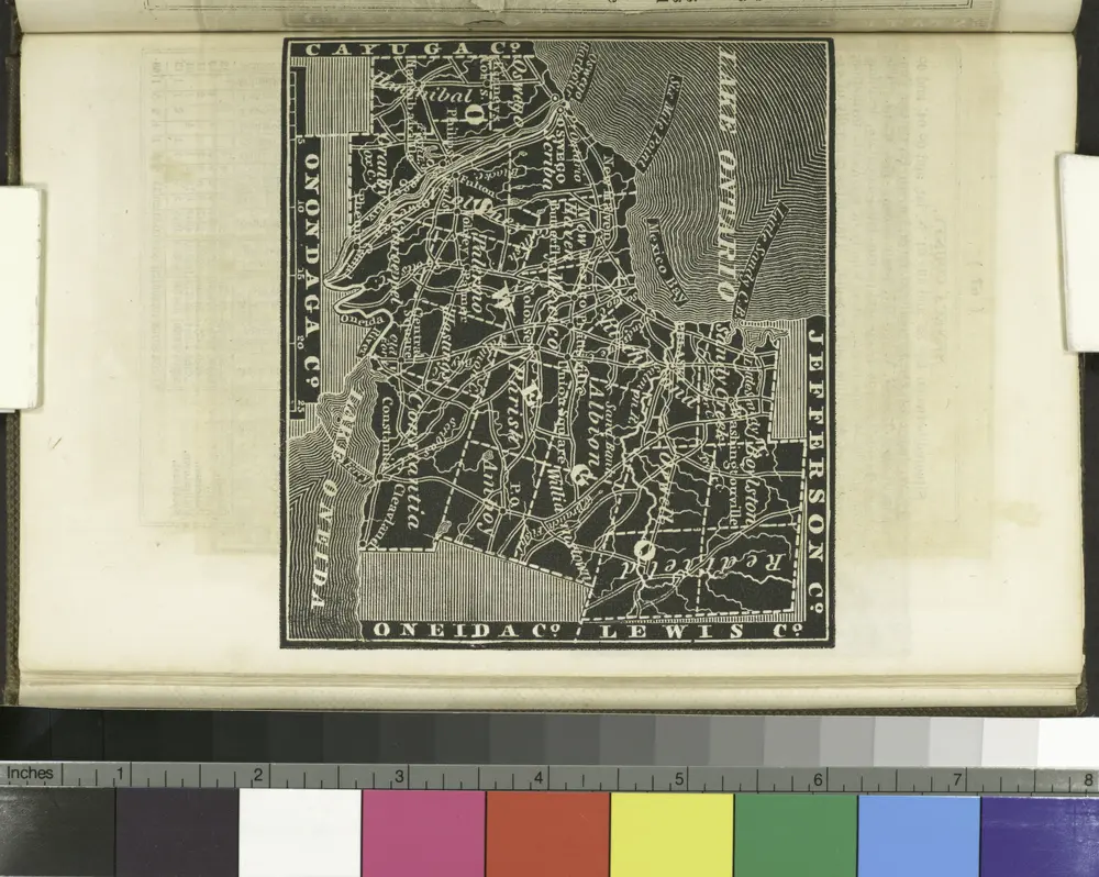
Madison County.
1829
Burr, David H., 1803-1875
1:151k
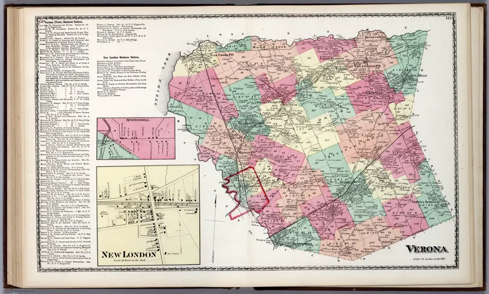
Verona, Oneida County, New York. Sconondoa. New London.
1874
Beers, D.G.
1:42k
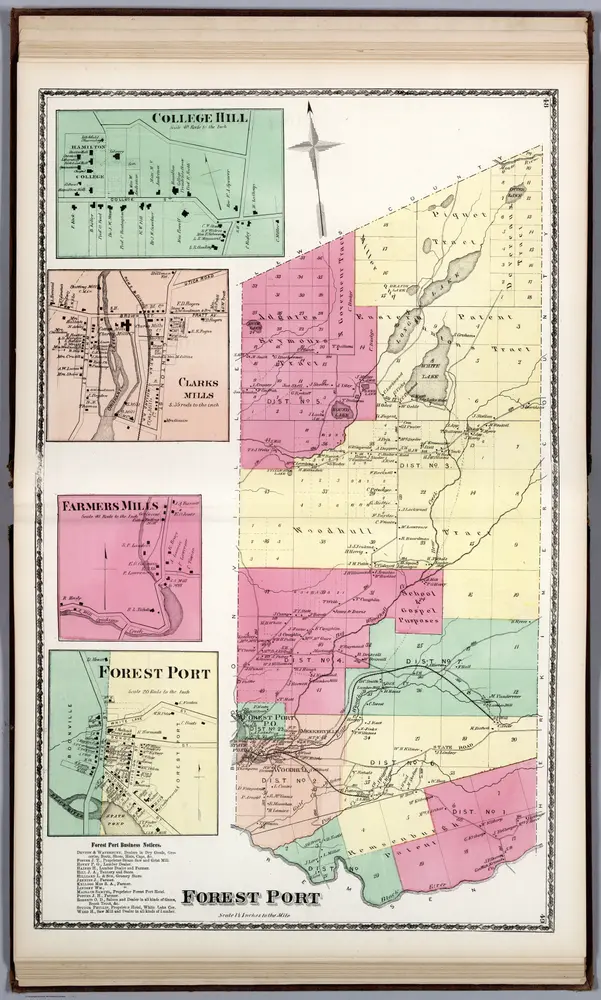
Forest Port, Oneida County, New York. College Hill. Clarks Mills. Farmers Mills. Forest Port.
1874
Beers, D.G.
1:42k
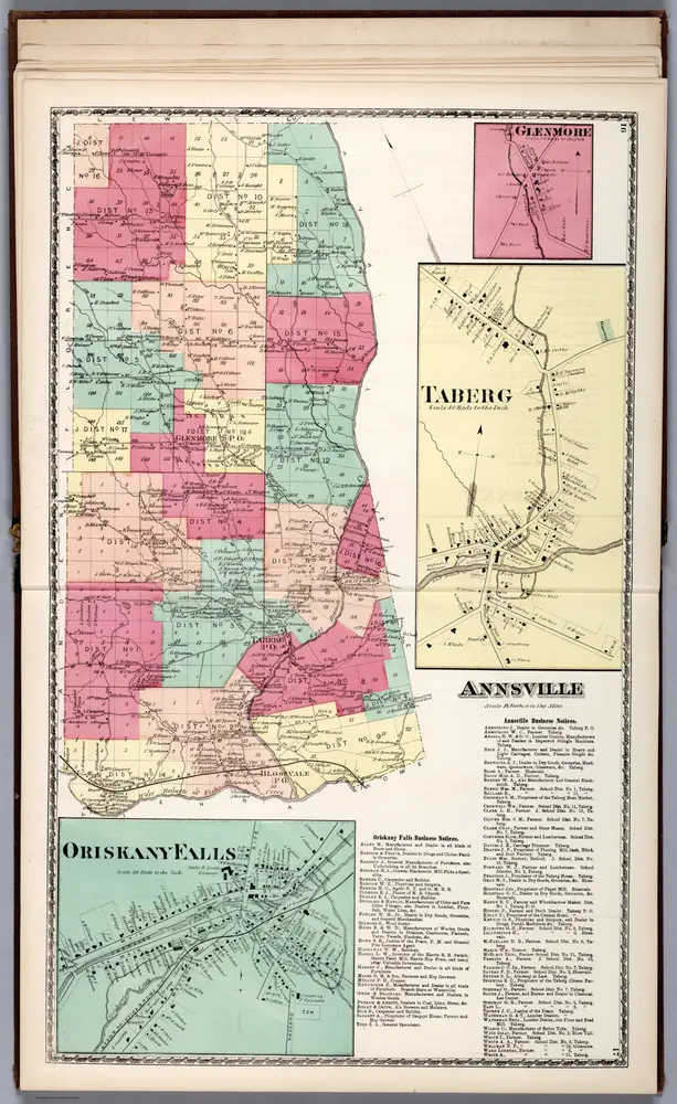
Annsville, Oneida County, New York. Glenmore. Taberg. Oriskany Falls.
1874
Beers, D.G.
1:42k
Oswego County.
1838
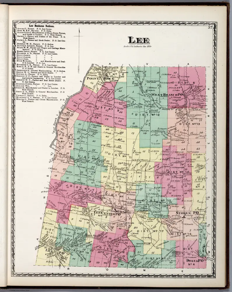
Lee, Oneida County, New York.
1874
Beers, D.G.
1:42k
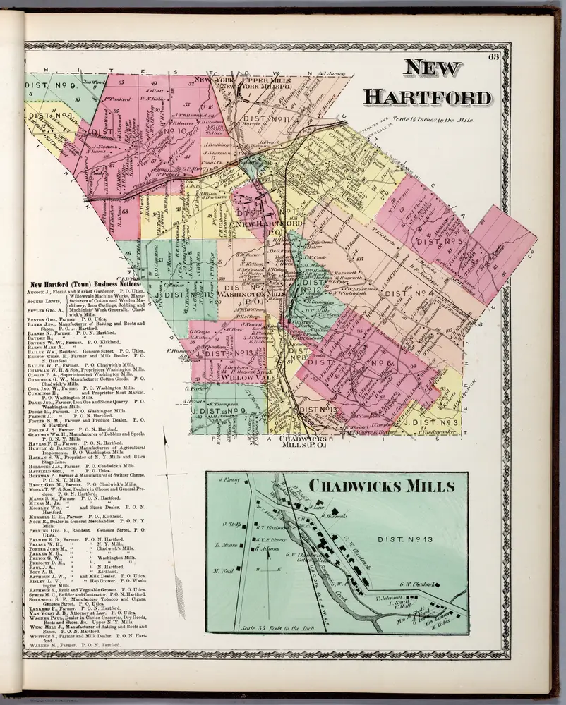
New Hartford, Oneida County, New York. Chadwicks Mills.
1874
Beers, D.G.
1:42k
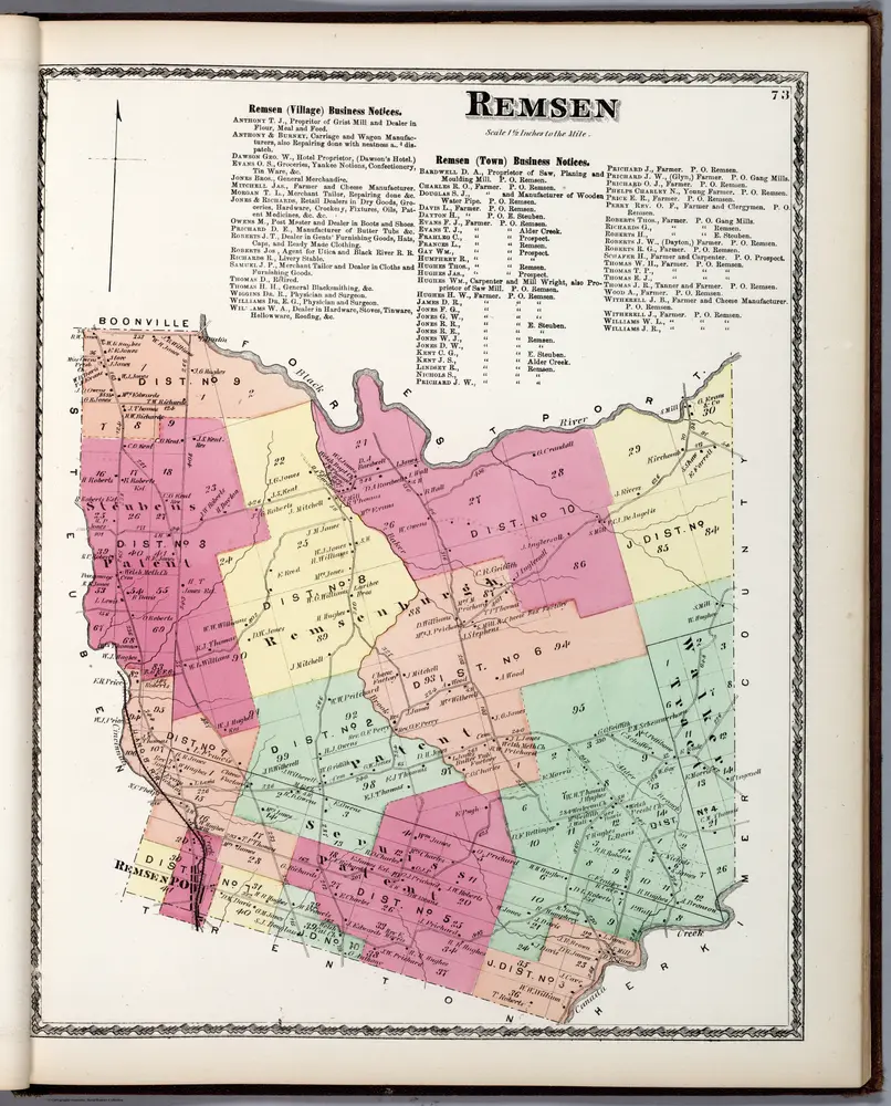
Remsen, Oneida County, New York.
1874
Beers, D.G.
1:42k
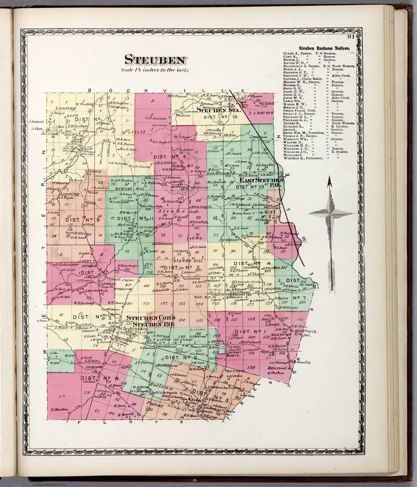
Steuben, Oneida County, New York.
1874
Beers, D.G.
1:42k
Historia
Oneida County, New York的老地图
在历史地图上发现 Oneida County, New York 的过去
Oneida County, New York的老地图
在历史地图上发现 Oneida County, New York 的过去
探索地图
发现历史
母区域
相关地点
城市
由提卡 (紐約州)