项目
社区
新闻
我的应用程序
我的地图
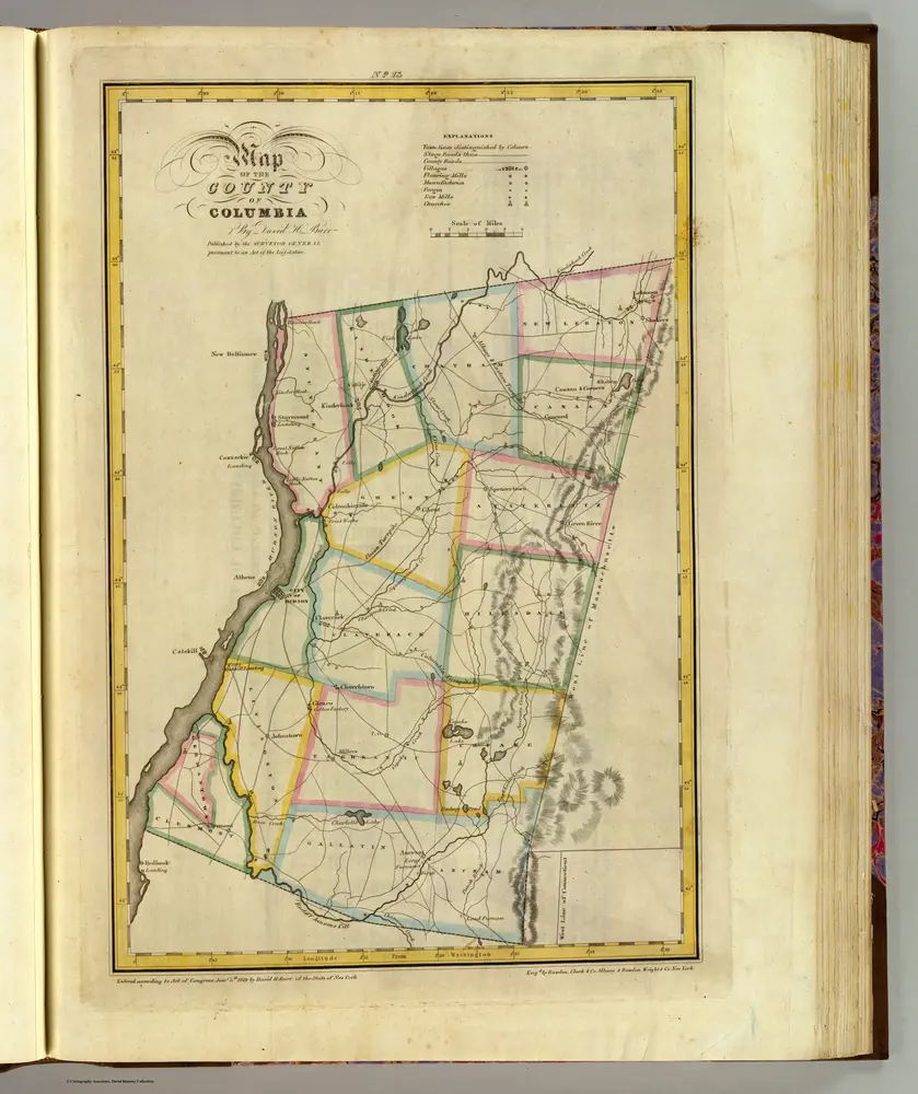
Columbia County.
1829
Burr, David H., 1803-1875
1:151k
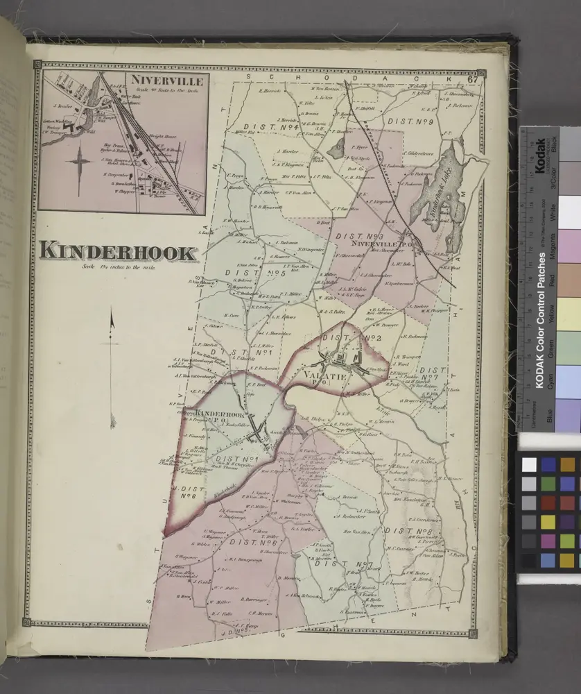
Niverville [Village]; Kinderhook [Township]
1873
Map of the county of Columbia / by David H. Burr ; engd. by Rawdon, Clark & Co., Albany, & Rawdon, Wright & Co., New York.
1829
Stuyvesant [Township]; Stuyvesant Business Notices.
1873
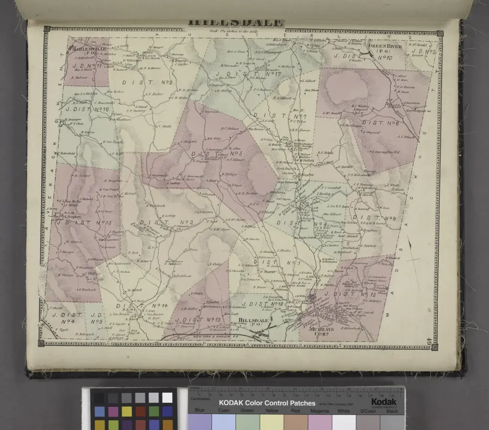
Hillsdale [Township]
1873
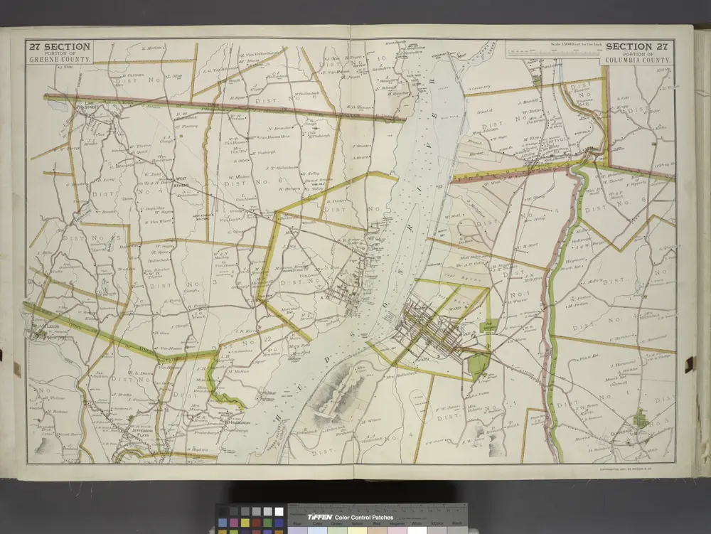
Portion of Greene County. ; Portion of Columbia County.
1891
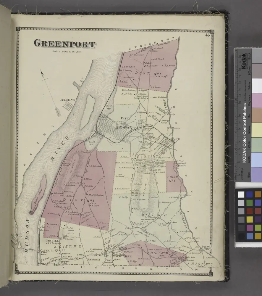
Greenport [Township]
1873
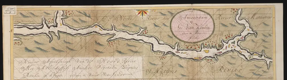
Nieuwe afteekeningh van de Noord Rivier met alle desselfs ancker plaetsen dieptens banken en klippen, geleegen in Nieuw Nederlandt [south part]
1720
Gerard van Keulen
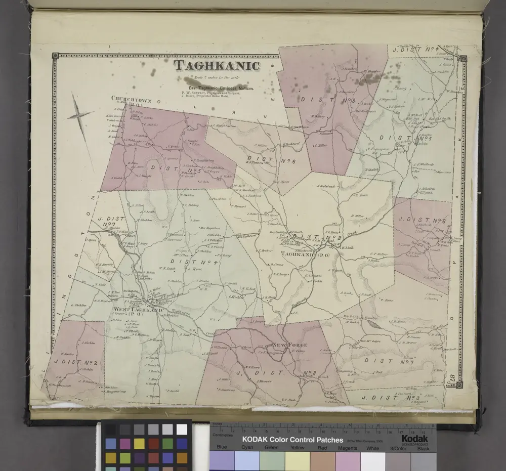
Taghkanic [Township]
1873
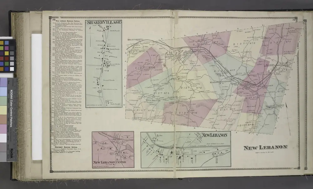
New Lebanon Business Notices.; Shaker Village [Village]; New Lebanon Center [Village]; New Lebanon [Village]; New Lebanon [Township]
1873
Geschiedenis
Columbia County, New York的老地图
在历史地图上发现 Columbia County, New York 的过去
Columbia County, New York的老地图
在历史地图上发现 Columbia County, New York 的过去
探索地图
发现历史
母区域
相关地点
地点
哈德遜 (佛羅里達州)
地点
根特 (纽约州)
城镇
哈德逊 (纽约州)