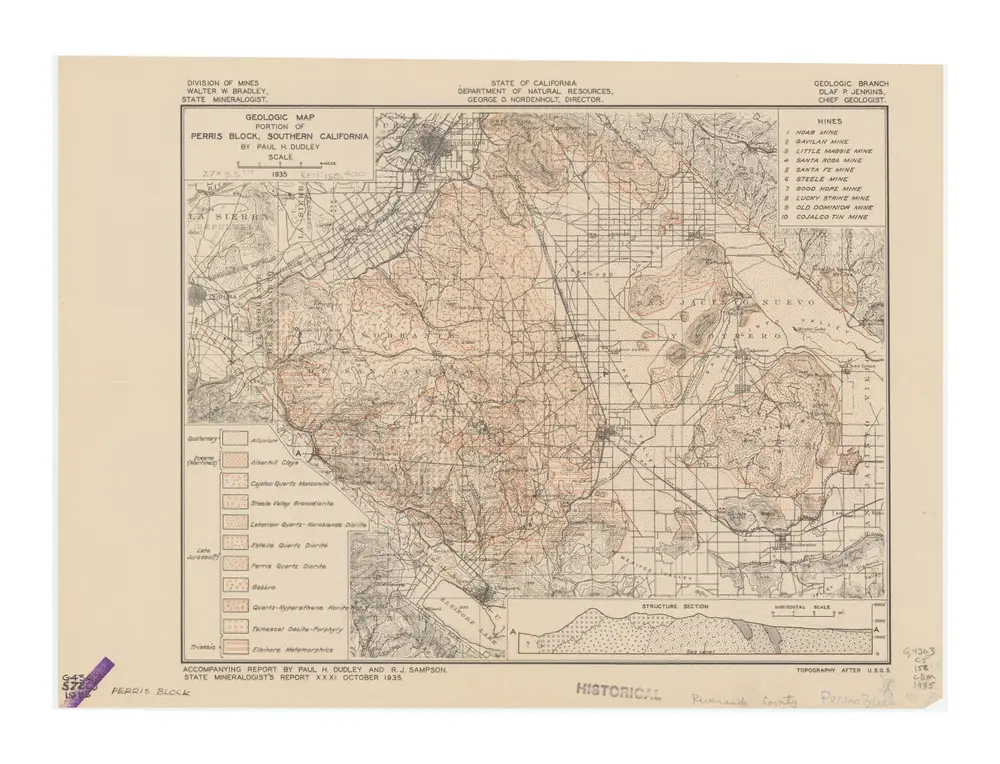
Geologic map, portion of Perris block, Southern California
1935
Dudley, Paul H.; California. Division of Mines.
1:158k
Map of the County of Los Angeles, California
1888
Rowan, Valentine James
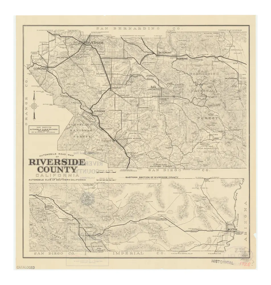
Automobile Road Map of Riverside County
1928
Los Angeles, Cal. : The Club
1:264k
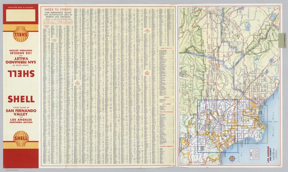
Los Angeles and Vicinity.
1956
Shell Oil Company
1:285k
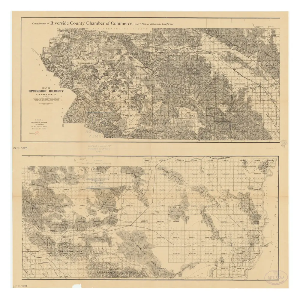
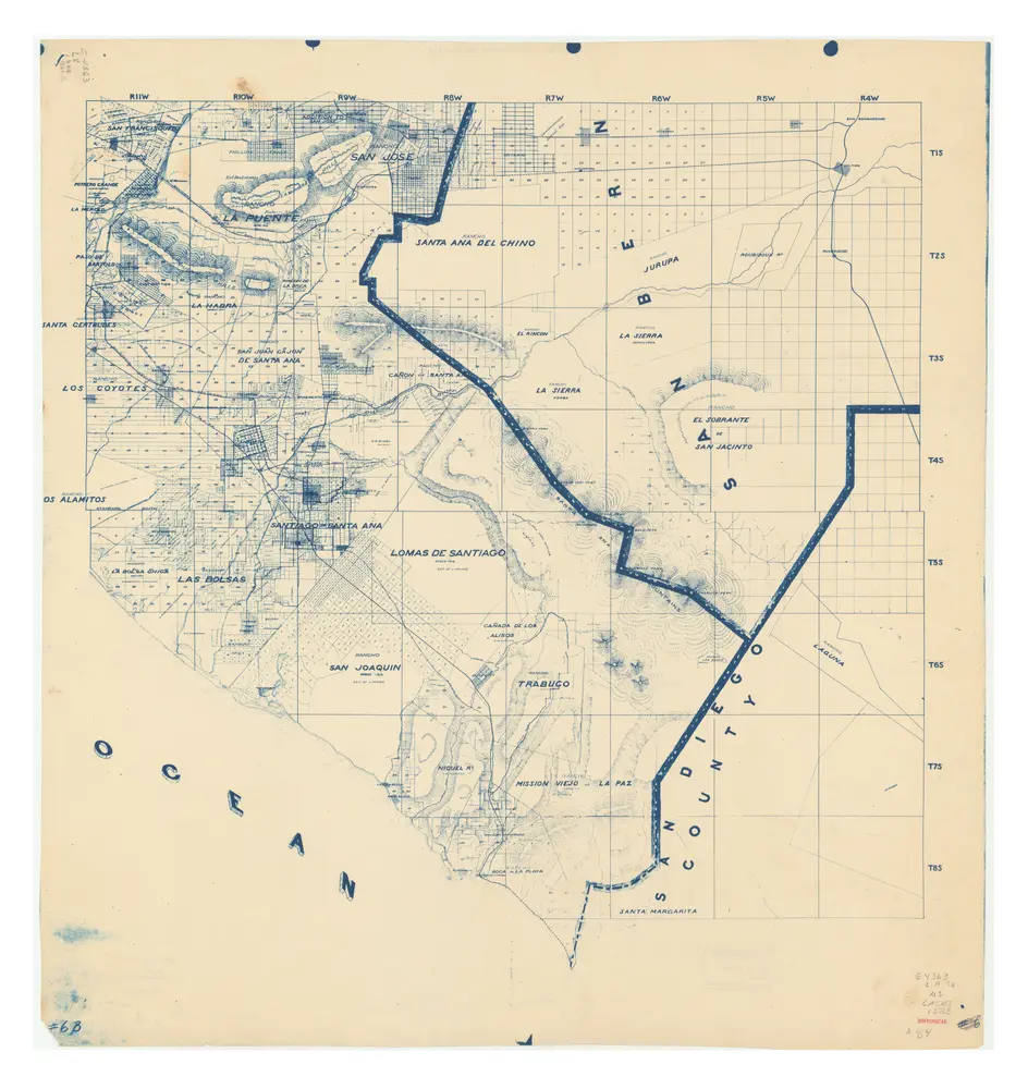
Map of Riverside County, California, showing sections, townships, ranch lines, and topography
1933
Riverside County (Calif.). County Surveyor's Office.; Riverside County Chamber of Commerce (Riverside County, Calif.); Fulmor, A. C.
1:250k
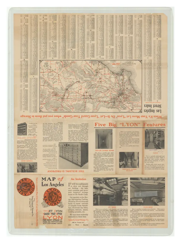
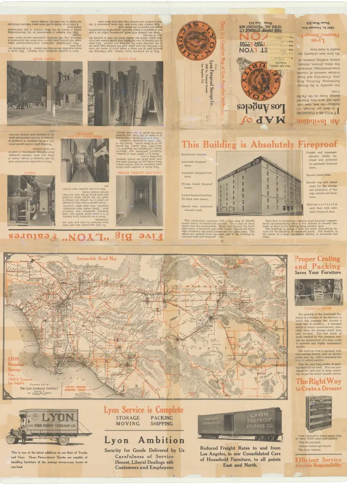
Lyon Fireproof Storage Company
1914
Clason Map Co.
Clason's map of Los Angeles.
1921
Lyon Fireproof Storage Co.
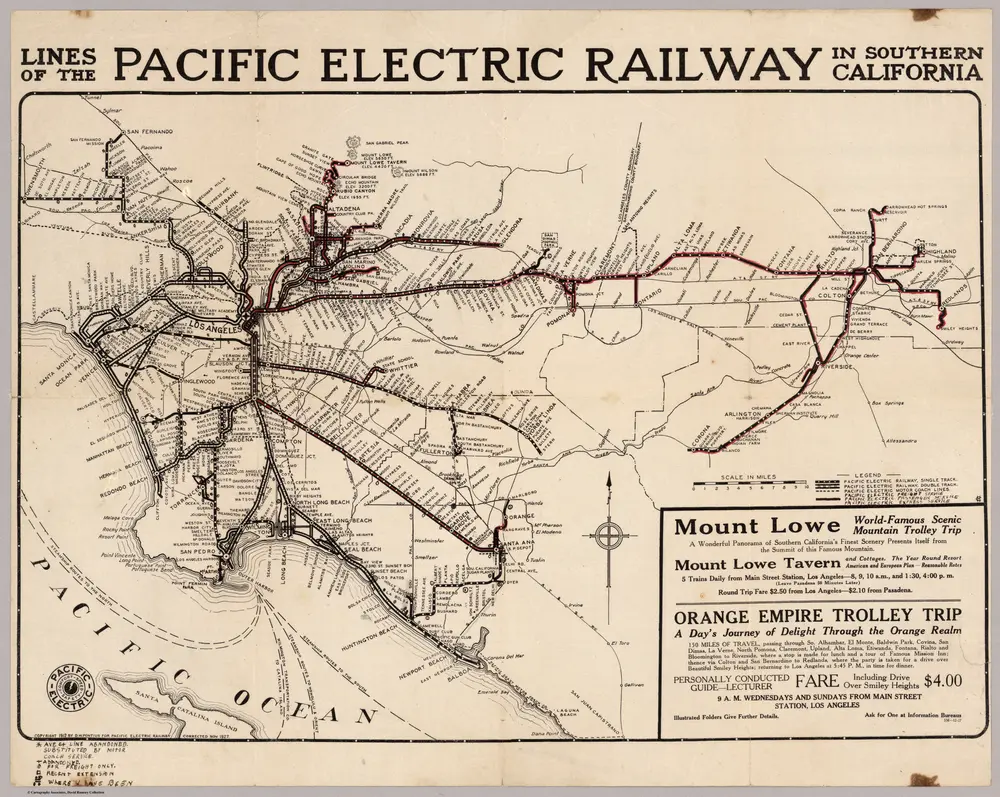
Pacific Electric Railway In Southern California
1927
Pontius, D.W.
1:222k
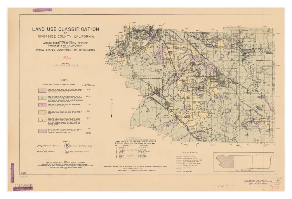
Land Use Classification of Riverside County, California
1939
University of California Agricultural Extension Service.; United States. Department of Agriculture.; United States. Bureau of Agricultural Economics.
1:312k
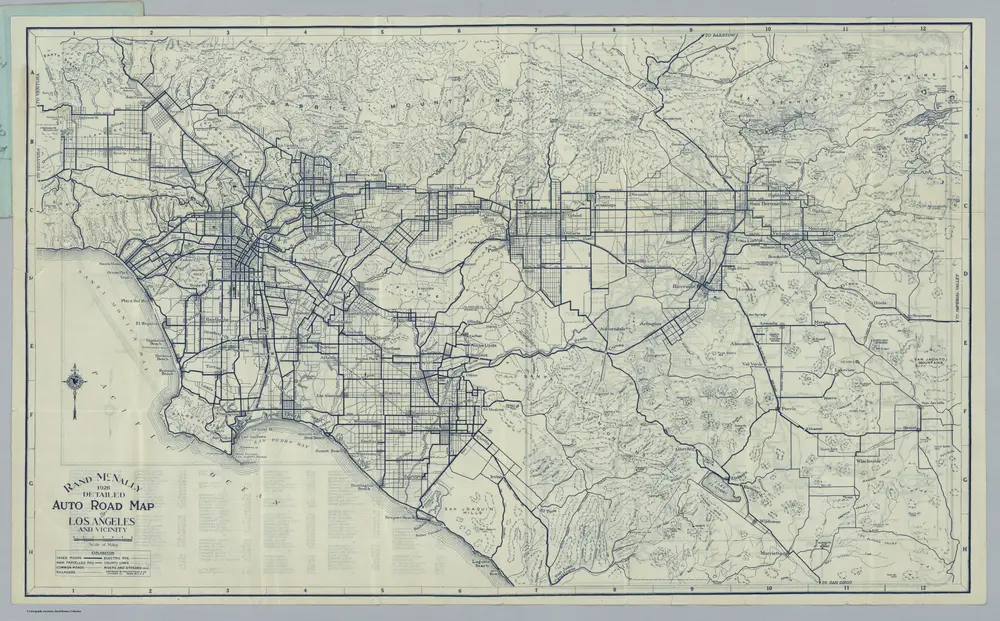
Auto Road Map of Los Angeles And Vicinity
1926
Rand McNally and Company
萊克蘭村 (加利福尼亞州)的老地图
在历史地图上发现 萊克蘭村 (加利福尼亞州) 的过去
萊克蘭村 (加利福尼亞州)的老地图
在历史地图上发现 萊克蘭村 (加利福尼亞州) 的过去
寻找 谷歌地图应用程序接口替代方案?