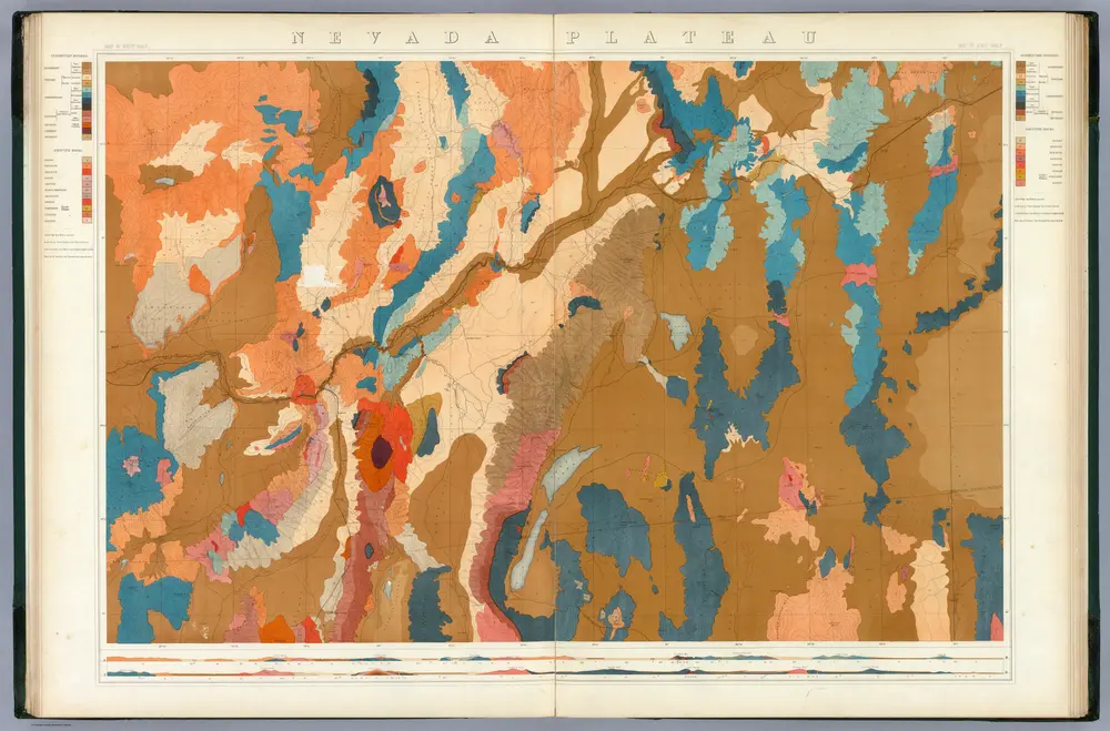
Nevada Plateau. (Geological)
1876
King, Clarence
1:253k
Other Countries ... With maps and illustrations
1872
BELL, William Morrison.
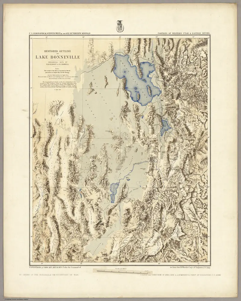
Restored Outline Of Lake Bonneville ... Portions Of Western Utah & Eastern Nevada.
1876
Wheeler, G.M.
1:1m
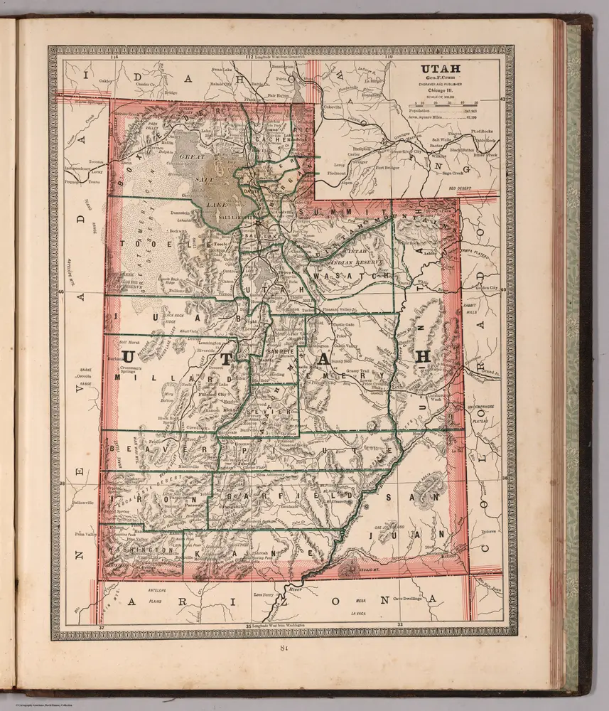
Utah.
1883
Cram, George Franklin
1:2m
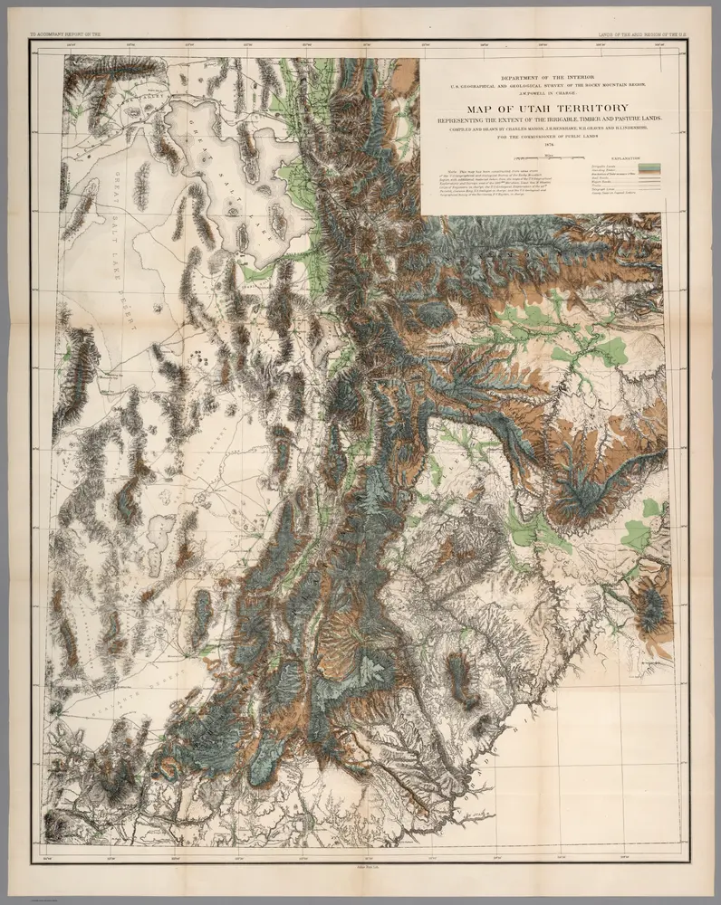
Map of Utah territory : representing the extent of the irrigable, timber and pasture lands
1878
Powell, John Wesley, 1834-1902.
1:630k

Map of the Western Division of the Fort Kearney South Pass and Honey Lake Road.
1857
Campbell, Albert
1:760k
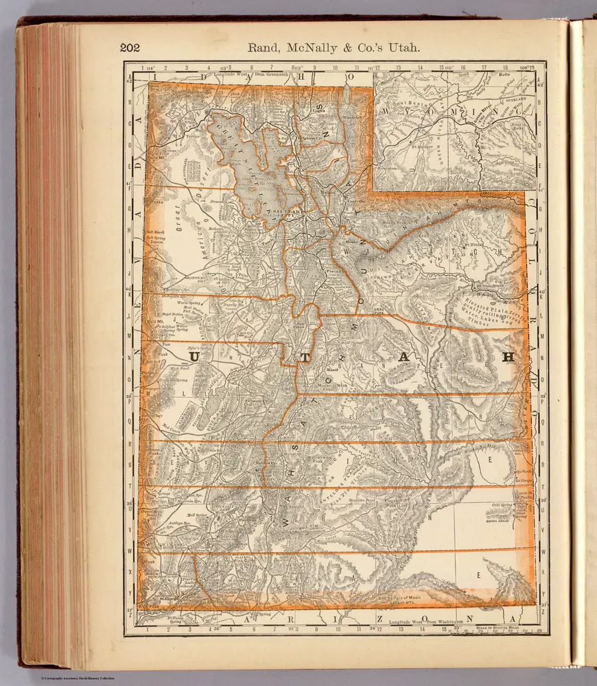
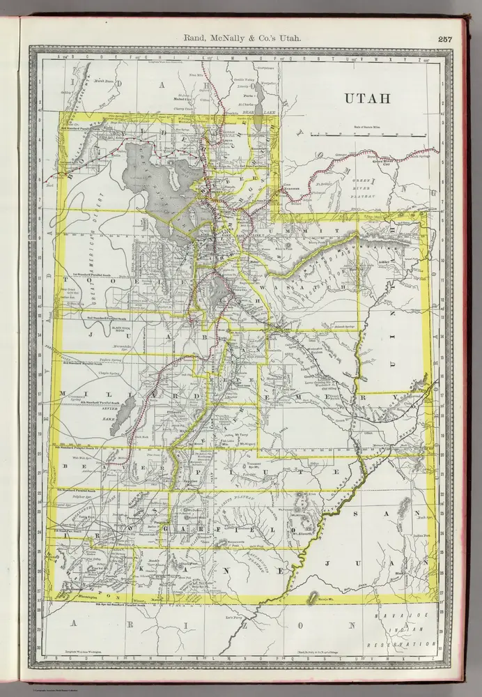
Utah.
1879
Rand McNally and Company
1:2m
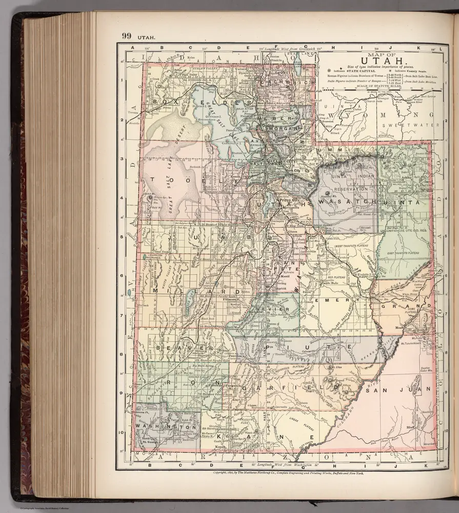
Map of Utah. 99
1891
Appleton, D. & Co.
1:2m
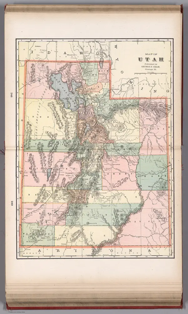
Map of Utah
1901
Murray-Aaron, Eugene, 1852-1941.
1:1m
Utah.
1889
Rand McNally and Company
1:1m
温多弗 (犹他州)的老地图
在历史地图上发现 温多弗 (犹他州) 的过去
温多弗 (犹他州)的老地图
在历史地图上发现 温多弗 (犹他州) 的过去
寻找 谷歌地图应用程序接口替代方案?