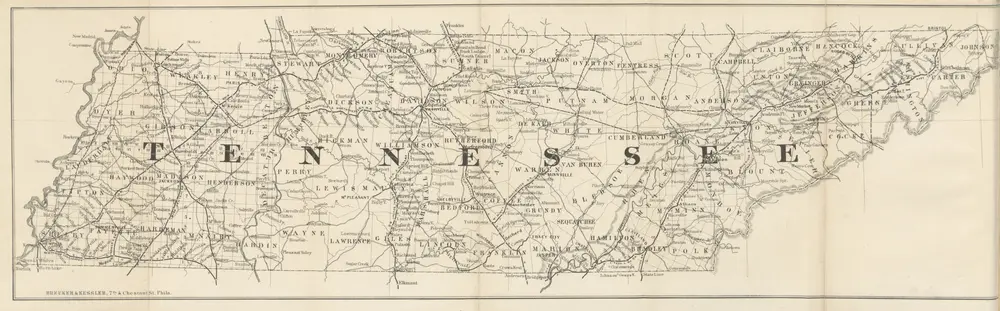
The Tennessee Hand-Book and Immigrant's Guide, etc. [With a map.]
1868
BOKUM, Hermann.
Kentucky.
1794
Morse, Jedidiah
1:634k
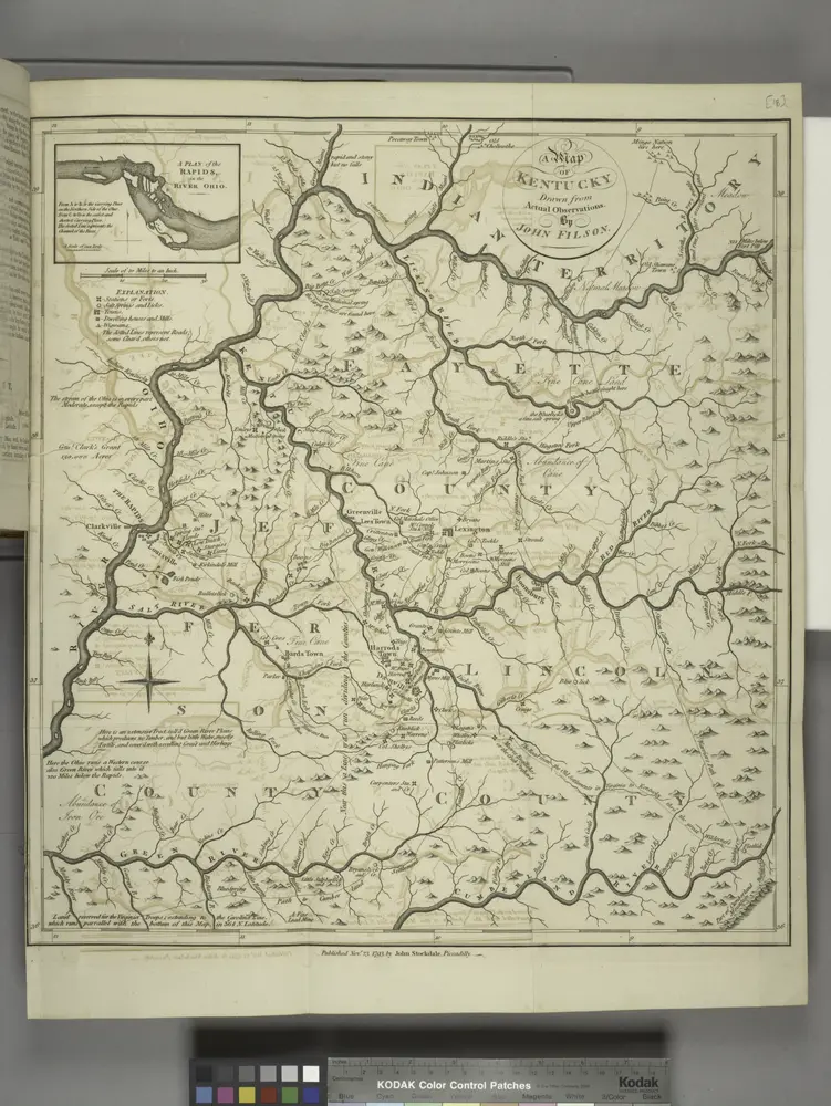
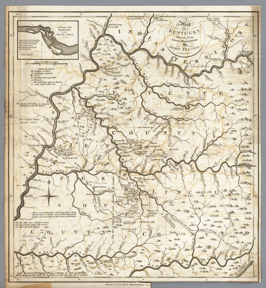
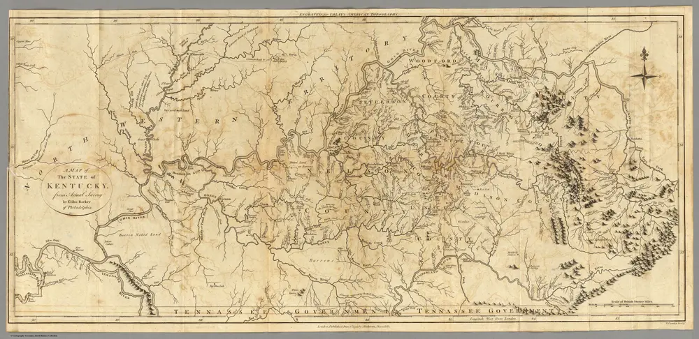
A map of Kentucky, drawn from actual observations by John Filson.
1794
Kentucky.
1795
Carey, Mathew
1:1m
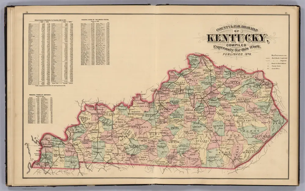
County and Road Map of Kentucky.
1876
McDonough, Leo & Co.
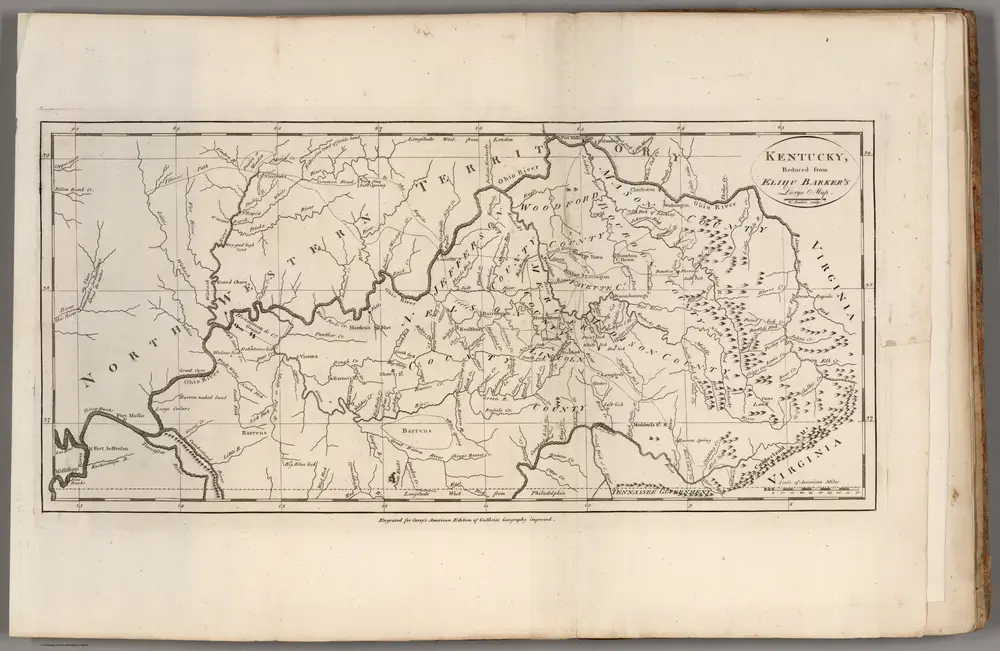
Kentucky.
1797
Imlay, Gilbert
1:634k
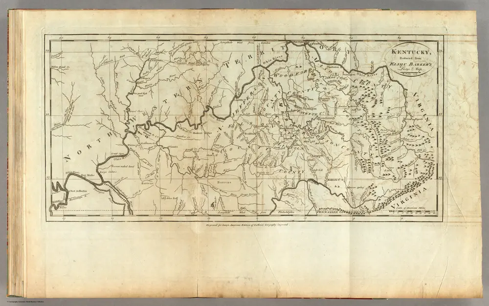
Kentucky.
1795
Carey, Mathew
1:2m
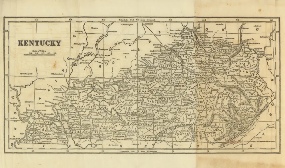
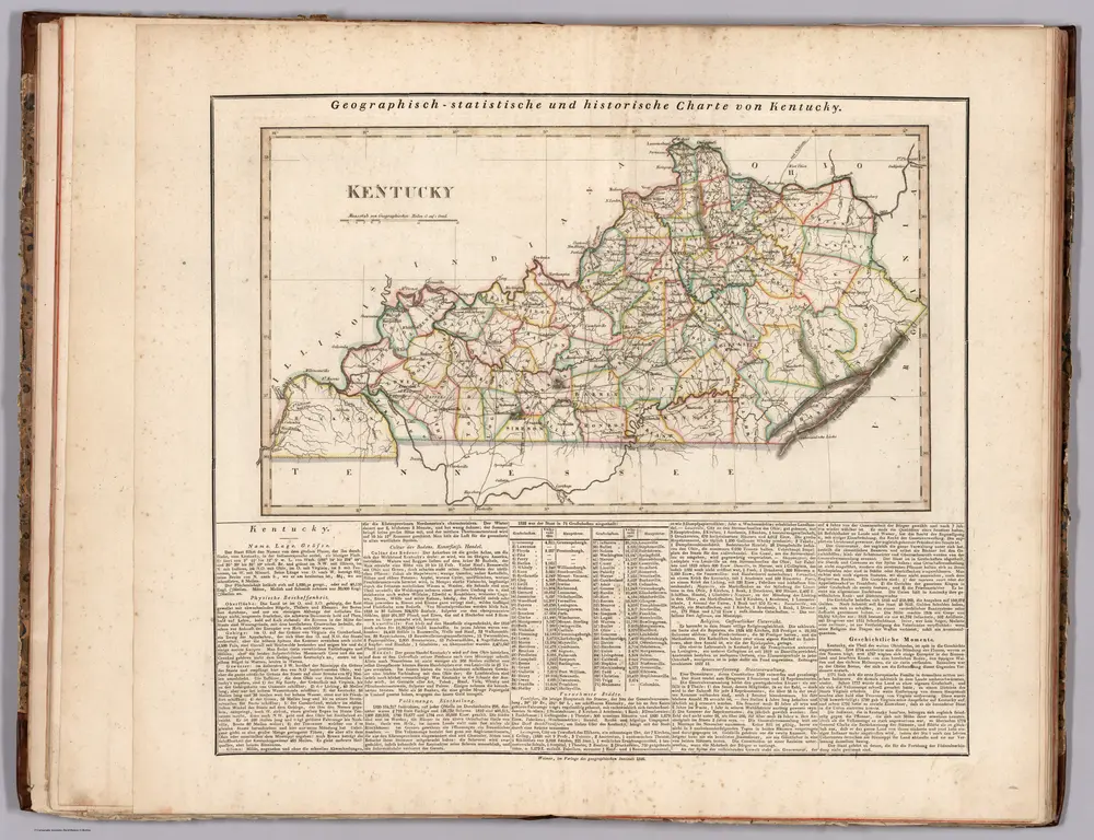
Historical Sketches of Kentucky: embracing its history, antiquities and natural curiosities, geographical, statistical and geological descriptions; with anecdotes of pioneer life ... and biographical sketches ... Illustrated by forty engravings. [Based on materials collected by H. P. Peers. With contributions by various authors. With a map.]
1850
COLLINS, Lewis.
Kentucky.
1826
Hassel, Georg, 1770-1829
1:1m
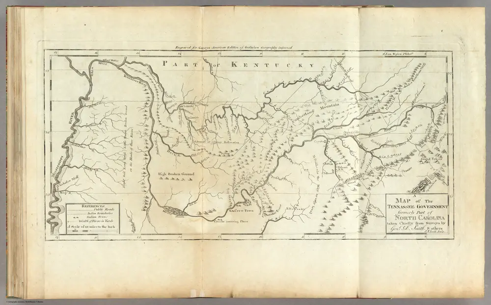
Map of The Tennassee (sic) Government.
1795
Carey, Mathew
1:1m
方廷伦的老地图
在历史地图上发现 方廷伦 的过去
方廷伦的老地图
在历史地图上发现 方廷伦 的过去
寻找 谷歌地图应用程序接口替代方案?