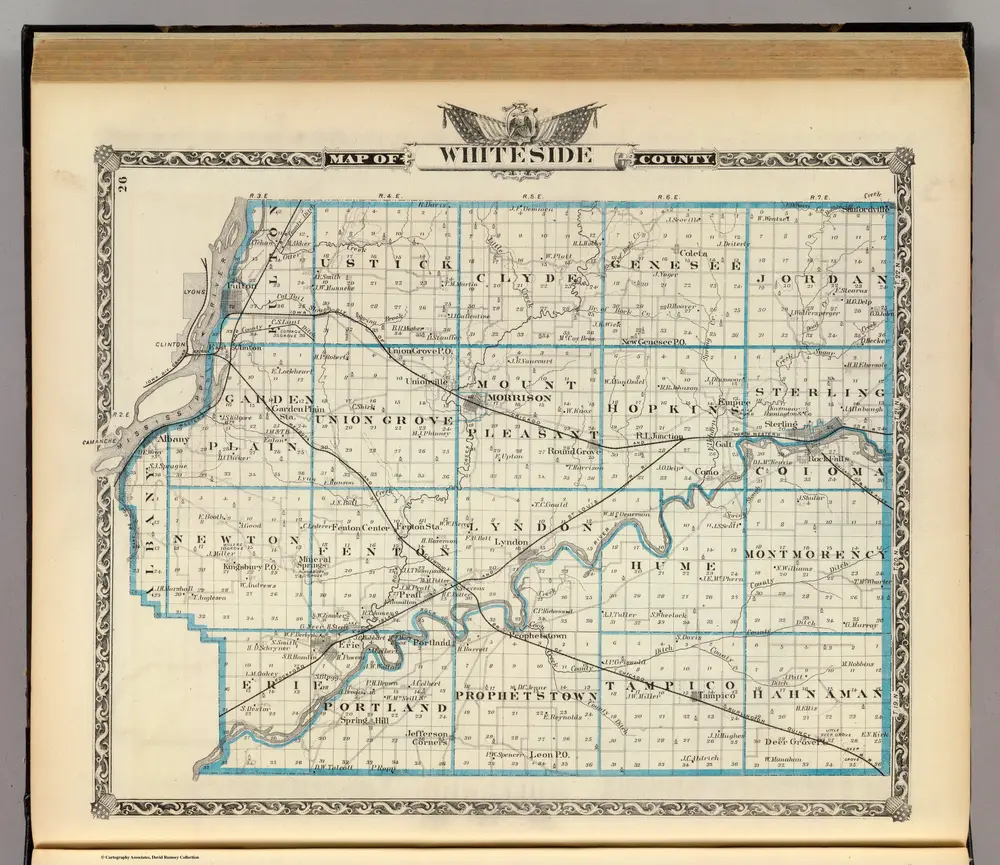
Map of Whiteside County.
1876
Warner & Beers
1:140k
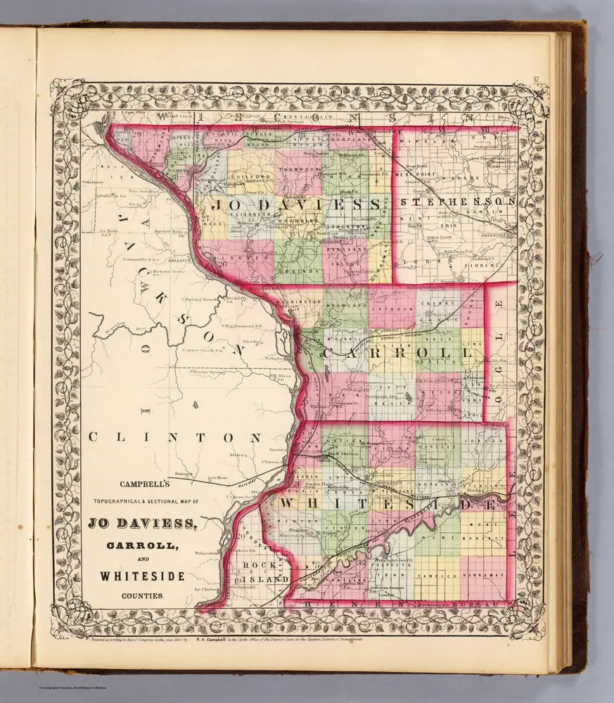
Jo Daviess, Carroll, Whiteside counties.
1870
Campbell, R.A.
1:350k
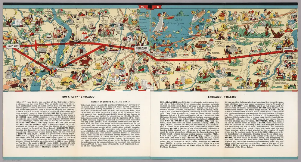
Iowa City - Chicago. Chicago - Toledo.
1939
White, Ruth Taylor

Iowa.
1842
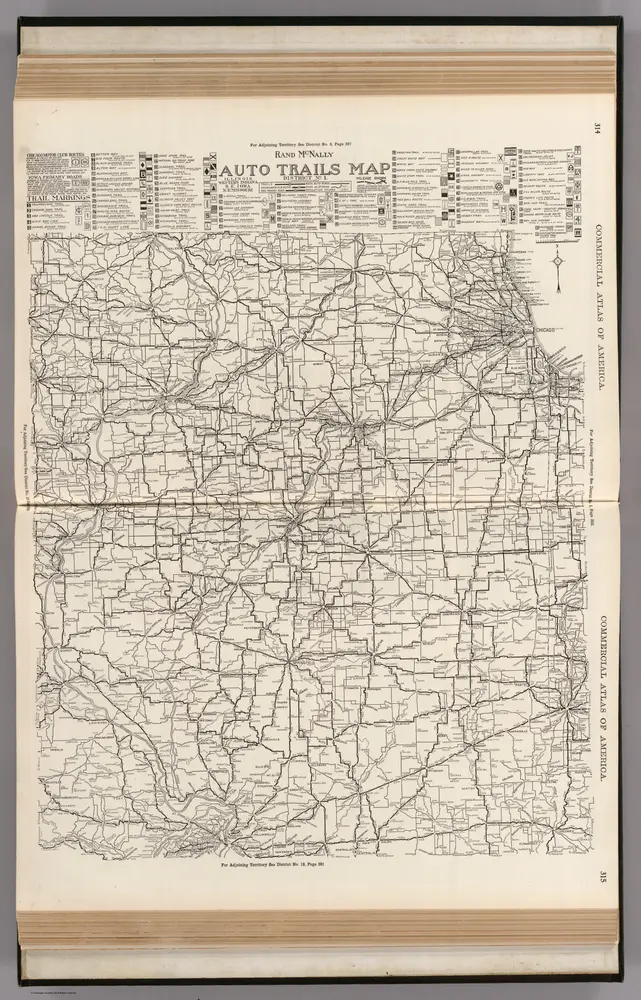
AutoTrails Map, Illinois, Western Indiana, Southeast Iowa, Northeast Missouri.
1924
Rand McNally and Company
1:783k
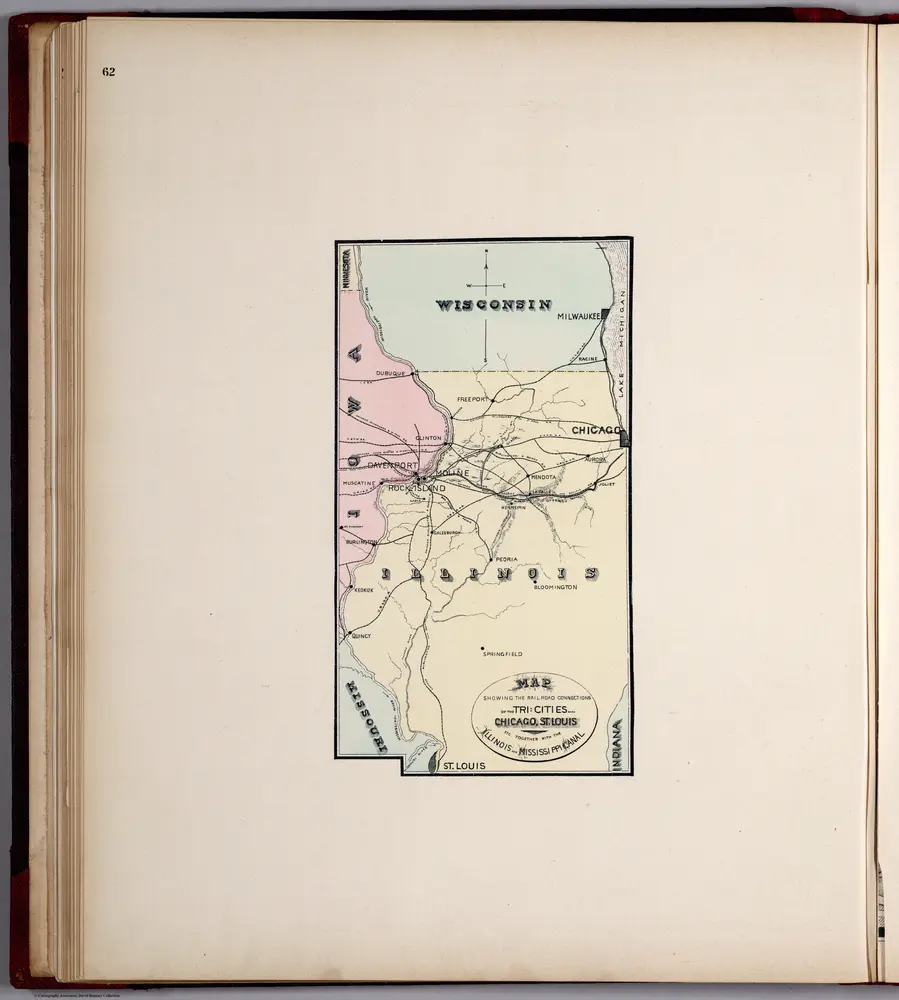
Railroad Connections of the Tri-Cities (Davenport, Moline, Rock Island) with Chicago, St. Louis.
1894
Huebinger, M. & Co.
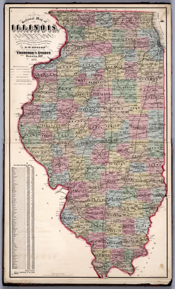
Sectional Map of Illinois ... by D.W. Ensign, Published by Thompson and Everts, Geneva, Illinois, 1871.
1871
Thompson and Everts
1:887k
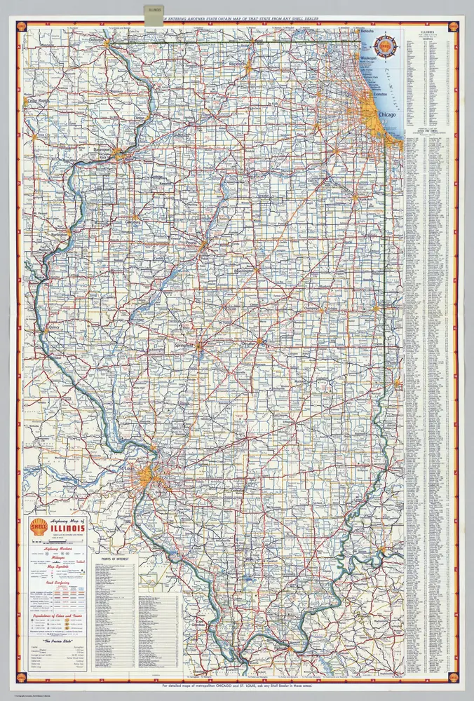
Shell Highway Map of Illinois.
1956
Shell Oil Company
1:1m
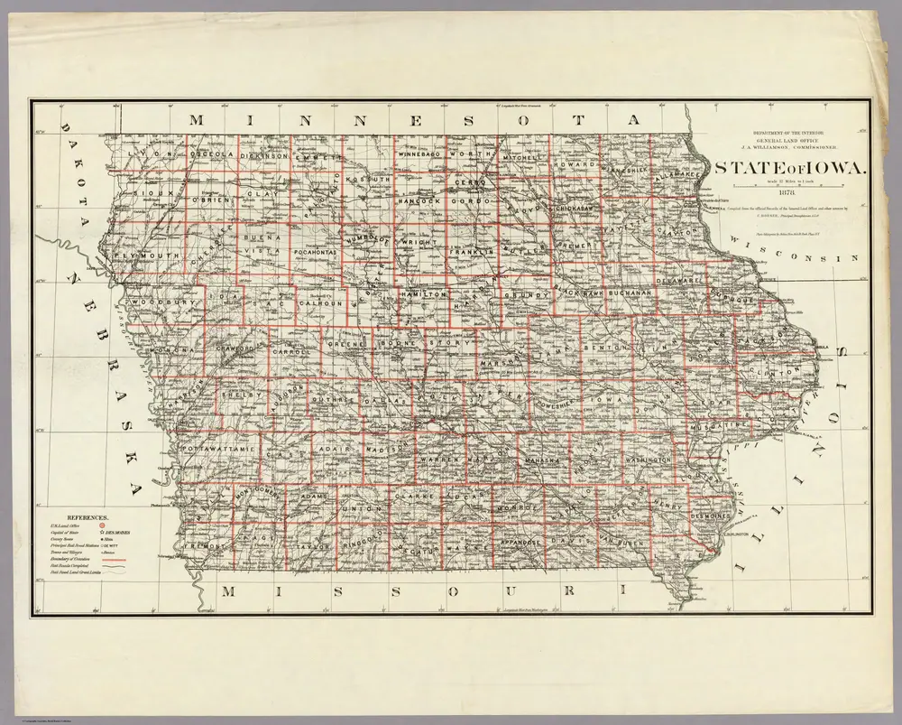
State of Iowa.
1878
U.S. General Land Office
1:760k
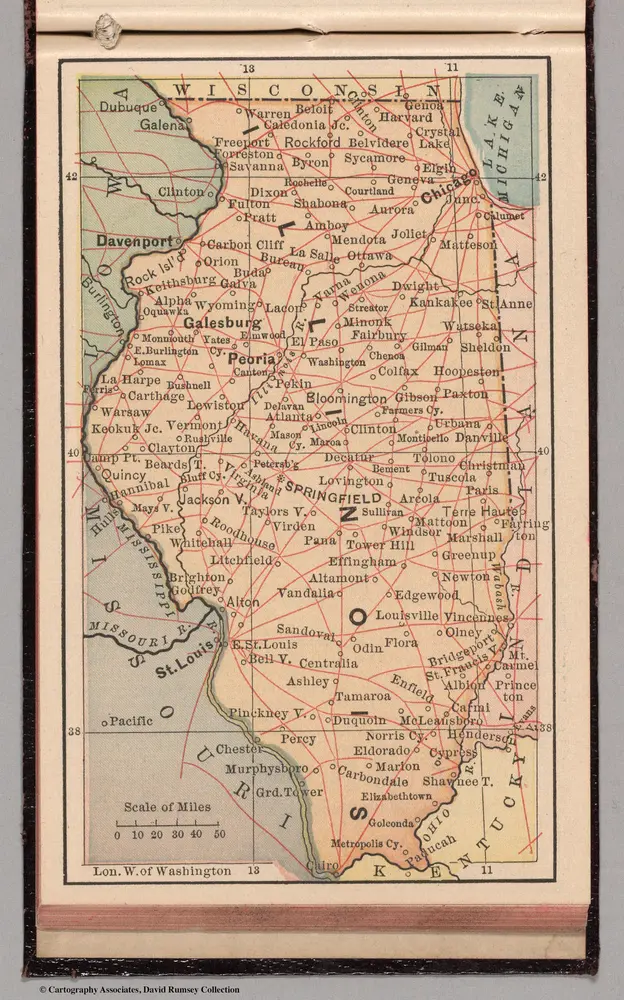
Illinois
1885
Bradstreet Company
1:6m
坦皮科的老地图
在历史地图上发现 坦皮科 的过去
坦皮科的老地图
在历史地图上发现 坦皮科 的过去
寻找 谷歌地图应用程序接口替代方案?