编目地图
Cheshire XXXVI.6 (includes: Henbury; Macclesfield; over Alderley) - 25 Inch Map
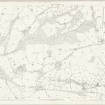

完整标题:Cheshire XXXVI.6 (includes: Henbury; Macclesfield; over Alderley) - 25 Inch Map
描述:1872
发布日期:1874
出版商:Ordnance Survey
地图比例尺:1:2 500
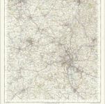
Stoke on Trent - OS One-Inch Map
1949
Ordnance Survey
1:63k
Macclesfield (Outline) - OS One-Inch Revised New Series
1895
Ordnance Survey
1:63k

Macclesfield (Hills) - OS One-Inch Revised New Series
1895
Ordnance Survey
1:63k

Stoke upon Trent (Outline) - OS One-Inch Revised New Series
1895
Ordnance Survey
1:63k

Stoke upon Trent (Hills) - OS One-Inch Revised New Series
1895
Ordnance Survey
1:63k
An accurate map of the county palatine of Chester
1765
Bowen; Hinton
Cestria comitatvs palatinvs
1690
Valck; Schenk
Cestria comitatvs palatinvs
1646
Blaeu

Stockport (Hills) - OS One-Inch Revised New Series
1895
Ordnance Survey
1:63k

Stockport (Outline) - OS One-Inch Revised New Series
1895
Ordnance Survey
1:63k