Projekt
Wspólnota
Aktualności
Moja aplikacja
Moje mapy
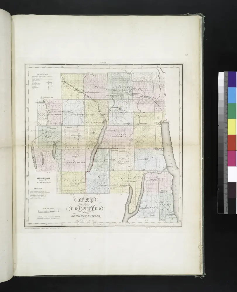
Map of the counties of Ontario & Yates / by David H. Burr ; engd. by Rawdon, Clark & Co., Albany, & Rawdon, Wright & Co., N.Y.
1829
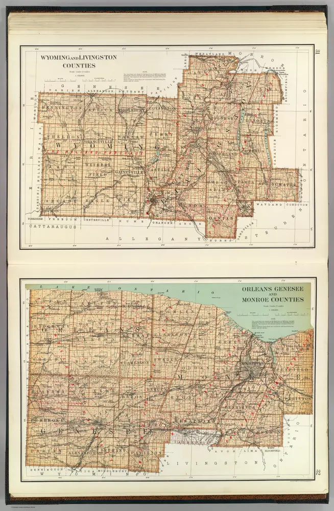
Wyoming, Livingston, Orleans, Genesee, Monroe counties.
1895
Bien, Joseph Rudolf
1:158k
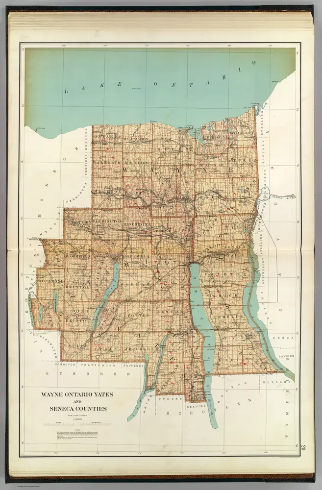
Wayne, Ontario, Yates, Seneca counties.
1895
Bien, Joseph Rudolf
1:158k
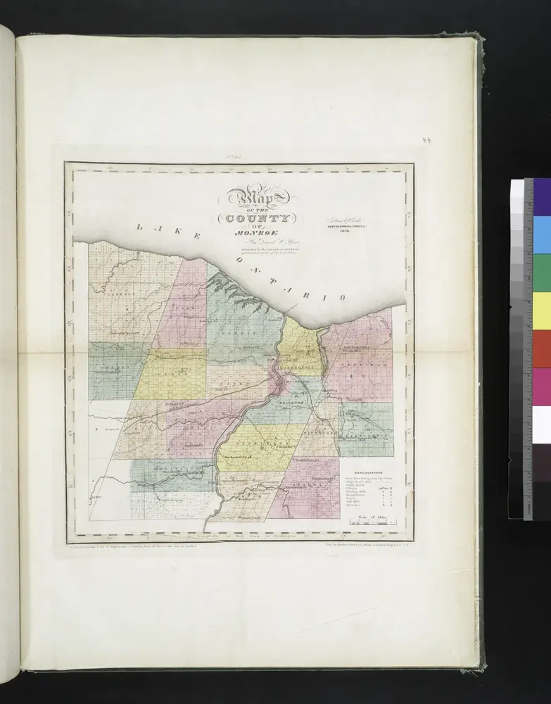
Map of the county of Monroe / by David H. Burr ; engd. by Rawdon, Clark & Co., Albany, & Rawdon, Wright & Co., N.Y.
1829
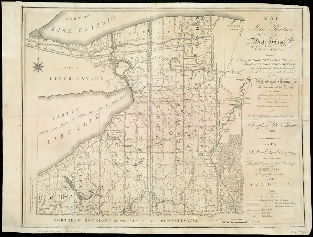
Map of Morris's Purchase or West Geneseo in the state of New York : exhibiting part of the Lakes Erie and Ontario, the Straights of Niagara ...
1804
Ellicott, Joseph
1:336k
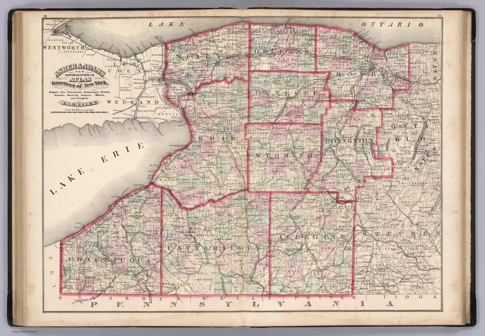
Niagara, Erie, Chautaugua, Cattaraugus, Orleans, Genesee, Wyoming, Allegheny, Monroe, and Livingston Counties, New York.
1870
Asher & Adams
1:400k
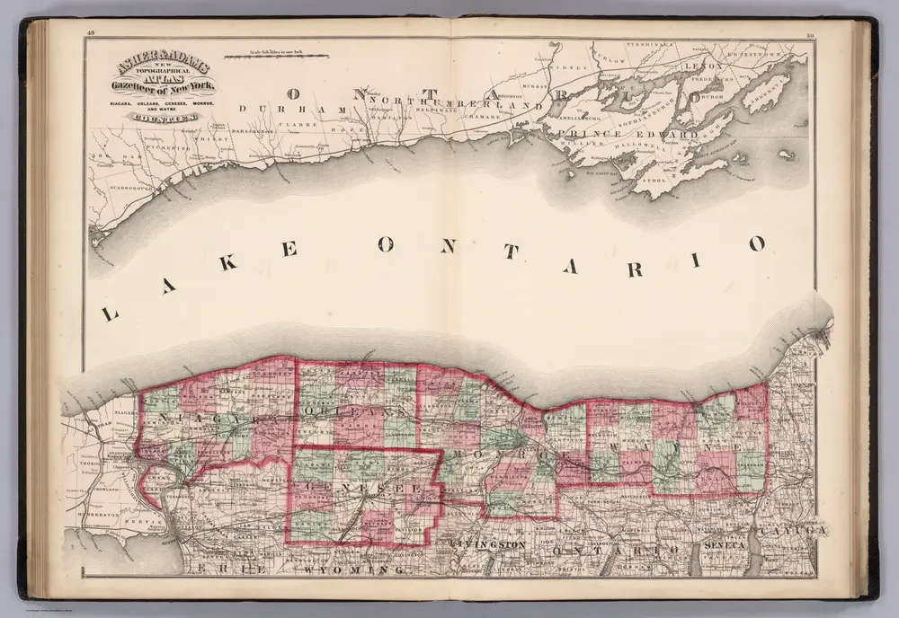
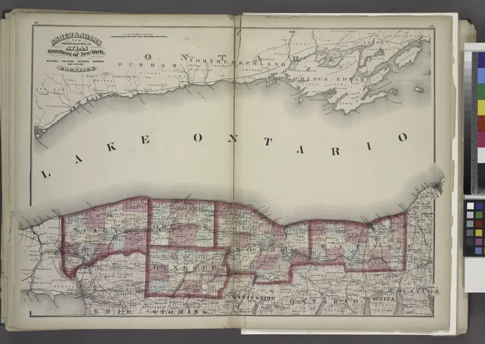
Niagara, Orleans, Genese, Monroe, and Wayne Counties, New York.
1870
Asher & Adams
1:400k
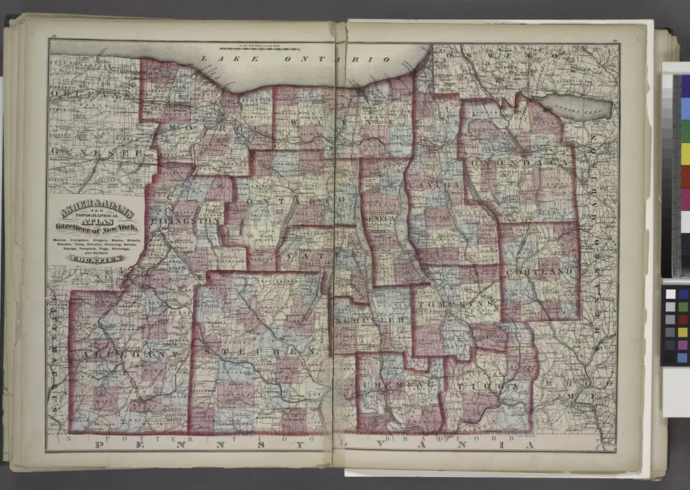
"Monroe, Livingston, Allegany, Wayne, Ontario, Steuben, Yates, Schuyler, Chemung, Seneca, Cayuga, Tompkins, Tioga, Onondaga, and Cortland Counties "
1871
"Niagara, Orleans, Genesee, Monroe, and Wayne counties"
1871
"Niagara, Erie, Chautauqua, Cattaraugus, Orleans, Genesee, Wyoming, Allegany, Monroe, and Livingston Counties"
1871
L'histoire
Stare mapy East Bloomfield, New York
Odkryj przeszłość East Bloomfield, New York na mapach historycznych
Stare mapy East Bloomfield, New York
Odkryj przeszłość East Bloomfield, New York na mapach historycznych
Odkryj mapy
Odkryj historię
Region nadrzędny
Hrabstwo Ontario
Powiązane miejsca