Projekt
Wspólnota
Aktualności
Moja aplikacja
Moje mapy
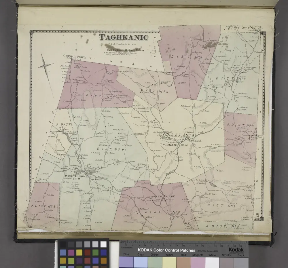
Taghkanic [Township]
1873
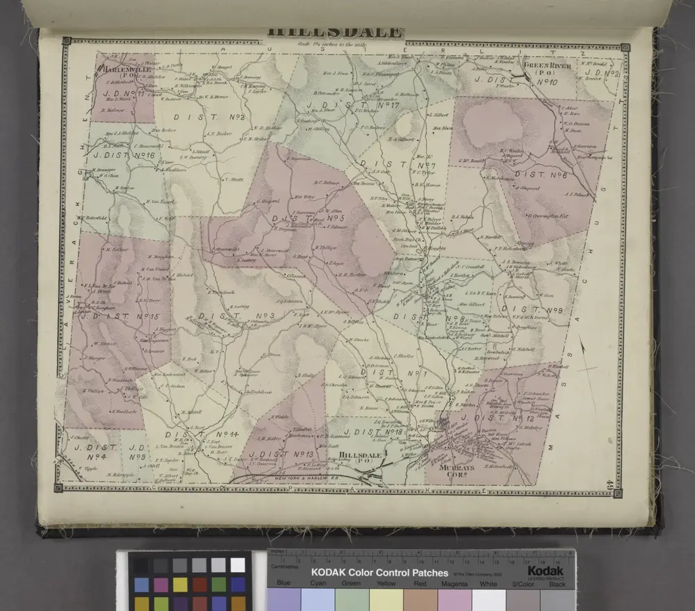
Hillsdale [Township]
1873
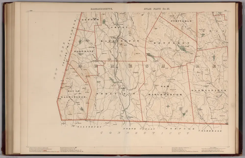
Massachusetts. Atlas Plate No. 27.
1891
Walker, O.W.
1:63k
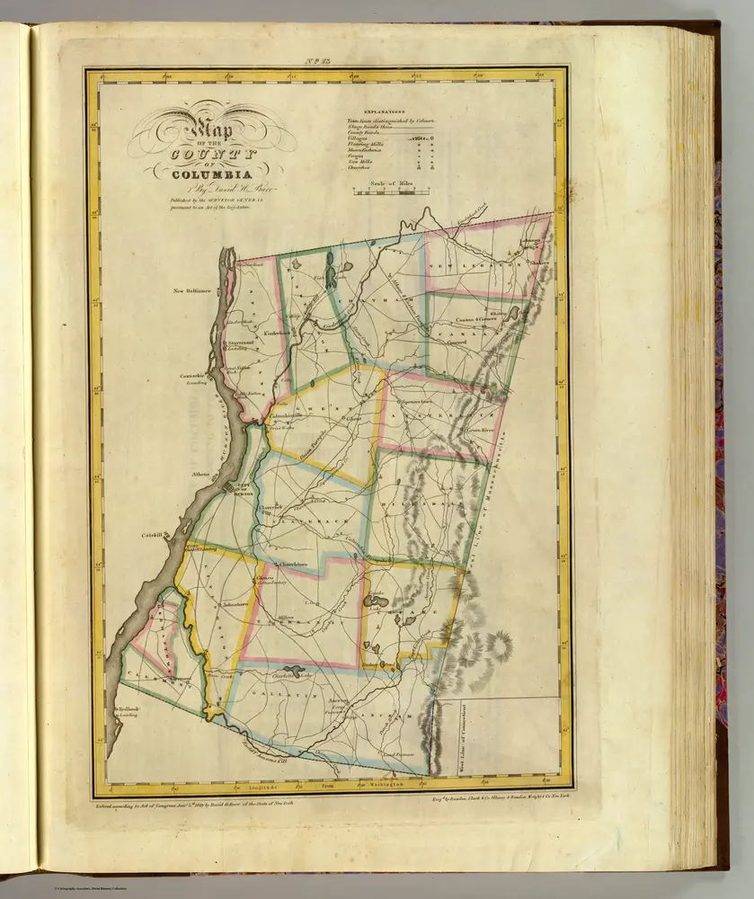
Columbia County.
1829
Burr, David H., 1803-1875
1:151k
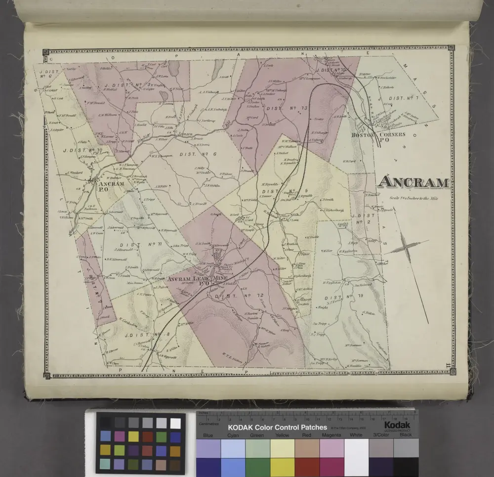
Ancram [Township]
1873
Map of the county of Columbia / by David H. Burr ; engd. by Rawdon, Clark & Co., Albany, & Rawdon, Wright & Co., New York.
1829
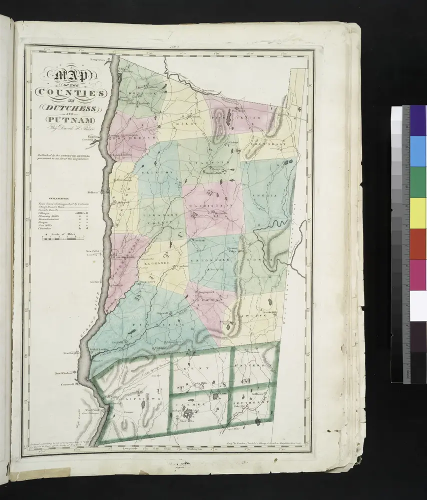
Map of the counties of Dutchess and Putnam / by David H. Burr ; engd. by Rawdon, Clark & Co., Albany, & Rawdon, Wright & Co., New York.
1829
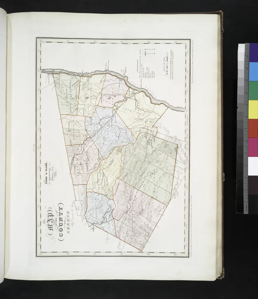
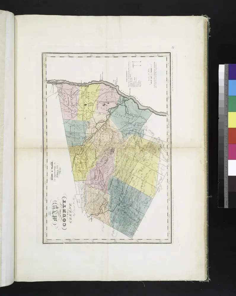
Map of the county of Greene / by David H. Burr ; engd. by Rawdon, Clark & Co., Albany, & Rawdon, Wright & Co., New York.
1841
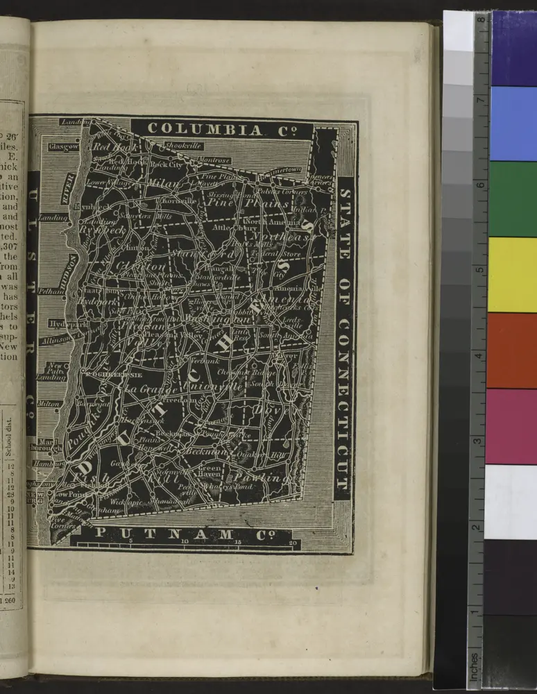
[Dutchess County].
1838
Map of the county of Greene / by David H. Burr ; engd. by Rawdon, Clark & Co., Albany, & Rawdon, Wright & Co., New York.
1829
Geschiedenis
Stare mapy Copake Lake, New York
Odkryj przeszłość Copake Lake, New York na mapach historycznych
Stare mapy Copake Lake, New York
Odkryj przeszłość Copake Lake, New York na mapach historycznych
Odkryj mapy
Odkryj historię
Region nadrzędny
Hrabstwo Columbia (Nowy Jork)
Powiązane miejsca