Projekt
Wspólnota
Aktualności
Moja aplikacja
Moje mapy
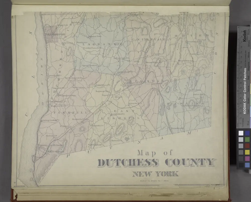
Map of Dutchess County New York
1876
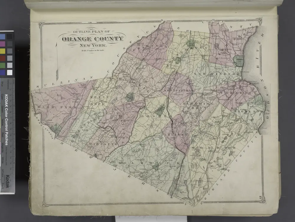
Outline Plan of Orange County New York.
1875
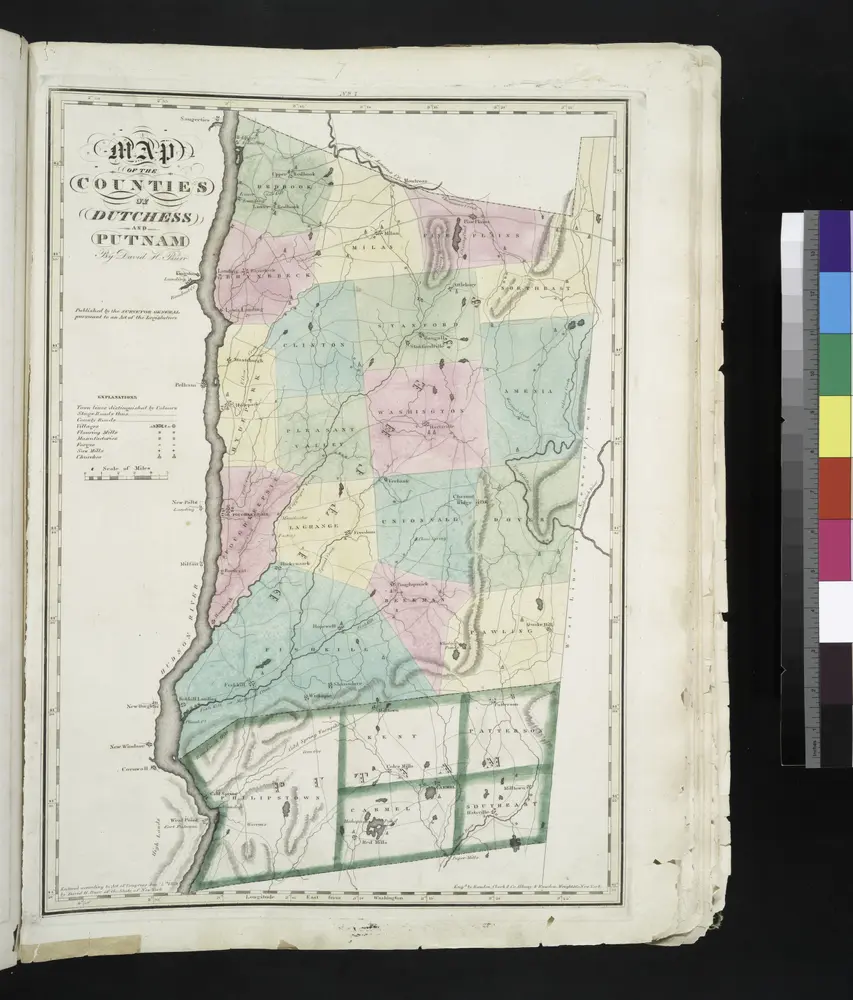
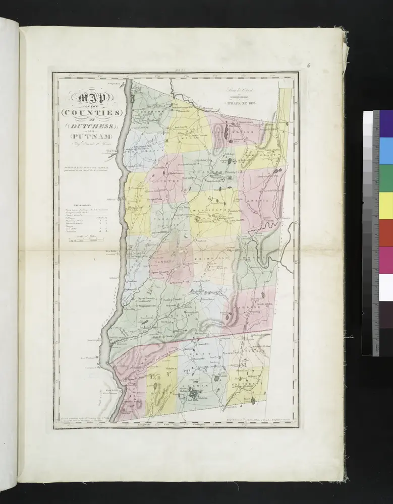
Map of the counties of Dutchess and Putnam / by David H. Burr ; engd. by Rawdon, Clark & Co., Albany, & Rawdon, Wright & Co., New York.
1829
[Dutchess County].
1838
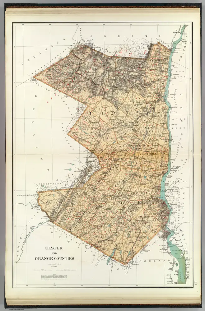
Map of the county of Ulster / by David H. Burr ; engd. by Rawdon, Clark & Co., Albany, & Rawdon, Wright & Co., New York.
1829
Map of the counties of Dutchess and Putnam / by David H. Burr ; engd. by Rawdon, Clark & Co., Albany, & Rawdon, Wright & Co., New York.
1829
Ulster, Orange counties.
1895
Bien, Joseph Rudolf
1:158k
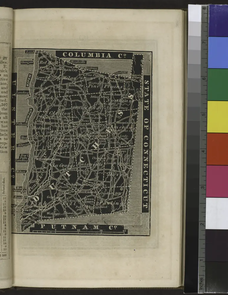
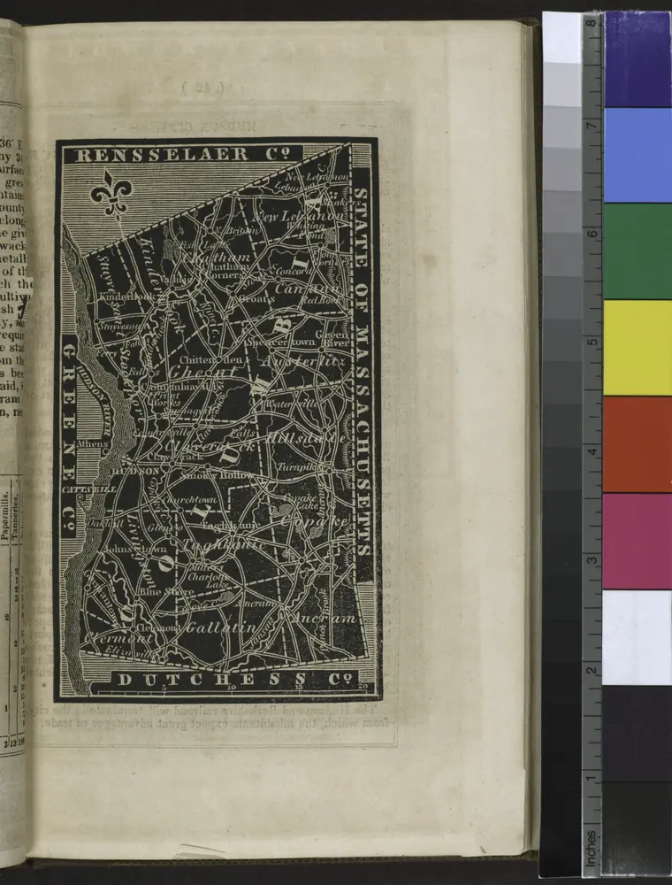
[Columbia County].
1838
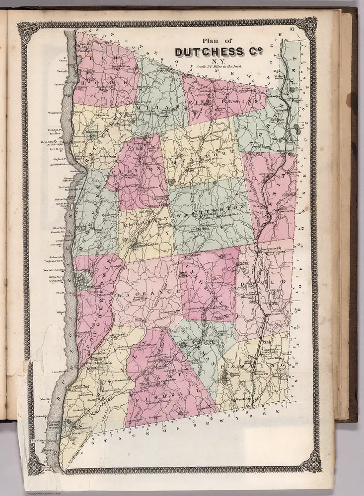
Plan of Dutchess County, New York.
1867
Beers, Frederick W.
1:135k
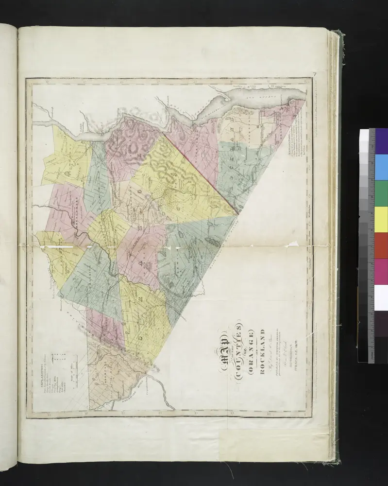
Map of the counties of Orange and Rockland / by David H. Burr ; engd. by Rawdon, Clark & Co., Albany, & Rawdon, Wright & Co., N. York.
1829
Geschiedenis
Stare mapy Clintondale, New York
Odkryj przeszłość Clintondale, New York na mapach historycznych
Stare mapy Clintondale, New York
Odkryj przeszłość Clintondale, New York na mapach historycznych
Odkryj mapy
Odkryj historię
Region nadrzędny
Hrabstwo Ulster
Powiązane miejsca