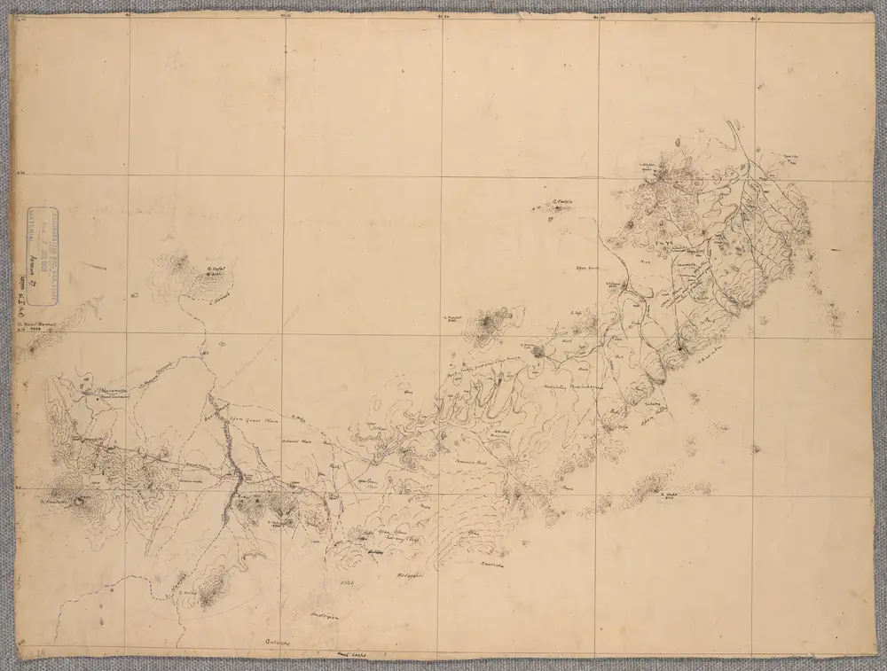
Southern Abyssinia Boundary Commission. Created by 'Maj. C.W. Gwynn R.E. Capt. R.L. Waller R.E. Commissioners. 1908 to 1909'. Harrar, Addis Abbaba & Ginir.- War Office ledger. Manuscripts.
Identifier
WOMAT_AFR_ABY_27_1_4_1_3
Collection
womat
Description
Covers two route corridors from the railhead at Dire Daua, one 30 miles south-eastwards to Harrar, and the other 370 miles southwards to Adis Ababa and Ginir, both to a width of approximately 25 miles. Portrays hydrology, relief by form lines, spot heights and rock drawings, roads and tracks, telegraphs, settlements, place names and the expedition route, and includes topographical and ethnographical notes. Plane table survey. Sheets numbered I to V, with a supplementary sheet to Sheet I. Sheets IV and V are signed by Corporal C. Carter R.E. and dated October1908.Sheets IV and V bear the undated note 'Work redrawn and adjusted', initialled by Corporal Carter.
Depicted date
From 1908 to 1909
Creator
Anglo-Abyssinian Boundary Commission, 1908-1909, Author. Gwynn, Sir, Charles William, 1870-1963, army officer, Knight, Surveyor. Waller, Richard Lancelot, 1875-1961, army officer, Surveyor, Carter, C, fl 1908-1909, military surveyor, Surveyor.