ℹ You will be redirected to OldMapsOnline.org to finish the export.
Sign in to access WMTS endpoints.
Sign in to download GeoTIFF.
Sign in to export as IIIF.
Compare
Website
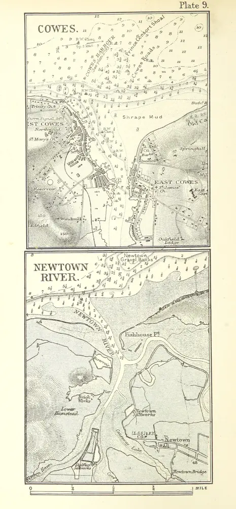
The Solent Chart Book, with sailing directions for all rivers and harbours between Selsea and Portland
11245066753
flickr
1898
KITCHIN, Darcy Butterworth.
Swan Sonnenschein & Co.
119.8 × 257.5 cm