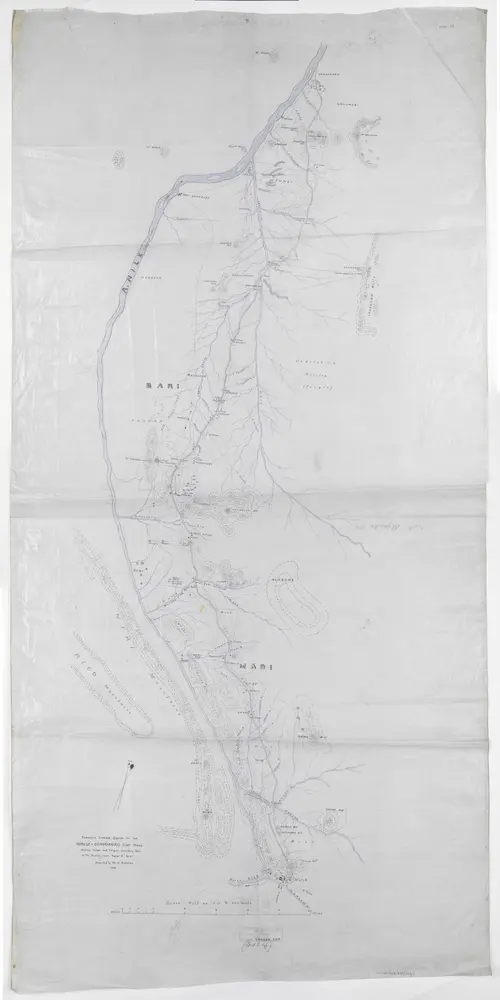
'Prismatic Compass Sketch of the Nimule-Gondokoro Cart Road Shewing Camps and Villages, including those in the Vicinity where Known to Exist. Executed by Mr W. Ramsay 1905'
'Prismatic Compass Sketch of the Nimule-Gondokoro Cart Road Shewing Camps and Villages, including those in the Vicinity where Known to Exist. Executed by Mr W. Ramsay 1905'
Identifier
WOMAT_AFR_BEA_223_1
Collection
womat
Description
Shows an area in the north-western portion of Uganda Protectorate and the southern portion of Anglo-Egyptian Sudan intersected by the Bahr el Gebel section of the river Nile, indicating hydrology, vegetation, relief with form lines, tribal regions, settlements and roads.
Publication date
1905
Creator
Ramsay, William, b 1862, army officer and colonial administrator, Author.