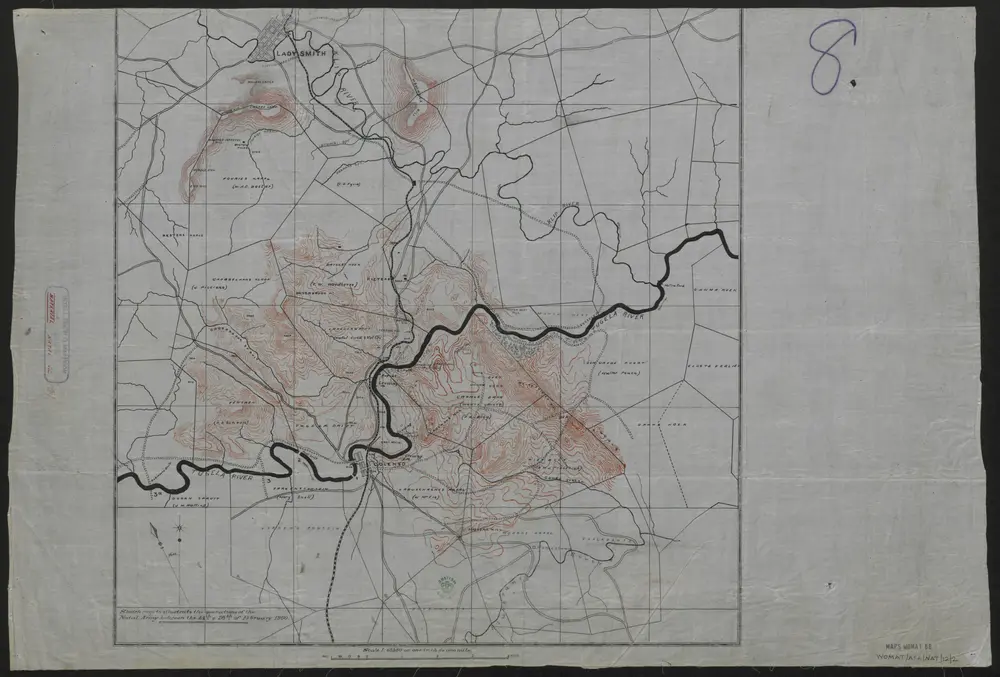
'Sketch Map to Illustrate the Operations of the Natal Army between the 14th & 28th of February 1900.'
Identifier
WOMAT_AFR_NAT_12_2
Collection
womat
Description
Covers the area from Colenso 12 miles northwards to Ladysmith. Portrays hydrology, relief by spot heights, form lines and rock drawing, railways, roads and tracks, fences, settlements and place names, and includes details of land ownership. Some crossing points on the River Tugela have been numbered. The northern edge of the map extends to the edge of the paper; the other edges posses both neatline and margin.The sheet bears the manuscript number '8' in the margin.
Publication date
1900
Creator
Simpson, Henry Charles, 1879-1943, army officer, Author