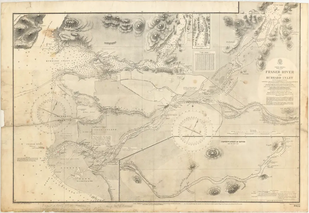
R. N. and the officers of the H.M.S. Plumper ; with corrections by D. Pender ; engraved by J. & C. Walker ; published at the Admiralty under the superintendence of Capt. Washington, R. N., F. R. S. Hydrographer
Item is a nautical chart which show details of area surveyed from Pitt Lake in the north to Roberts Bank in the south and from (what is now) Harrison Hot Springs in the east to Bowen Island in the west. The chart shows soundings in Burrard Inlet, and along the Fraser River.
Copyright status Public domain
Copyright status determination date 2015-09-08
Copyright jurisdiction CA
Act Replicate
Restriction Allow
Start date 2015-09-08