Sign in to access WMTS endpoints.
Sign in to download GeoTIFF.
Sign in to export as IIIF.
Compare
Website
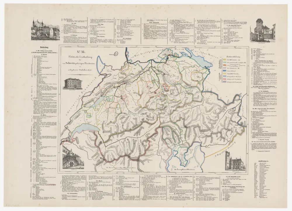
Historisch-geographischer Atlas der Schweiz: Karte XI: Politische Einteilung der zur Schweiz gehörigen Territorien im 18. Jahrhundert
PLAN_G_200_12
Maps
From 1870-01-01 to 1870-12-31
Bearbeitung: Vögelin, J. K.; Meyer von Knonau, G.
75 × 54.5 cm
300