ℹ You will be redirected to OldMapsOnline.org to finish the export.
Sign in to access WMTS endpoints.
Sign in to download GeoTIFF.
Sign in to export as IIIF.
Compare
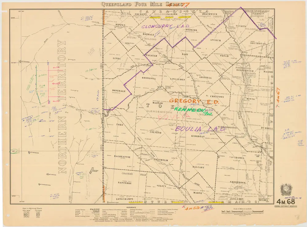
Queensland Four Mile Second series sheet 4m68
cad-map-4mile-qld-2nd-series-4m68-admin-bdy-1947
4 mile Second Series Maps
Cadastral map of Queensland Four Mile (1:253440) Second series sheet 4m68 displaying real property information, major road names and Administrative Areas including Parish and County. Annotated with administrative boundaries
1947
Department of Natural Resources Mines and Energy
31.563734576 × 23.359534253000003 cm
300